Area Overview for CV3 1QL
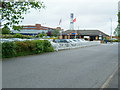
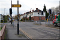
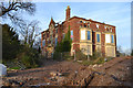
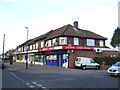
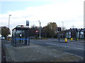
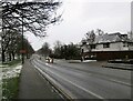
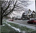
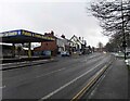
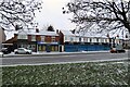
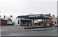
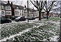
Photos of CV3 1QL

Area Information
CV3 1QL is a compact residential postcode in Coventry’s Lower Stoke Ward, nestled to the south-east of the city centre. Covering 9,893 square metres, it is densely populated, with 1,388 residents living at a density of 140,307 people per square kilometre. This area is defined by its dual character: to the north, newer housing developments have replaced former industrial sites like the Humber and Peugeot factories, while the south retains older light industrial estates and office spaces. Historically rooted in Saxon-era land use, the area has evolved through 20th-century car manufacturing and post-2005 redevelopment. Its proximity to Coventry city centre and the Coventry-Rugby railway line makes it a practical choice for commuters. Daily life here is shaped by its blend of residential and industrial zones, with residents benefiting from nearby rail networks, two airports, and a mix of retail amenities. The community is predominantly middle-aged, with a median age of 22, though the 30–64 age group dominates, suggesting a stable, working-age population.
- Area Type
- Postcode
- Area Size
- 9893 m²
- Population
- 1388
- Population Density
- 2853 people/km²
The property market in CV3 1QL is shaped by its dual-use history as both residential and industrial land. With 49% home ownership, the area is not dominated by rental properties but reflects a mix of owner-occupied and let properties. The accommodation type is primarily houses, which are more common than flats, suggesting a preference for single-family homes. The redevelopment of former car manufacturing sites, such as the Peugeot factory, has introduced newer housing in the northern part of the area, while the southern side retains older industrial estates and office spaces. This mix may appeal to buyers seeking either modern housing or proximity to light industry. However, the small size of the postcode and its limited housing stock mean the market is tightly focused, with limited options for expansion or diversity in property types.
House Prices in CV3 1QL
Showing 26 properties
| Address | Type | Beds | Baths | Last Sale Price | Last Sale Date | |
|---|---|---|---|---|---|---|
| 9 Weir Way, Coventry, CV3 1QL | Detached | 3 | 2 | £338,000 | Jul 2025 | |
| 15 Weir Way, Coventry, CV3 1QL | house | - | - | £284,000 | Mar 2025 | |
| 17 Weir Way, Coventry, CV3 1QL | Detached | 4 | 2 | £495,000 | Jan 2025 | |
| 22 Weir Way, Coventry, CV3 1QL | Semi-detached | 3 | 2 | £290,000 | Aug 2022 | |
| 11 Weir Way, Coventry, CV3 1QL | house | - | - | £252,000 | Nov 2021 | |
| 28 Weir Way, Coventry, CV3 1QL | Detached | 3 | 2 | £280,000 | Apr 2021 | |
| 7 Weir Way, Coventry, CV3 1QL | Detached | 3 | 2 | £260,000 | Apr 2020 | |
| 5 Weir Way, Coventry, CV3 1QL | Retail | 4 | 2 | £349,750 | Jan 2020 | |
| 2 Weir Way, Coventry, CV3 1QL | house | - | - | £199,750 | Jan 2020 | |
| 3 Weir Way, Coventry, CV3 1QL | house | - | - | £354,750 | Jan 2020 |
Energy Efficiency in CV3 1QL
Living in CV3 1QL offers access to a range of practical amenities within reach. Retail options include Budgens Aldermoor, Lidl Upper, and Iceland Binley, providing everyday shopping convenience. The area’s proximity to rail stations such as Coventry Arena and Canley, along with two airports, ensures easy travel for both leisure and business. While the data does not specify parks or leisure facilities, the area’s industrial heritage and recent housing developments suggest a focus on functional living rather than expansive recreational spaces. The compact nature of the postcode means amenities are concentrated, requiring minimal travel. Residents can enjoy the convenience of nearby retail and transport networks, though the absence of detailed information on leisure options means the lifestyle is primarily defined by practicality and connectivity.
Amenities
Schools
| Rank | School | Type | Entry gender | Ages |
|---|
Explore more schools in this area
Go to Schools tabDemographics
The population of CV3 1QL is characterised by a median age of 22, though the most common age range is 30–64 years, indicating a mature, working-age demographic. Home ownership stands at 49%, meaning nearly half of residents rent their homes. The area is composed predominantly of houses, not flats, and the majority of residents identify as White. The high population density of 140,307 people per square kilometre reflects the compact nature of the postcode, which may influence the pace of life and availability of private space. While no specific data on deprivation is provided, the high density and mix of housing types suggest a community that balances affordability with proximity to urban amenities. The absence of detailed diversity metrics means the ethnic composition is largely unquantified beyond the predominant White group.
Household Size
Accommodation Type
Tenure
Ethnic Group
Religion
Household Composition
Age
Household Deprivation
NS-SEC
Explore more demographic insights in this area
Go to Demographics tabPlanning
Planning Constraints
- Flood RiskPremium
- Ramsar Wetland SitesPremium
- Area of Outstanding Natural BeautyPremium
- Protected Nature ReservePremium
- Protected WoodlandPremium