Area Overview for CV3 1QP
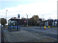
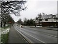
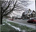
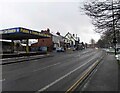
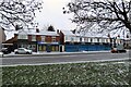
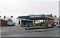
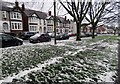
Photos of CV3 1QP

Area Information
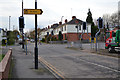
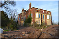
CV3 1QP is a compact residential postcode in Lower Stoke Ward, Coventry, covering 9,752 square metres and home to 1,388 residents. Its high population density of 142,330 people per square kilometre reflects a tightly knit community, though the area is defined by a mix of newer housing developments and older industrial zones. Historically linked to Pinley, the area’s Saxon roots and 19th-century railway infrastructure shaped its evolution. Today, it lies just south-east of Coventry’s city centre, with the Coventry-Rugby railway line dividing it into two distinct zones: newer residential areas to the north and light industrial estates to the south. This proximity to the city offers easy access to urban amenities, while the area’s industrial heritage remains visible in its warehouse-style architecture and small-scale factories. Despite its density, CV3 1QP retains a distinct character, shaped by its history of car manufacturing and post-2005 housing redevelopment. Living here means balancing urban convenience with a quieter, more industrialised backdrop.
- Area Type
- Postcode
- Area Size
- 9752 m²
- Population
- 1388
- Population Density
- 2853 people/km²
The property market in CV3 1QP is characterised by a 49% home ownership rate, with the remaining properties likely in the rental sector. The area’s accommodation type is primarily houses, though the small size of the postcode and high population density suggest these are compact, possibly terraced homes. Given the area’s history of industrial use, the housing stock may be newer developments built on former factory sites, particularly in the northern zone. This creates a mixed landscape where residential properties sit alongside light industrial or office spaces. For buyers, the limited size of CV3 1QP means the immediate surroundings are crucial. Proximity to Coventry’s city centre offers additional housing options, but within the postcode itself, the focus is on smaller, family-oriented homes. The market may appeal to those seeking affordability in a semi-industrial setting, though the lack of larger properties or luxury options limits its appeal to specific buyer profiles.
House Prices in CV3 1QP
Showing 34 properties
| Address | Type | Beds | Baths | Last Sale Price | Last Sale Date | |
|---|---|---|---|---|---|---|
| 2 The Pavilion, Coventry, CV3 1QP | Semi-detached | 3 | 2 | £273,000 | Sep 2019 | |
| 1 The Pavilion, Coventry, CV3 1QP | Semi-detached | - | - | £264,750 | Mar 2019 | |
| 18 The Pavilion, Coventry, CV3 1QP | Semi-detached | 3 | 3 | £267,750 | Mar 2019 | |
| 20 The Pavilion, Coventry, CV3 1QP | house | - | - | £264,750 | Mar 2019 | |
| 22 The Pavilion, Coventry, CV3 1QP | house | - | - | £269,750 | Mar 2019 | |
| 16 The Pavilion, Coventry, CV3 1QP | house | - | - | £274,750 | Mar 2019 | |
| 7 The Pavilion, Coventry, CV3 1QP | Semi-detached | - | - | £259,750 | Feb 2019 | |
| 4 The Pavilion, Coventry, CV3 1QP | Detached | - | - | £295,750 | Feb 2019 | |
| 3 The Pavilion, Coventry, CV3 1QP | Detached | - | - | £295,750 | Feb 2019 | |
| 5 The Pavilion, Coventry, CV3 1QP | Semi-detached | - | - | £252,750 | Feb 2019 |
Energy Efficiency in CV3 1QP
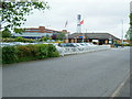
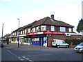
Daily life in CV3 1QP is shaped by its proximity to retail, transport, and industrial hubs. Within practical reach are five retail outlets, including Budgens Aldermoor, Lidl Upper, and Iceland Binley, offering essentials for local needs. The area’s two airports—both named Coventry Airport—may provide travel options, though their role in daily life is not specified. Rail connectivity is robust, with five stations offering links to Coventry and surrounding areas, making commuting straightforward. The character of the area blends residential and industrial elements, with small factories and warehouses visible in the southern zone. While parks or green spaces are not explicitly mentioned, the absence of protected nature reserves or conservation areas suggests a focus on functional living over leisure. Residents may rely on nearby Coventry for larger amenities, but the immediate vicinity provides enough convenience for daily errands and transport.
Amenities
Schools
| Rank | School | Type | Entry gender | Ages |
|---|
Explore more schools in this area
Go to Schools tabDemographics
The population of CV3 1QP has a median age of 22, but the most common age range is 30-64 years, suggesting a mix of younger and middle-aged residents. Home ownership stands at 49%, with the remaining 51% likely to be renters, indicating a community that includes both long-term residents and those in transient housing. The predominant accommodation type is houses, though the small area size and high density suggest these are likely smaller, terraced properties. The majority of residents identify as White, with no specific data on other ethnic groups. The age profile and ownership rates imply a stable, working-age population, possibly drawn from nearby industrial or office jobs. The absence of specific deprivation data means the area’s quality of life remains unquantified, but the low crime score and lack of environmental constraints suggest a functional, if modest, living environment.
Household Size
Accommodation Type
Tenure
Ethnic Group
Religion
Household Composition
Age
Household Deprivation
NS-SEC
Explore more demographic insights in this area
Go to Demographics tabPlanning
Planning Constraints
- Flood RiskPremium
- Ramsar Wetland SitesPremium
- Area of Outstanding Natural BeautyPremium
- Protected Nature ReservePremium
- Protected WoodlandPremium