Area Overview for CV3 1QG
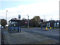
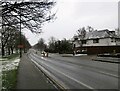
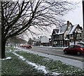
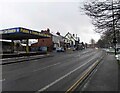
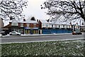
Photos of CV3 1QG


Area Information
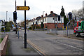
CV3 1QG is a compact residential postcode in Coventry’s Lower Stoke Ward, covering just 3.1 hectares and home to 1,388 people. Its high population density—44,569 people per square kilometre—reflects a tightly knit community, though the area’s character is shaped by its industrial past. Once a hub for car manufacturing, including Humber and Peugeot factories, it has since transitioned to a mix of newer housing and light industry. The area is divided by the Coventry-Rugby railway line, with recent residential developments on the north and older industrial estates to the south. Proximity to Coventry city centre and multiple rail stations makes it a practical choice for commuters, while its compact size means amenities are within easy reach. The median age of 22 suggests a younger demographic, but the most common age range is 30–64, indicating a balance between families and professionals. This blend of history and modernity defines daily life here, with a focus on connectivity, affordability, and proximity to urban amenities.
- Area Type
- Postcode
- Area Size
- 3.1 hectares
- Population
- 1388
- Population Density
- 2853 people/km²
The property market in CV3 1QG is dominated by houses, with 49% of residents owning their homes. Given the area’s small size and high density, housing stock is limited, making it a niche market for buyers seeking affordable, compact properties. The predominance of owner-occupation suggests a stable, long-term resident base, though the lack of specific rental data means the extent of the rental market is unclear. The area’s proximity to Coventry city centre and rail links may appeal to commuters, but the industrial legacy of the south side could influence property desirability. Buyers should consider the mix of newer residential developments and older industrial estates, which may affect property value and condition.
House Prices in CV3 1QG
Showing 40 properties
| Address | Type | Beds | Baths | Last Sale Price | Last Sale Date | |
|---|---|---|---|---|---|---|
| 20 David Spencer Drive, Coventry, CV3 1QG | Terraced | 3 | 2 | £274,000 | Feb 2025 | |
| 22 David Spencer Drive, Coventry, CV3 1QG | Terraced | 3 | 2 | £250,000 | Mar 2024 | |
| 12 David Spencer Drive, Coventry, CV3 1QG | house | - | - | £315,500 | Jun 2023 | |
| 16 David Spencer Drive, Coventry, CV3 1QG | Terraced | 3 | 2 | £258,500 | Mar 2023 | |
| 10 David Spencer Drive, Coventry, CV3 1QG | Semi-detached | 3 | 1 | £295,000 | Dec 2022 | |
| 18 David Spencer Drive, Coventry, CV3 1QG | house | - | - | £237,000 | Feb 2021 | |
| 51 David Spencer Drive, Coventry, CV3 1QG | Detached | 4 | 2 | £449,750 | Sep 2019 | |
| 49 David Spencer Drive, Coventry, CV3 1QG | house | - | - | £539,750 | Apr 2019 | |
| 47 David Spencer Drive, Coventry, CV3 1QG | house | - | - | £459,750 | Jul 2018 | |
| 24 David Spencer Drive, Coventry, CV3 1QG | house | - | - | £237,750 | Jul 2018 |
Energy Efficiency in CV3 1QG
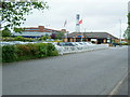
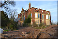
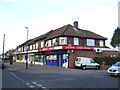
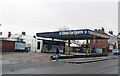
Residents of CV3 1QG have access to essential retail amenities, including Budgens Aldermoor, Lidl Upper, and Iceland Binley, within practical reach. The area’s proximity to Coventry city centre and multiple rail stations enhances convenience for commuting and leisure. While no parks or green spaces are explicitly mentioned, the historical industrial landscape includes remnants like Pinley House and archaeological sites, hinting at a layered local environment. The presence of two airports and five rail stations supports both daily travel and regional connectivity. The compact nature of the area means amenities are closely clustered, though the lack of named parks or recreational facilities may require residents to travel slightly further for leisure activities.
Amenities
Schools
| Rank | School | Type | Entry gender | Ages |
|---|
Explore more schools in this area
Go to Schools tabDemographics
The population of CV3 1QG skews toward adults aged 30–64, making up the most common age range, while the median age of 22 reflects a younger presence. Home ownership stands at 49%, with houses being the predominant accommodation type. This suggests a mix of owner-occupied properties and rental units, though specific rental data is not provided. The predominant ethnic group is White, and no data on diversity beyond this is available. The area’s high population density—44,569 people per square kilometre—means living spaces are closely packed, which can influence community dynamics and local services. While no specific deprivation data is cited, the low crime score (74/100) and absence of environmental constraints suggest a relatively stable, low-risk environment for residents.
Household Size
Accommodation Type
Tenure
Ethnic Group
Religion
Household Composition
Age
Household Deprivation
NS-SEC
Explore more demographic insights in this area
Go to Demographics tabPlanning
Planning Constraints
- Flood RiskPremium
- Ramsar Wetland SitesPremium
- Area of Outstanding Natural BeautyPremium
- Protected Nature ReservePremium
- Protected WoodlandPremium