Area Overview for CV3 1JZ
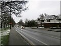
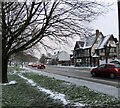
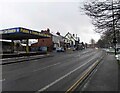
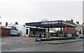
Photos of CV3 1JZ


Area Information
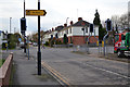
CV3 1JZ is a small, densely populated postcode area in Coventry, England, covering just 1.4 hectares and home to 1,388 residents. Its compact size means it is a tightly knit residential cluster, with a high population density of 96,218 people per square kilometre. The area sits within Lower Stoke Ward, a historically industrial zone that has seen significant redevelopment. Today, it is defined by two distinct phases: newer housing to the north, replacing former car manufacturing sites, and older light industrial estates to the south. Despite its small footprint, the area is well-connected, with multiple railway stations nearby and proximity to Coventry Airport. Daily life here is shaped by its location—close to the city centre yet with a distinct character rooted in its industrial past. The mix of housing and former industrial spaces creates a unique blend of practicality and accessibility, making it a viable option for those seeking a compact, connected neighbourhood with a clear sense of purpose.
- Area Type
- Postcode
- Area Size
- 1.4 hectares
- Population
- 1388
- Population Density
- 2853 people/km²
The property market in CV3 1JZ is characterised by a 49% home ownership rate, with houses being the primary accommodation type. This suggests a mix of owner-occupied and rental properties, though the exact proportion of rentals is not specified. Given the area’s small size and high density, the housing stock is likely limited, with properties concentrated in the north, where redevelopment has prioritised residential use. The presence of former industrial sites to the south may mean a mix of older, possibly converted buildings and newer housing developments. For buyers, this small area offers a compact, connected location with proximity to transport links and the city centre. However, the limited size of CV3 1JZ means the immediate surrounding areas are critical for additional housing options. The dominance of houses over flats or apartments may appeal to families or those seeking more space, though the high density could imply smaller individual properties.
House Prices in CV3 1JZ
Showing 37 properties
| Address | Type | Beds | Baths | Last Sale Price | Last Sale Date | |
|---|---|---|---|---|---|---|
| 24 Gwendolyn Drive, Coventry, CV3 1JZ | Terraced | 2 | 2 | £175,000 | Jun 2025 | |
| 7 Gwendolyn Drive, Coventry, CV3 1JZ | Detached | 4 | 2 | £450,000 | May 2025 | |
| 20 Gwendolyn Drive, Coventry, CV3 1JZ | Semi-detached | 3 | 2 | £320,000 | May 2024 | |
| 14 Gwendolyn Drive, Coventry, CV3 1JZ | Terraced | 3 | 2 | £295,000 | Jan 2024 | |
| 18 Gwendolyn Drive, Coventry, CV3 1JZ | house | - | - | £250,000 | May 2022 | |
| 15 Gwendolyn Drive, Coventry, CV3 1JZ | house | - | - | £255,000 | Dec 2021 | |
| 12 Gwendolyn Drive, Coventry, CV3 1JZ | house | - | - | £393,000 | Aug 2021 | |
| 4 Gwendolyn Drive, Coventry, CV3 1JZ | Detached | 3 | 1 | £280,000 | Nov 2020 | |
| 29 Gwendolyn Drive, Coventry, CV3 1JZ | Semi-detached | 3 | 2 | £248,000 | Oct 2020 | |
| 28 Gwendolyn Drive, Coventry, CV3 1JZ | house | - | - | £387,500 | May 2020 |
Energy Efficiency in CV3 1JZ
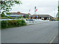
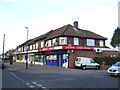
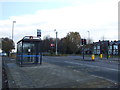
Living in CV3 1JZ offers access to a range of practical amenities within close reach. The area is served by five retail outlets, including Lidl Upper, Budgens Aldermoor, and Iceland Binley, providing everyday shopping convenience. Two nearby airports, both named Coventry Airport, suggest proximity to air travel, though the exact location of these airports is not specified. The railway network is a key feature, with five stations offering connections to Coventry and beyond, including Coventry Arena Railway Station and Bedworth Railway Station. While the area lacks detailed information on parks or leisure facilities, its industrial heritage and proximity to the city centre may offer opportunities for cultural or recreational activities in nearby Coventry. The compact nature of CV3 1JZ means residents must rely on nearby areas for more extensive amenities, but the existing retail and transport links support a functional, accessible lifestyle.
Amenities
Schools
| Rank | School | Type | Entry gender | Ages |
|---|
Explore more schools in this area
Go to Schools tabDemographics
The population of CV3 1JZ is predominantly adults aged 30–64, with a median age of 22. This suggests a community with a strong working-age population, though the younger median age may reflect student or transient residents. Home ownership in the area is 49%, indicating a balance between owner-occupied and rental properties. The primary accommodation type is houses, which is unusual for a high-density postcode, hinting at a mix of semi-detached or terraced homes. The predominant ethnic group is White, with no specific data on other demographics provided. The area’s compact size and high density may influence social dynamics, but the lack of specific deprivation data means quality of life factors remain unquantified. The presence of older adults in the 30–64 range suggests a community with established roots, though the younger median age could indicate a younger workforce or student population.
Household Size
Accommodation Type
Tenure
Ethnic Group
Religion
Household Composition
Age
Household Deprivation
NS-SEC
Explore more demographic insights in this area
Go to Demographics tabPlanning
Planning Constraints
- Flood RiskPremium
- Ramsar Wetland SitesPremium
- Area of Outstanding Natural BeautyPremium
- Protected Nature ReservePremium
- Protected WoodlandPremium