Area Overview for West Midlands English Region
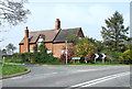
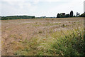
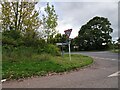
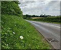
Photos of West Midlands English Region


Area Information
Living in West Midlands English Region means settling into one of England's largest and most populous administrative regions. You are choosing a home within a territory that covers 13,013 square kilometres, a vast expanse for a single geographical designation. Some 5,733,211 people call this area home, creating a population density of 441 people per square kilometre. This figure indicates a region that is neither a remote countryside expanse nor a speaker's corner high-density inner city. Daily life here balances urban energy with significant rural pockets, offering a broader scope than many micro-localised search results suggest. The sheer scale allows for diverse lifestyles, from coastal living near the English coastline to historic city centres and extensive parklands. You should expect a varied experience depending on your specific street, as the region's size means local conditions change rapidly over distances as short as a few miles. Prospective buyers find that the regional identity provides a framework for exploring vast swathes of England without feeling overwhelmed by specific borough boundaries. The community reflects this mix, drawing residents from diverse backgrounds who settle across the broad landscape defined by the 13,013 square kilometres you are considering.
- Area Type
- Region
- Area Size
- 13013.0 km²
- Population
- 5733211
- Population Density
- 441 people/km²
Demographics
The community within West Midlands English Region is substantial, housing 5,733,211 residents across its extensive geography. While specific age profiles and household type breakdowns are not detailed in the current records, the population density of 441 people per square kilometre suggests a significant number of multi-generational households and city-dwellers coexisting with other living arrangements. This density often correlates with a mix of families, professionals, and retirees seeking accommodation throughout the region. The large population size means that wherever you choose to buy homes in West Midlands English Region, you are entering a well-established social fabric. You will encounter neighbours from a wide range of backgrounds, contributing to a culturally rich environment that characterises the area. The sheer volume of residents ensures that services, from local shops to major hospitals, operate on a scale that supports high demand. This demographic weight creates a resilient community able to support various industries and lifestyles. When evaluating schools near West Midlands English Region, you benefit from a region with resources designed to cater to hundreds of thousands of children. The diversity of people living here ensures that the area does not feel monolithic, despite the single regional label used in planning and statistics.