Area Overview for CV3 1QH
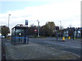
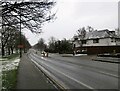
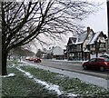
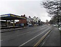
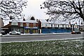
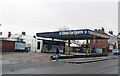
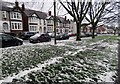
Photos of CV3 1QH

Area Information
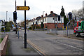
CV3 1QH is a compact postcode area in Coventry, England, encompassing a small residential cluster with a population of 2,798 people spread over 4,954 square metres. This results in a high population density of 564,746 people per square kilometre, reflecting a tightly knit community. The area lies within Lower Stoke Ward, historically shaped by light industry and recent housing developments. Its proximity to Coventry city centre and the Coventry-Rugby railway line positions it as a convenient location for commuters. The landscape is a mix of older industrial estates and newer residential areas, with the northern part redeveloped from former car manufacturing sites. Daily life here is characterised by a balance of practicality and accessibility, with local amenities and transport links facilitating both work and leisure. The area’s history as a former industrial hub contrasts with its current focus on housing, though remnants of its past remain in the layout of streets and the presence of former factories. For homebuyers, CV3 1QH offers a compact, densely populated environment with a stable community profile.
- Area Type
- Postcode
- Area Size
- 4954 m²
- Population
- Not available
- Population Density
- Not available
The property market in CV3 1QH is dominated by owner-occupied homes, with 70% of properties owned by residents rather than rented. The accommodation type is predominantly houses, which is unusual for a small postcode area but reflects the suburban layout and historical industrial legacy of the region. This mix suggests a market skewed towards long-term residents seeking stable, family-friendly housing. Given the area’s limited size, buyers should consider nearby postcode areas for additional options. The presence of houses, rather than flats or apartments, indicates a preference for larger properties, which may appeal to families or those requiring more space. However, the small footprint of CV3 1QH means property availability is constrained, and potential buyers may need to look beyond immediate surroundings for a broader selection. The high home ownership rate also suggests limited rental stock, which could impact affordability for those seeking to rent.
House Prices in CV3 1QH
Showing 14 properties
| Address | Type | Beds | Baths | Last Sale Price | Last Sale Date | |
|---|---|---|---|---|---|---|
| 12 Joseph Levy Walk, Coventry, CV3 1QH | Detached | 4 | 2 | £360,000 | Oct 2024 | |
| 9 Joseph Levy Walk, Coventry, CV3 1QH | Detached | 4 | 2 | £352,000 | Aug 2024 | |
| 18 Joseph Levy Walk, Coventry, CV3 1QH | Detached | 4 | 2 | £430,000 | May 2024 | |
| 1 Joseph Levy Walk, Coventry, CV3 1QH | Semi-detached | 4 | 2 | £308,000 | Apr 2024 | |
| 16 Joseph Levy Walk, Coventry, CV3 1QH | Retail | 4 | 2 | £420,000 | May 2022 | |
| 4 Joseph Levy Walk, Coventry, CV3 1QH | Retail | 4 | 2 | £417,500 | Apr 2022 | |
| 7 Joseph Levy Walk, Coventry, CV3 1QH | Detached | 4 | 2 | £372,000 | Aug 2019 | |
| 8 Joseph Levy Walk, Coventry, CV3 1QH | Detached | 4 | 2 | £382,500 | Sep 2018 | |
| 5 Joseph Levy Walk, Coventry, CV3 1QH | Detached | 4 | 2 | £324,750 | Mar 2017 | |
| 3 Joseph Levy Walk, Coventry, CV3 1QH | house | - | - | £319,750 | Mar 2017 |
Energy Efficiency in CV3 1QH
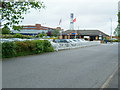
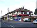
The lifestyle in CV3 1QH is shaped by its proximity to retail, rail, and airports. Nearby retail options include Budgens Aldermoor, Lidl Upper, and Iceland Binley, offering essential shopping and convenience stores. These venues cater to daily needs, though the selection is limited to smaller, local outlets. The area’s rail network, with stations such as Coventry Arena and Canley, provides access to broader regional travel, while the presence of two airports, both named Coventry Airport, suggests connectivity for air travel. However, no parks, leisure facilities, or dining options are listed in the data, meaning residents may need to travel further for recreational activities. The combination of retail, rail, and air links creates a practical environment for daily life, though the lack of detailed information on leisure or cultural amenities indicates a focus on functional rather than expansive lifestyle options.
Amenities
Schools
The nearest school to CV3 1QH is Pattison College, an independent institution. Independent schools are typically fee-paying and offer a specific educational approach, often with smaller class sizes and specialist facilities. However, no Ofsted rating is provided for this school, so prospective families must conduct further research to assess its performance. The absence of other schools in the data means the area’s educational options are limited to this single institution. For families prioritising state education, the nearest schools may lie outside CV3 1QH, requiring a broader search. The mix of school types here is narrow, with only an independent option available. This could be a consideration for parents seeking a range of educational choices, though the presence of Pattison College may appeal to those valuing the characteristics of independent schooling.
| Rank | School | Type | Entry gender | Ages |
|---|
Explore more schools in this area
Go to Schools tabDemographics
The median age in CV3 1QH is 47, with the most common age range being adults aged 30–64 years. This suggests a mature, established population with a focus on long-term residency. Home ownership is high, at 70%, indicating a stable community with a strong presence of owner-occupied properties. The predominant accommodation type is houses, reflecting a suburban or semi-rural character, though the area’s small size means housing options are limited. The predominant ethnic group is White, with no specific data provided on other demographics. The absence of detailed information on deprivation or diversity means the area’s social composition remains relatively homogeneous. For residents, this translates to a community with a clear generational profile, where most households are owner-occupied and the housing stock is primarily residential. The age range implies a population less likely to move frequently, contributing to a sense of continuity in the area.
Household Size
Accommodation Type
Tenure
Ethnic Group
Religion
Household Composition
Age
Household Deprivation
NS-SEC
Explore more demographic insights in this area
Go to Demographics tabPlanning
Planning Constraints
- Flood RiskPremium
- Ramsar Wetland SitesPremium
- Area of Outstanding Natural BeautyPremium
- Protected Nature ReservePremium
- Protected WoodlandPremium