Area Overview for CV3 1JT
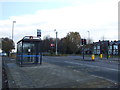
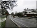
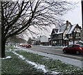
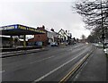
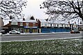
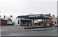
Photos of CV3 1JT


Area Information
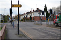
CV3 1JT is a compact residential postcode in the Lower Stoke Ward of Coventry, a city in the West Midlands. Spanning 9,224 square metres, this area is densely populated, with 2,798 residents packed into a small cluster. Its proximity to Coventry city centre and the Coventry-Rugby railway line defines its character: a blend of newer housing developments to the north and older industrial estates to the south. Historically rooted in agriculture and 20th-century car manufacturing, the area has evolved into a mix of light industry, offices, and residential zones. Daily life here is shaped by its connectivity—multiple railway stations, two airports nearby, and a network of retail outlets. The community is predominantly middle-aged, with a strong presence of owner-occupied homes. While the area lacks historic landmarks, its practical layout and modern infrastructure cater to commuters and families seeking a balance between urban access and suburban living. The high population density means a tight-knit community, though the lack of green spaces or major parks is notable. For buyers, CV3 1JT offers a snapshot of Coventry’s industrial past and its transition into a more residential, yet functional, part of the city.
- Area Type
- Postcode
- Area Size
- 9224 m²
- Population
- Not available
- Population Density
- Not available
The property market in CV3 1JT is characterised by a high rate of home ownership—70% of residents own their homes. This contrasts with areas where rental demand drives the market, suggesting a more stable, long-term demographic. The primary accommodation type is houses, which is unusual in urban areas but aligns with the area’s layout of tightly packed residential clusters. Given the small size of the postcode (9,224 m²) and its proximity to industrial zones, housing stock is likely limited, with properties concentrated in the newer developments north of the Coventry-Rugby railway line. For buyers, this means a niche market with limited options, though the predominance of owner-occupied homes may indicate strong local demand. The mix of housing types—likely semi-detached or terraced homes—could appeal to those seeking practical, compact living. However, the lack of larger properties or new builds may restrict choices for growing families.
House Prices in CV3 1JT
Showing 45 properties
| Address | Type | Beds | Baths | Last Sale Price | Last Sale Date | |
|---|---|---|---|---|---|---|
| 27 Marjorie Way, Stoke, Coventry, CV3 1JT | Terraced | 3 | 1 | £66,300 | Jan 2025 | |
| 61 Marjorie Way, Stoke, Coventry, CV3 1JT | Semi-detached | 2 | 1 | £190,000 | Jul 2022 | |
| 13 Marjorie Way, Stoke, Coventry, CV3 1JT | Semi-detached | 2 | 1 | £185,000 | Oct 2019 | |
| 5 Marjorie Way, Stoke, Coventry, CV3 1JT | Detached | 4 | 1 | £324,000 | May 2019 | |
| 11 Marjorie Way, Stoke, Coventry, CV3 1JT | Detached | 4 | 3 | £294,500 | Aug 2018 | |
| 59 Marjorie Way, Stoke, Coventry, CV3 1JT | Semi-detached | 2 | 2 | £32,500 | Apr 2017 | |
| 1 Marjorie Way, Stoke, Coventry, CV3 1JT | house | - | - | £294,950 | Dec 2015 | |
| 3 Marjorie Way, Stoke, Coventry, CV3 1JT | house | - | - | £289,950 | Dec 2015 | |
| 7 Marjorie Way, Stoke, Coventry, CV3 1JT | house | - | - | £291,600 | Dec 2015 | |
| 9 Marjorie Way, Stoke, Coventry, CV3 1JT | house | - | - | £284,950 | Dec 2015 |
Energy Efficiency in CV3 1JT
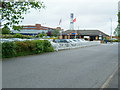
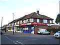
Residents of CV3 1JT have access to a range of practical amenities within walking or short driving distance. Retail options include Budgens Aldermoor, Lidl Upper, and Iceland Binley, providing everyday shopping convenience. The area’s proximity to multiple railway stations—Coventry Arena, Canley, and Bedworth—ensures easy access to public transport, while two airports (both named Coventry Airport) may offer regional travel options. Though there are no named parks or leisure facilities in the immediate vicinity, the area’s industrial layout suggests a focus on function over leisure. The presence of light industrial estates and offices may limit access to cultural or recreational amenities, but the compact nature of the postcode means residents can quickly reach Coventry’s broader offerings. For those prioritising convenience over green spaces, the mix of retail, transport, and proximity to the city makes CV3 1JT a practical choice.
Amenities
Schools
The nearest school to CV3 1JT is Pattison College, an independent institution. While no Ofsted rating is provided, independent schools often cater to specific educational preferences, such as smaller class sizes or specialised curricula. The absence of state schools in the immediate vicinity may mean families rely on nearby Coventry schools, which could be 10-15 minutes away by car. This mix of school types offers parents options, though the lack of local state schools might impact convenience for those prioritising proximity. For families considering CV3 1JT, it is worth investigating the broader Coventry school network to assess suitability for their children’s needs.
| Rank | School | Type | Entry gender | Ages |
|---|
Explore more schools in this area
Go to Schools tabDemographics
The population of CV3 1JT is 2,798 people, with a median age of 47. The majority of residents fall into the 30-64 age range, indicating a mature, established community. Home ownership is high at 70%, with houses being the primary accommodation type. This suggests a stable, long-term resident base rather than a transient rental market. The predominant ethnic group is White, reflecting the broader demographic trends in Coventry. The area’s demographics imply a focus on family-oriented living, with older households likely to be homeowners. However, the absence of specific data on deprivation or income levels means that the quality of life is inferred from infrastructure and services. The high home ownership rate may correlate with lower turnover, fostering a sense of continuity. For buyers, this profile suggests an area suited to those seeking a settled lifestyle, though the lack of younger demographics could indicate limited demand for larger family homes or schools catering to children.
Household Size
Accommodation Type
Tenure
Ethnic Group
Religion
Household Composition
Age
Household Deprivation
NS-SEC
Explore more demographic insights in this area
Go to Demographics tabPlanning
Planning Constraints
- Flood RiskPremium
- Ramsar Wetland SitesPremium
- Area of Outstanding Natural BeautyPremium
- Protected Nature ReservePremium
- Protected WoodlandPremium