Area Overview for CV3 1HP
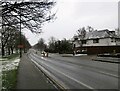
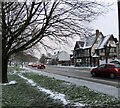
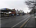
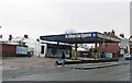
Photos of CV3 1HP


Area Information
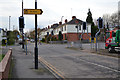
CV3 1HP is a small, densely populated residential postcode area in Coventry, England, covering just 1.1 hectares and home to 1,388 people. Its compact size means it is a tightly knit community, with a high population density of 125,150 people per square kilometre. Situated south-east of Coventry city centre, the area is part of the Lower Stoke Ward, a character area defined by a mix of newer housing developments and remnants of 20th-century light industry. Historically linked to Pinley, the area has roots in Saxon-era land use and 13th-century manorial activity. Today, its layout is shaped by the Coventry-Rugby railway line, which divides the area into two distinct zones: newer residential housing to the north, replacing former car manufacturing sites, and older industrial estates to the south. Living here means proximity to Coventry’s urban amenities, with multiple railway stations and two airports within reach, making it a practical choice for commuters and those needing transport links. The area’s compact nature and mix of housing and industry create a unique blend of convenience and historical context for residents.
- Area Type
- Postcode
- Area Size
- 1.1 hectares
- Population
- 1388
- Population Density
- 2853 people/km²
The property market in CV3 1HP is characterised by a 49% home ownership rate, indicating that nearly half of properties are rented, which may reflect a strong rental market in this small area. The predominant accommodation type is houses, suggesting a focus on family homes rather than flats or apartments. This aligns with the area’s historical development, where newer housing has been built on former industrial land to the north, while older industrial estates remain to the south. The limited size of the area—just 1.1 hectares—means the housing stock is constrained, and buyers should consider proximity to surrounding regions for more options. The mix of housing types and the area’s transport links, including multiple railway stations, make it appealing for commuters. However, the small size and high density may limit availability, requiring buyers to look beyond CV3 1HP for larger property selections.
House Prices in CV3 1HP
Showing 27 properties
| Address | Type | Beds | Baths | Last Sale Price | Last Sale Date | |
|---|---|---|---|---|---|---|
| 35 Second Avenue, Coventry, CV3 1HP | Terraced | 2 | 1 | £210,000 | Aug 2025 | |
| 39 Second Avenue, Coventry, CV3 1HP | Semi-detached | 3 | 2 | £291,000 | Dec 2024 | |
| 47 Second Avenue, Coventry, CV3 1HP | house | - | - | £199,750 | Mar 2020 | |
| 37 Second Avenue, Coventry, CV3 1HP | Terraced | - | - | £242,750 | Mar 2019 | |
| 31 Second Avenue, Coventry, CV3 1HP | Terraced | - | - | £242,750 | Mar 2019 | |
| 33 Second Avenue, Coventry, CV3 1HP | house | - | - | £182,750 | Mar 2019 | |
| 5, Witton House, 29 Second Avenue, Coventry, CV3 1HP | Flat | 2 | 1 | - | - | |
| 1, Witton House, 29 Second Avenue, Coventry, CV3 1HP | Flat | 2 | 1 | - | - | |
| 41 Second Avenue, Coventry, CV3 1HP | house | - | - | - | - | |
| 6, Witton House, 29 Second Avenue, Coventry, CV3 1HP | Flat | - | - | - | - |
Energy Efficiency in CV3 1HP
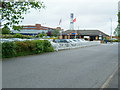
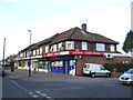
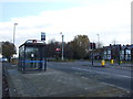
Living in CV3 1HP offers access to a range of nearby amenities, including five retail outlets such as Budgens Aldermoor, Lidl Upper, and Iceland Binley, providing convenience for daily shopping. The area’s proximity to multiple railway stations—Coventry Arena, Canley, and Bedworth—ensures easy access to public transport, while two airports nearby cater to travel needs. Though the area itself is small, its location near Coventry’s urban core means residents can access the city’s broader amenities, including cultural and leisure facilities. The mix of retail options and transport links contributes to a practical lifestyle, with shops and stations within walking distance. The compact nature of the area fosters a sense of community, while the availability of transport and retail options ensures daily life remains efficient and connected.
Amenities
Schools
| Rank | School | Type | Entry gender | Ages |
|---|
Explore more schools in this area
Go to Schools tabDemographics
The population of CV3 1HP is 1,388, with a median age of 22, though the most common age range is 30–64 years. This suggests a mix of younger residents and families. Home ownership in the area is 49%, indicating a significant proportion of renters, which may influence the local rental market dynamics. The predominant accommodation type is houses, reflecting a community of family homes rather than flats or apartments. The predominant ethnic group is White, though specific diversity statistics are not provided. The area’s youthful median age contrasts with the prevalence of middle-aged adults, potentially shaping local social dynamics and service needs. With a population density over 125,000 people per square kilometre, the area is highly compact, which may affect living conditions and community interaction. This density, combined with the age profile, suggests a mix of young professionals, families, and long-term residents.
Household Size
Accommodation Type
Tenure
Ethnic Group
Religion
Household Composition
Age
Household Deprivation
NS-SEC
Explore more demographic insights in this area
Go to Demographics tabPlanning
Planning Constraints
- Flood RiskPremium
- Ramsar Wetland SitesPremium
- Area of Outstanding Natural BeautyPremium
- Protected Nature ReservePremium
- Protected WoodlandPremium