Area Overview for CV3 1QJ
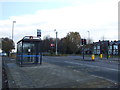
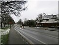
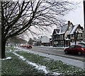
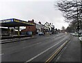
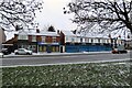
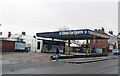
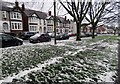
Photos of CV3 1QJ

Area Information
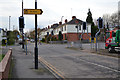
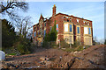
CV3 1QJ is a small, densely populated residential cluster in Coventry, England, covering just 3,760 m² and home to 2,798 people. Its compact size and high population density of 744,071 people per km² reflect a tightly knit community, though the area’s character is shaped by its industrial past and recent housing developments. Situated to the south-east of Coventry city centre, it lies within Lower Stoke Ward, an area historically linked to Pinley, a settlement with Saxon origins. The landscape is divided by the Coventry-Rugby railway line, with newer residential areas to the north and older light industrial zones to the south. This duality means residents live near both modern housing and remnants of 20th-century car manufacturing sites, such as former Humber and Peugeot factories. Despite its industrial roots, the area is now defined by its proximity to Coventry’s transport networks, including multiple rail stations and two airports, making it a practical choice for commuters. The mix of housing and industry creates a unique dynamic, where daily life balances quiet residential pockets with the hum of nearby logistics and office spaces.
- Area Type
- Postcode
- Area Size
- 3760 m²
- Population
- Not available
- Population Density
- Not available
The property market in CV3 1QJ is predominantly owner-occupied, with 70% of homes owned by residents rather than rented. This suggests a stable, long-term population with a preference for private housing. The accommodation type is primarily houses, which is unusual for a small postcode area but may reflect the legacy of 20th-century industrial development, where housing was built to accommodate workers. The limited size of the area means the housing stock is constrained, and buyers should consider nearby postcode clusters for more options. The mix of newer residential developments to the north and older industrial estates to the south creates a varied housing landscape, though the predominance of houses over flats may appeal to families seeking space. For buyers, the challenge lies in the area’s small size, which could limit availability, but the proximity to Coventry’s transport links and amenities may offset this.
House Prices in CV3 1QJ
Showing 16 properties
| Address | Type | Beds | Baths | Last Sale Price | Last Sale Date | |
|---|---|---|---|---|---|---|
| 2 Sylvia Bird Close, Coventry, CV3 1QJ | house | - | - | £263,750 | Jul 2020 | |
| 1 Sylvia Bird Close, Coventry, CV3 1QJ | house | - | - | £79,979 | Apr 2020 | |
| 14 Sylvia Bird Close, Coventry, CV3 1QJ | house | - | - | - | - | |
| 4 Sylvia Bird Close, Coventry, CV3 1QJ | house | - | - | - | - | |
| 17 Sylvia Bird Close, Coventry, CV3 1QJ | house | - | - | - | - | |
| 3 Sylvia Bird Close, Coventry, CV3 1QJ | house | - | - | - | - | |
| 15 Sylvia Bird Close, Coventry, CV3 1QJ | house | - | - | - | - | |
| 19 Sylvia Bird Close, Coventry, CV3 1QJ | house | - | - | - | - | |
| 8 Sylvia Bird Close, Coventry, CV3 1QJ | house | - | - | - | - | |
| 7 Sylvia Bird Close, Coventry, CV3 1QJ | house | - | - | - | - |
Energy Efficiency in CV3 1QJ
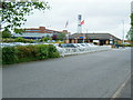
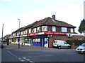
The lifestyle in CV3 1QJ is shaped by its proximity to retail, transport, and industrial zones. Within practical reach are five retail outlets, including Budgens Aldermoor, Lidl Upper, and Iceland Binley, offering everyday shopping needs. The area’s rail network connects residents to Coventry’s cultural and commercial centres, while two airports provide regional travel options. However, the absence of major parks or leisure facilities means residents may need to travel further for recreational activities. The mix of small retail outlets and transport links creates a practical, no-frills lifestyle, ideal for those prioritising convenience over luxury. The industrial character of the area, with its warehouses and offices, contrasts with the residential pockets, offering a balance between urban and semi-rural living. For those accustomed to a fast-paced, service-oriented lifestyle, CV3 1QJ provides accessibility without the density of a city centre.
Amenities
Schools
The nearest school to CV3 1QJ is Pattison College, an independent institution. While no Ofsted rating is provided, the fact that it is an independent school suggests it may cater to a specific demographic, likely families seeking private education. However, the area’s limited school options mean families may need to look beyond CV3 1QJ for state-run primary or secondary schools. The absence of additional schools in the data indicates that the area is not a primary education hub, which could be a consideration for parents prioritising proximity to schools. For those seeking private education, Pattison College is a notable option, but its availability and admissions criteria would need further investigation.
| Rank | School | Type | Entry gender | Ages |
|---|
Explore more schools in this area
Go to Schools tabDemographics
The population of CV3 1QJ skews towards adults aged 30–64, with a median age of 47. This suggests a mature, settled community, likely with strong ties to local employment and family life. Home ownership is high at 70%, indicating a stable demographic where most residents are long-term residents rather than renters. The predominant accommodation type is houses, which aligns with the area’s residential character. The ethnic composition is predominantly White, with no specific data on other groups, though this may reflect broader regional trends. The high population density—over 744,000 people per km²—raises questions about living conditions, though the area’s compact size and proximity to Coventry’s amenities may mitigate this. For families, the presence of independent schools like Pattison College nearby could be a draw, though the area’s limited retail and leisure options may require residents to venture further afield for daily needs.
Household Size
Accommodation Type
Tenure
Ethnic Group
Religion
Household Composition
Age
Household Deprivation
NS-SEC
Explore more demographic insights in this area
Go to Demographics tabPlanning
Planning Constraints
- Flood RiskPremium
- Ramsar Wetland SitesPremium
- Area of Outstanding Natural BeautyPremium
- Protected Nature ReservePremium
- Protected WoodlandPremium