Area Overview for CV3 1FH
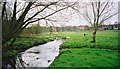
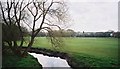
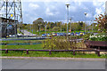
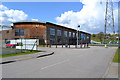
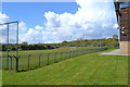
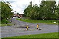
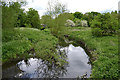
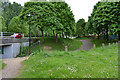
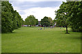
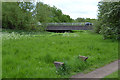
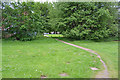
Photos of CV3 1FH

Area Information
CV3 1FH is a small, densely populated residential cluster in Coventry’s Lower Stoke Ward, covering just 1.5 hectares with 1,388 residents. Its compact size and high population density of 92,849 people per square kilometre reflect a tightly packed community. Situated south-east of Coventry city centre, the area lies within a character area defined by historical light industry and recent housing development. The northern part, once home to car manufacturing sites like Humber and Peugeot, now hosts newer residential properties, while the southern side retains industrial estates and offices. Daily life here is shaped by proximity to the Coventry-Rugby railway line and the city’s urban fabric, with a mix of practical amenities and a focus on connectivity. The area’s history as a former agricultural site, bisected by the 1838 London and Birmingham Railway, underpins its current layout of small, square-shaped buildings and grass verges. Despite its density, it offers a blend of residential and industrial features, with limited historic preservation beyond nearby Stoke Green’s The Langleys, a 17th-century listed house slated for demolition.
- Area Type
- Postcode
- Area Size
- 1.5 hectares
- Population
- 1388
- Population Density
- 2853 people/km²
The property market in CV3 1FH is characterised by a 49% home ownership rate, suggesting a mix of owner-occupied homes and rental properties. The area’s accommodation type is primarily houses, which is unusual for a small postcode area but aligns with its historical industrial roots and recent redevelopment. The northern part, once home to car factories, now features housing that may appeal to buyers seeking larger properties, while the southern side retains industrial estates. This duality means the market is not purely residential but influenced by proximity to light industry. Buyers should consider the area’s compact size and limited surrounding housing stock, which may affect property values and availability. The presence of rail stations nearby could enhance its appeal for commuters, though the flood risk assessment may influence long-term investment decisions.
House Prices in CV3 1FH
Showing 32 properties
| Address | Type | Beds | Baths | Last Sale Price | Last Sale Date | |
|---|---|---|---|---|---|---|
| 218 Whitworth Avenue, Coventry, CV3 1FH | Flat | - | - | £60,000 | Dec 2005 | |
| 228 Whitworth Avenue, Coventry, CV3 1FH | house | - | - | - | - | |
| 236 Whitworth Avenue, Coventry, CV3 1FH | house | - | - | - | - | |
| 206 Whitworth Avenue, Coventry, CV3 1FH | Flat | - | - | - | - | |
| 224 Whitworth Avenue, Coventry, CV3 1FH | house | - | - | - | - | |
| 226 Whitworth Avenue, Coventry, CV3 1FH | house | - | - | - | - | |
| 186 Whitworth Avenue, Coventry, CV3 1FH | Flat | - | - | - | - | |
| 208 Whitworth Avenue, Coventry, CV3 1FH | Flat | - | - | - | - | |
| 232 Whitworth Avenue, Coventry, CV3 1FH | house | - | - | - | - | |
| 212 Whitworth Avenue, Coventry, CV3 1FH | Flat | - | - | - | - |
Energy Efficiency in CV3 1FH
The lifestyle in CV3 1FH is defined by practical accessibility to retail, transport, and light industry. Within walking distance are five retail outlets, including Budgens Aldermoor and Lidl Upper, providing everyday shopping needs. The area’s rail connections, such as Tile Hill and Coventry Arena stations, offer easy access to Coventry’s cultural and commercial hubs. While there are no named parks or leisure facilities in the data, the proximity to the Coventry-Rugby railway line and historical sites like Pinley House suggest a mix of industrial and semi-rural character. The presence of small factories and warehouses may limit green spaces, but the compact layout ensures amenities are within reach. For residents, this means a balance between convenience and the area’s industrial legacy, with no major leisure venues detailed in the data.
Amenities
Schools
| Rank | School | Type | Entry gender | Ages |
|---|
Explore more schools in this area
Go to Schools tabDemographics
The population of CV3 1FH is young, with a median age of 22, though the most common age range is adults aged 30–64. This suggests a mix of younger residents and working-age households. Home ownership stands at 49%, indicating a modest balance between owner-occupied and rental properties. The accommodation type is predominantly houses, reflecting a residential character rather than flats or apartments. The predominant ethnic group is White, with no specific data on other demographics. The high population density, combined with the age profile, points to a community where families and professionals coexist. However, the lack of detailed diversity statistics means the full range of cultural or socioeconomic factors influencing daily life remains unexplored.
Household Size
Accommodation Type
Tenure
Ethnic Group
Religion
Household Composition
Age
Household Deprivation
NS-SEC
Explore more demographic insights in this area
Go to Demographics tabPlanning
Planning Constraints
- Flood RiskPremium
- Ramsar Wetland SitesPremium
- Area of Outstanding Natural BeautyPremium
- Protected Nature ReservePremium
- Protected WoodlandPremium