Area Overview for CV3 1EZ
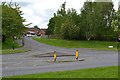
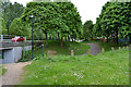
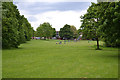
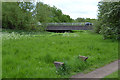
Photos of CV3 1EZ


Area Information
CV3 1EZ is a small residential postcode area in Coventry, England, encompassing just 1890 m² and home to 1660 residents. Its high population density—878,472 people per km²—reflects a compact, tightly packed community. The area lies within Lower Stoke Ward, historically shaped by light industry and recent housing development. Divided by the Coventry-Rugby railway line, the north features newer residential zones, while the south retains older industrial estates and offices. Despite its small size, CV3 1EZ offers proximity to Coventry’s city centre, with easy access to rail networks and major roads. The area’s character blends post-2005 housing redevelopment with remnants of 20th-century car manufacturing sites, such as the former Peugeot factory. Daily life here is defined by practicality, with residents relying on nearby rail stations and retail hubs. The median age of 22 contrasts with the most common age range of 30-64, suggesting a mix of young professionals and families. Living in CV3 1EZ means navigating a dynamic, evolving landscape where history and modernity coexist.
- Area Type
- Postcode
- Area Size
- 1890 m²
- Population
- 1660
- Population Density
- 6417 people/km²
The property market in CV3 1EZ is characterised by a low home ownership rate—just 17% of households own their homes—suggesting a rental-dominated market. The area’s accommodation is primarily houses, reflecting a mix of older residential stock and newer developments. The small size of the postcode area, combined with its proximity to industrial estates, means housing options are limited. Redevelopment of former car manufacturing sites, such as the northern area near the Coventry-Rugby railway line, has introduced newer homes, but the overall stock remains modest. Buyers should consider the area’s compact nature, which may limit availability. The rental market is likely competitive, with demand driven by nearby employment hubs and transport links. For those seeking owner-occupation, the low home ownership rate indicates a potential opportunity, though property choices may be constrained by the area’s size and industrial legacy.
House Prices in CV3 1EZ
Showing 6 properties
| Address | Type | Beds | Baths | Last Sale Price | Last Sale Date | |
|---|---|---|---|---|---|---|
| 195 Whitworth Avenue, Coventry, CV3 1EZ | house | - | - | - | - | |
| 193 Whitworth Avenue, Coventry, CV3 1EZ | house | - | - | - | - | |
| 201 Whitworth Avenue, Coventry, CV3 1EZ | house | - | - | - | - | |
| 191 Whitworth Avenue, Coventry, CV3 1EZ | house | - | - | - | - | |
| 199 Whitworth Avenue, Coventry, CV3 1EZ | house | - | - | - | - | |
| 197 Whitworth Avenue, Coventry, CV3 1EZ | house | - | - | - | - |
Energy Efficiency in CV3 1EZ
Living in CV3 1EZ offers access to a range of practical amenities within close reach. The area is served by five retail outlets, including Budgens Aldermoor, Lidl Upper, and Iceland Binley, providing essential shopping options. While dining and leisure facilities are not explicitly listed, the presence of multiple retail stores suggests a focus on convenience. The nearby rail stations—Canley, Coventry Arena, and Tile Hill—enhance mobility, enabling quick travel to Coventry’s city centre or surrounding areas. The area’s industrial heritage means it lacks large parks or recreational spaces, but its proximity to Coventry may compensate with broader leisure opportunities. Overall, daily life in CV3 1EZ balances practicality with the limitations of a compact, historically industrialised postcode.
Amenities
Schools
The nearest school to CV3 1EZ is Aldermoor Farm Primary School, which serves the local community with a good Ofsted rating. This primary school is a key resource for families with young children, though the area lacks secondary schools, requiring students to travel to nearby Coventry districts. The presence of a well-rated primary school suggests a focus on early education, but parents seeking a full range of schooling options may need to look beyond CV3 1EZ. The school’s location within the area ensures accessibility for residents, particularly those living near the northern housing developments. While the data does not specify additional schools, the single listed institution highlights the importance of nearby educational infrastructure for the community.
| Rank | School | Type | Entry gender | Ages |
|---|
Explore more schools in this area
Go to Schools tabDemographics
The population of CV3 1EZ is predominantly adults aged 30-64, with a median age of 22, indicating a significant presence of younger residents. Only 17% of households are owner-occupied, reflecting a rental-heavy market, while the majority of accommodation is in houses. The predominant ethnic group is White, with no specific data on other demographics. The high population density—878,472 people per km²—suggests a compact, possibly overcrowded living environment. This density may impact quality of life, though it also fosters a tight-knit community. The low home ownership rate implies limited long-term investment in property, which could affect housing stability. The area’s demographic profile suggests a mix of transient workers and families, with limited data on deprivation levels. However, the presence of schools and transport links indicates efforts to support residents’ needs.
Household Size
Accommodation Type
Tenure
Ethnic Group
Religion
Household Composition
Age
Household Deprivation
NS-SEC
Explore more demographic insights in this area
Go to Demographics tabPlanning
Planning Constraints
- Flood RiskPremium
- Ramsar Wetland SitesPremium
- Area of Outstanding Natural BeautyPremium
- Protected Nature ReservePremium
- Protected WoodlandPremium