Area Overview for CV3 1LY
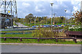
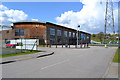
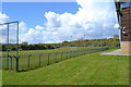
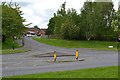
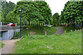
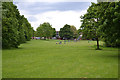
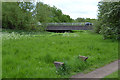
Photos of CV3 1LY


Area Information
CV3 1LY is a small, densely populated postcode area in Coventry, England, covering 5,124 square metres and home to 1,388 residents. Its compact size and high population density of 270,879 people per square kilometre reflect a tightly knit community. Nestled to the south-east of Coventry city centre, the area straddles the Coventry-Rugby railway line, with a history of industrial activity that has gradually shifted to housing and light industry. The northern part features newer residential developments, while the south retains older industrial estates and warehouses. Despite its small footprint, the area is well-connected, with multiple rail stations and proximity to two airports. Residents benefit from a low flood risk, a safety score of 74, and a mix of modern and historic influences. Daily life here is shaped by its proximity to the city, offering convenience without the sprawl of larger urban areas. The character of the area is defined by its compact layout, with grass verges, small factories, and a legacy of car manufacturing now repurposed for housing. It’s a place where history and modernity coexist, appealing to those seeking accessibility without sacrificing a sense of community.
- Area Type
- Postcode
- Area Size
- 5124 m²
- Population
- 1388
- Population Density
- 2853 people/km²
The property market in CV3 1LY is characterised by a 49% home ownership rate, suggesting a mix of owner-occupied and rental properties. The area is predominantly composed of houses rather than flats, which may appeal to buyers seeking more space in a compact setting. Given the small size of the postcode and its focus on housing, the market is likely limited in scale, with properties concentrated in the newer residential developments to the north of the Coventry-Rugby railway line. These areas were previously industrial sites, such as former car manufacturing plants, which have been redeveloped for housing. Buyers should consider the proximity to light industrial estates and offices to the south, which may influence property values and desirability. The area’s small size means that the immediate surroundings—such as nearby Coventry—play a significant role in the property market. For those seeking a balance between residential and industrial environments, CV3 1LY offers a unique blend of accessibility and character, though the limited housing stock may require flexibility in location preferences.
House Prices in CV3 1LY
Showing 20 properties
| Address | Type | Beds | Baths | Last Sale Price | Last Sale Date | |
|---|---|---|---|---|---|---|
| 15 Chatham Close, Coventry, CV3 1LY | house | - | - | - | - | |
| 10 Chatham Close, Coventry, CV3 1LY | house | - | - | - | - | |
| 9 Chatham Close, Coventry, CV3 1LY | house | - | - | - | - | |
| 20 Chatham Close, Coventry, CV3 1LY | house | - | - | - | - | |
| 21 Chatham Close, Coventry, CV3 1LY | house | - | - | - | - | |
| 17 Chatham Close, Coventry, CV3 1LY | house | - | - | - | - | |
| 3 Chatham Close, Coventry, CV3 1LY | house | - | - | - | - | |
| 4 Chatham Close, Coventry, CV3 1LY | house | - | - | - | - | |
| 1 Chatham Close, Coventry, CV3 1LY | house | - | - | - | - | |
| 12 Chatham Close, Coventry, CV3 1LY | house | - | - | - | - |
Energy Efficiency in CV3 1LY
Living in CV3 1LY offers access to a range of amenities within walking or short driving distance. Retail options include Budgens Aldermoor, Lidl Upper, and Iceland Binley, providing everyday shopping convenience. The area’s proximity to rail stations—such as Canley and Coventry Arena—connects residents to Coventry’s broader network, enabling easy access to city centre services, cultural attractions, and employment hubs. While the data does not mention parks or leisure facilities, the area’s industrial heritage is evident in its mix of warehouses and small factories, which now coexist with residential spaces. The legacy of car manufacturing, including former sites like Pinley House, adds historical interest. The compact layout ensures that essential services are nearby, reducing the need for long commutes. For those who enjoy a blend of practicality and accessibility, CV3 1LY provides a straightforward lifestyle, with shops, transport, and the city’s vibrancy all within reach. The area’s character is defined by its efficiency, making it suitable for those prioritising convenience over expansive green spaces.
Amenities
Schools
| Rank | School | Type | Entry gender | Ages |
|---|
Explore more schools in this area
Go to Schools tabDemographics
The population of CV3 1LY is 1,388, with a median age of 22, though the most common age range is adults aged 30–64. This suggests a mix of younger residents and families, possibly linked to nearby employment opportunities. Home ownership sits at 49%, indicating a balance between owner-occupied properties and rental stock. The area is predominantly composed of houses, not flats, which may appeal to those seeking more space. The predominant ethnic group is White, though specific data on diversity is not provided. The high population density—270,879 people per square kilometre—reflects a compact, closely packed community. This density can influence local amenities and services, ensuring proximity to shops, transport, and other essentials. While the data does not specify deprivation levels, the low crime risk and safety score of 74 suggest a stable environment. The age profile, with a significant proportion of working-age adults, may indicate a community focused on employment and family life, supported by nearby industrial and office spaces.
Household Size
Accommodation Type
Tenure
Ethnic Group
Religion
Household Composition
Age
Household Deprivation
NS-SEC
Explore more demographic insights in this area
Go to Demographics tabPlanning
Planning Constraints
- Flood RiskPremium
- Ramsar Wetland SitesPremium
- Area of Outstanding Natural BeautyPremium
- Protected Nature ReservePremium
- Protected WoodlandPremium