Area Overview for CV3 1FL
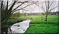
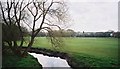
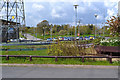
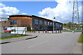
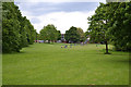
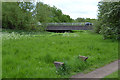
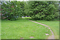
Photos of CV3 1FL

Area Information
CV3 1FL is a compact residential postcode in Coventry, England, covering 9995 m² with a population of 1660 people. Its high population density of 166080 people/km² reflects a tightly knit community, though the area’s character is shaped by its dual nature: newer housing developments to the north, replacing former industrial sites, and older light industrial estates to the south. Situated near the Coventry-Rugby railway line, the area is within easy reach of the city centre, offering a blend of proximity to urban amenities and quieter residential living. The median age of 22 contrasts with the most common age range of 30-64 years, suggesting a mix of younger professionals and established families. With a predominantly White population and 17% home ownership, the area leans toward rental properties, reflecting its history as a site of industrial redevelopment. Nearby, Aldermoor Farm Primary School provides a good-rated education option, while multiple rail stations and retail spots like Budgens Aldermoor and Lidl Upper cater to daily needs. The area’s compact size and strategic location make it appealing for those seeking a balance between city access and residential tranquillity.
- Area Type
- Postcode
- Area Size
- 9995 m²
- Population
- 1660
- Population Density
- 6417 people/km²
The property market in CV3 1FL is characterised by a low home ownership rate of 17%, indicating a strong rental market. The predominant accommodation type is houses, but the area’s compact size and industrial heritage suggest a mix of smaller, practical properties. Redevelopment of former car manufacturing sites, such as the ex-Peugeot factory, has introduced newer housing north of the Coventry-Rugby railway line, while the southern part retains light industrial and office spaces. This duality means buyers should expect a limited selection of homes, with a focus on terraced or semi-detached properties. The area’s proximity to Coventry city centre and multiple rail stations may appeal to those seeking affordable housing with good transport links. However, the small postcode size means the immediate surroundings are crucial for property options. For buyers, the market is likely to prioritise location over property size, with potential for growth in the newer developments.
House Prices in CV3 1FL
Showing 38 properties
| Address | Type | Beds | Baths | Last Sale Price | Last Sale Date | |
|---|---|---|---|---|---|---|
| 37 The Lindfield, Coventry, CV3 1FL | Terraced | 3 | 1 | £160,000 | Feb 2024 | |
| 31 The Lindfield, Coventry, CV3 1FL | Flat | - | - | £85,500 | Jun 2018 | |
| 45 The Lindfield, Coventry, CV3 1FL | Terraced | 3 | 2 | £126,000 | Feb 2018 | |
| 51 The Lindfield, Coventry, CV3 1FL | house | 3 | - | £88,000 | Feb 2014 | |
| 41 The Lindfield, Coventry, CV3 1FL | Terraced | 3 | 1 | £90,000 | Oct 2007 | |
| 49 The Lindfield, Coventry, CV3 1FL | Terraced | 4 | 1 | £100,000 | Dec 2006 | |
| 39 The Lindfield, Coventry, CV3 1FL | Terraced | 3 | 1 | £21,000 | May 1997 | |
| 5 The Lindfield, Coventry, CV3 1FL | Flat | - | - | - | - | |
| 29 The Lindfield, Coventry, CV3 1FL | Flat | - | - | - | - | |
| 25 The Lindfield, Coventry, CV3 1FL | Flat | - | - | - | - |
Energy Efficiency in CV3 1FL
Living in CV3 1FL offers access to a range of nearby amenities, including five retail outlets such as Budgens Aldermoor and Lidl Upper, providing essential shopping options. The area’s rail stations, including Tile Hill and Coventry Arena, connect residents to broader networks, facilitating travel to work, leisure, or social activities. While the data does not mention parks or leisure facilities, the proximity to Coventry city centre suggests additional options for dining, entertainment, and cultural activities. The compact nature of the area means amenities are within practical reach, though the lack of detailed information on green spaces or recreational facilities may require further investigation. The mix of retail, transport, and industrial zones creates a functional lifestyle, balancing convenience with the area’s historical industrial character.
Amenities
Schools
The nearest school to CV3 1FL is Aldermoor Farm Primary School, which provides a good-rated education for young children. As a primary school, it serves the local community’s needs for early education, though no secondary schools are listed in the data. The presence of a good-rated primary school is a key consideration for families with young children, offering a reliable foundation for their education. The school’s proximity to the area suggests that parents can easily access it, reducing commuting times. However, families requiring secondary education may need to look beyond CV3 1FL, as the data does not include nearby secondary schools. This highlights the importance of checking additional resources for comprehensive schooling options.
| Rank | School | Type | Entry gender | Ages |
|---|
Explore more schools in this area
Go to Schools tabDemographics
The population of CV3 1FL is 1660, with a median age of 22, though the most common age range is 30-64 years. This suggests a community of working-age adults, possibly including younger professionals and families. Home ownership is low at 17%, indicating a rental-dominated market, which may reflect the area’s history as a site of industrial redevelopment. The predominant accommodation type is houses, but the high population density implies a mix of smaller, closely packed properties. The White ethnic group is the largest, though specific data on other groups is not provided. The area’s demographics suggest a practical, working-class orientation, with limited data on deprivation levels. The high density and rental focus may influence community dynamics, fostering a shared reliance on local amenities and public transport. For residents, this profile means a focus on affordability and proximity to essential services rather than luxury or large properties.
Household Size
Accommodation Type
Tenure
Ethnic Group
Religion
Household Composition
Age
Household Deprivation
NS-SEC
Explore more demographic insights in this area
Go to Demographics tabPlanning
Planning Constraints
- Flood RiskPremium
- Ramsar Wetland SitesPremium
- Area of Outstanding Natural BeautyPremium
- Protected Nature ReservePremium
- Protected WoodlandPremium