Area Overview for CV3 1FG
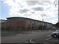
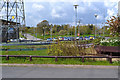
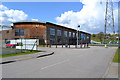
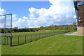
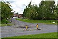
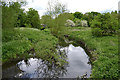
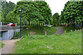
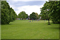
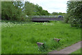
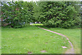
Photos of CV3 1FG
Area Information
CV3 1FG is a small, densely populated residential cluster in Coventry, England, covering just 4.9 hectares and home to 1,388 residents. Its compact size and high population density of 28,514 people per square kilometre reflect a tightly packed community. Situated in Lower Stoke Ward, the area straddles the Coventry-Rugby railway line, with newer housing developments to the north and older industrial estates to the south. Historically shaped by car manufacturing and light industry, the area has evolved into a mix of residential and commercial spaces. The northern part, once occupied by Humber and Peugeot factories, now hosts housing, while the southern side retains small factories, warehouses, and offices. Despite its industrial roots, the area’s proximity to Coventry city centre offers easy access to urban amenities. Daily life here is defined by its practical layout, with narrow streets and limited green spaces, but residents benefit from strong rail links and proximity to retail hubs. The community is young, with a median age of 22, suggesting a dynamic, possibly student or young professional demographic.
- Area Type
- Postcode
- Area Size
- 4.9 hectares
- Population
- 1388
- Population Density
- 2853 people/km²
The property market in CV3 1FG is characterised by a 49% home ownership rate, indicating a mix of owner-occupied and rental properties. The area’s accommodation type is predominantly houses, reflecting a traditional, often family-oriented housing stock. Given its small size—just 4.9 hectares—the housing stock is limited, with most properties concentrated in the northern residential developments that replaced former industrial sites. This suggests a focus on single-family homes rather than apartments or flats, which may appeal to buyers seeking space in a compact area. However, the proximity to Coventry city centre and rail links could make the area attractive for commuters or those seeking affordability near urban amenities. Buyers should consider the area’s industrial heritage, as some properties may be near former factories or warehouses. The small footprint of CV3 1FG also means that immediate surroundings, such as nearby wards, may offer more housing diversity.
House Prices in CV3 1FG
Showing 19 properties
| Address | Type | Beds | Baths | Last Sale Price | Last Sale Date | |
|---|---|---|---|---|---|---|
| 2 Yew Close, Coventry, CV3 1FG | Semi-detached | 4 | 1 | £100,000 | Oct 2013 | |
| 24 Yew Close, Coventry, CV3 1FG | house | - | - | - | - | |
| 20 Yew Close, Coventry, CV3 1FG | house | - | - | - | - | |
| 15 Yew Close, Coventry, CV3 1FG | house | - | - | - | - | |
| 14 Yew Close, Coventry, CV3 1FG | house | - | - | - | - | |
| 1 Yew Close, Coventry, CV3 1FG | Semi-detached | 4 | 1 | - | - | |
| 5 Yew Close, Coventry, CV3 1FG | house | - | - | - | - | |
| 12 Yew Close, Coventry, CV3 1FG | house | - | - | - | - | |
| 9 Yew Close, Coventry, CV3 1FG | house | - | - | - | - | |
| 11 Yew Close, Coventry, CV3 1FG | house | - | - | - | - |
Energy Efficiency in CV3 1FG
Living in CV3 1FG offers access to a range of practical amenities within walking or short driving distance. Retail options include Budgens Aldermoor, Heron Willenhall, and Lidl Upper, providing essential shopping and grocery needs. The area’s proximity to Coventry city centre and rail stations enhances its connectivity, allowing residents to access broader urban facilities. While there are no named parks or leisure venues in the immediate area, the presence of nearby rail links and retail hubs suggests a functional lifestyle focused on convenience. The industrial legacy of the area means some streets feature small factories and warehouses, but the newer housing developments to the north offer more residential-focused living. The compact nature of the area means amenities are closely clustered, reducing travel time for daily errands. However, the lack of dedicated green spaces or recreational facilities may limit options for outdoor activities, requiring residents to seek nearby parks or nature reserves.
Amenities
Schools
| Rank | School | Type | Entry gender | Ages |
|---|
Explore more schools in this area
Go to Schools tabDemographics
The population of CV3 1FG is predominantly adults aged 30–64, with a median age of 22, indicating a mix of younger and middle-aged residents. Home ownership sits at 49%, slightly below the national average, suggesting a balance between owner-occupied and rental properties. The accommodation type is primarily houses, reflecting a traditional housing stock rather than flats or apartments. The predominant ethnic group is White, with no specific data on other demographics provided. The high population density—28,514 people per square kilometre—suggests a compact, possibly mixed-use environment where residential and industrial spaces coexist. This density may influence local services and infrastructure, but the area’s small size means community interactions are likely frequent. The absence of detailed diversity statistics means broader social dynamics remain less defined, though the presence of nearby amenities and transport links suggests a functional, if tightly packed, community.
Household Size
Accommodation Type
Tenure
Ethnic Group
Religion
Household Composition
Age
Household Deprivation
NS-SEC
Explore more demographic insights in this area
Go to Demographics tabPlanning
Planning Constraints
- Flood RiskPremium
- Ramsar Wetland SitesPremium
- Area of Outstanding Natural BeautyPremium
- Protected Nature ReservePremium
- Protected WoodlandPremium