Area Overview for RG2 9DT
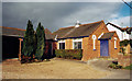
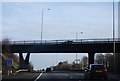
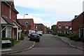
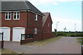
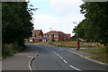
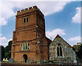
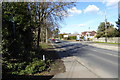
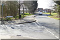
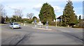
Photos of RG2 9DT
Area Information
RG2 9DT is a specific postcode area covering a small residential cluster in England. You are looking at a community defined by its compact size, spanning just 9821 square metres. This limited footprint creates an intimate environment where neighbours know each other. The area accommodates 1993 residents, resulting in a population density of 480 people per square kilometre. Living in RG2 9DT means opting for a concentrated neighbourhood rather than a sprawling banlieue. The demographic make-up is dominated by adults aged between 30 and 64 years, indicating a established population rather than a student or commuter hotspot. You will find a concentration of houses within these boundaries. The area exists within the RG2 postal district, serving local residents with direct access to nearby transport hubs and retail centres. While the square footage is small, the infrastructure supports the daily needs of nearly two thousand households. This postcode represents a slice of life where convenience is engineered into the layout. Residents benefit from proximity to major stations without the noise typically associated with such closeness. It is a place where the built environment is optimised for ground-level living. The character of RG2 9DT is shaped by this high density of housing combined with mature occupation rates.
- Area Type
- Postcode
- Area Size
- 9821 m²
- Population
- 1993
- Population Density
- 480 people/km²
The property market in RG2 9DT is defined by a heavily owner-occupied stock. With home ownership at 83 percent, the area is far removed from the volatile rental sector seen in some southern London municipalities. Houses dominate the accommodation type mix, meaning you will not find apartment blocks or converted flats as primary listings. This structural bias ensures that buyers looking at this small area are seeking traditional brick-built or stone-built homes. The high ownership rate implies that properties often change hands through inheritance, construction of newer builds on brownfield sites, or private sales rather than corporate buy-to-let schemes. For those viewing homes in RG2 9DT, the expectation should be of owner-maintained gardens and private driveways rather than communal corridors. The small area size of 9821 square metres limits the sheer volume of stock but increases competition for the available large detached or semi-detached properties. Buyers seeking investment returns via short-term rentals may find this market less dynamic due to the 83 percent ownership figure. Instead, this is a market driven by long-term value, school catchments, and transport links. The concentration of houses ensures that character homes can survive the development pressures that affect other parts of the RG2 district. It is a market for those who wish to put down roots rather than spin through a portfolio of investments.
House Prices in RG2 9DT
Showing 28 properties
| Address | Type | Beds | Baths | Last Sale Price | Last Sale Date | |
|---|---|---|---|---|---|---|
| 6 Seymour Avenue, Shinfield, RG2 9DT | Semi-detached | 3 | 1 | £335,000 | Jun 2025 | |
| 11 Seymour Avenue, Shinfield, RG2 9DT | Semi-detached | 4 | 2 | £425,000 | Apr 2024 | |
| 1 Seymour Avenue, Shinfield, RG2 9DT | Semi-detached | 3 | 1 | £450,000 | Feb 2024 | |
| 9 Seymour Avenue, Shinfield, RG2 9DT | house | 3 | 1 | £360,248 | Jul 2023 | |
| 4 Seymour Avenue, Shinfield, RG2 9DT | Semi-detached | 3 | 1 | £360,000 | May 2023 | |
| 3 Seymour Avenue, Shinfield, RG2 9DT | house | - | - | £420,000 | Feb 2021 | |
| 25 Seymour Avenue, Shinfield, RG2 9DT | Semi-detached | 3 | 2 | £380,000 | Sep 2019 | |
| 26 Seymour Avenue, Shinfield, RG2 9DT | Semi-detached | 3 | 1 | £325,000 | Jul 2019 | |
| 32 Seymour Avenue, Shinfield, RG2 9DT | Semi-detached | 3 | 1 | £345,000 | Feb 2019 | |
| 12 Seymour Avenue, Shinfield, RG2 9DT | Semi-detached | 3 | 2 | £370,000 | Dec 2018 |
Energy Efficiency in RG2 9DT
Life in RG2 9DT centres on a blend of immediate retail convenience and short-distance travel to wider amenities. Five retail outlets operate within practical reach, providing daily necessities without requiring a drive to town centres. Asda Shinfield, Lidl Beke, and the Co-op Former station nearby form the commercial backbone for local shoppers. These supermarkets offer a wide range of groceries, household goods, and fresh produce. Residents can stock their cupboards without travelling far from their homes in RG2 9DT. Transport infrastructure further extends your lifestyle radius. You have access to Earley Railway Station, Winnersh Triangle Railway Station, and Winnersh Railway Station. These stations connect you to the wider Thames Valley network and central London. Dining options are naturally linked to the presence of Asda Shinfield and Lidl Beke, which often host cafes or have adjacent hospitality venues. While the area is residential, the density of 480 people per square kilometre ensures that no resident is truly isolated from services. The 1993 population supports local community groups and possibly a small library or community centre nearby. You do not need to commute to Reading or Maidenhead for basic errands. The 9821 square metre size means your daily journey is often measured in minutes rather than miles.
Amenities
Schools
| Rank | School | Type | Entry gender | Ages |
|---|
Explore more schools in this area
Go to Schools tabDemographics
The community in RG2 9DT reflects a settled society with a median age of 47 years. Adults aged between 30 and 64 years represent the most common age range within this cluster. This profile suggests a population that has taken root in the property and is unlikely to move frequently. A significant strength of the area is the home ownership level, which stands at 83 percent. This high figure indicates that the vast majority of residents purchased their homes or inherited them, rather than renting. Such stability often correlates with lower turnover rates and a more stable local fabric. Houses are the predominant accommodation type found within RG2 9DT, reinforcing the established residential nature of the location. White residents form the predominant ethnic group in this specific postcode area. The low population density of 480 people per square kilometre provides a buffer against overcrowding. You can expect a neighbourhood where residents value long-term tenure over temporary stays. The age distribution means the area relies less on young families needing large gardens and more on households that appreciate cleaner streets and better services. This demographic structure supports local businesses that cater to mature consumers. Home ownership ratios like this often mean the local school system benefits from steady families.
Household Size
Accommodation Type
Tenure
Ethnic Group
Religion
Household Composition
Age
Household Deprivation
NS-SEC
Explore more demographic insights in this area
Go to Demographics tabPlanning
Planning Constraints
- Flood RiskPremium
- Ramsar Wetland SitesPremium
- Area of Outstanding Natural BeautyPremium
- Protected Nature ReservePremium
- Protected WoodlandPremium