Area Overview for RG2 9DR
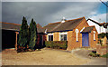
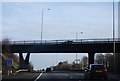
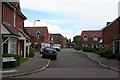
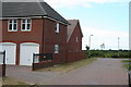
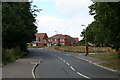
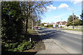
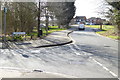
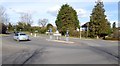
Photos of RG2 9DR

Area Information
RG2 9DR represents a specific postcode cluster within the broader Reading landscape, covering a precise 4,806 square metres. Despite its small footprint, this residential zone accommodates 1,993 people, resulting in a population density of 480 residents per square kilometre. This concentration suggests a compact neighbourhood where daily life revolves around immediate proximity rather than vast distances. Living in RG2 9DR means being part of a defined community where homes are arranged in close proximity to one another. The area functions as a self-contained residential pocket, ideal for those who value a settled environment over sprawling urban amenities. You will find that the daily rhythm here is dominated by the routines of a mature population. The defining characteristic of this cluster is its exclusivity as a very small area, which often creates a tight-knit atmosphere among neighbours. You navigate a space where the boundary between households is short, fostering a sense of familiarity among residents who have called this specific postcode home for many years. The compact nature of the site means that while it feels like a distinct neighbourhood, it is also deeply integrated into the wider transport corridors serving the wider RG2 region. This location offers the advantage of being situated in a stable part of Berkshire, away from the chaotic edges of major cities but still connected to them through established rail networks. The community within RG2 9DR is defined by a mature demographic profile, with a median age of 47 years. Most residents fall into the adult bracket between 30 and 64 years old, indicating a neighbourhood settled by households that have moved beyond their twenties or early thirties. This age distribution points to families with older children or empty-nester couples who have prioritised stability in their choice of home. Over 83% of residents are owner-occupiers, which creates a strong sense of permanence and long-term investment in the local streets. You will find very few purpose-built rental schemes here; instead, the housing stock consists predominantly of houses that have been lived in for generations. The ethnic composition is overwhelmingly White, reflecting a traditional suburban make-up that has remained relatively static over time. This demographic consistency contributes to a predictable social environment where community norms are well established. Because over four-fifths of the population owns their homes, you are unlikely to encounter the transient nature often found in high-rent districts. Instead, neighbours tend to know one another through years of shared history, resulting in a quiet, observado community where change is slow and deliberate. The data shows no significant skew toward younger professionals or students, reinforcing the area's role as a permanent residence for established families rather than a commuter hub for the young. Your expectations for the housing market in RG2 9DR should align with the reality of a heavily owner-occupied zone. With 83% of the population holding titles to their properties, this area is almost entirely characterised by long-term owners rather than landlords or short-term tenants. This statistic translates directly into the physical streetscapes you will encounter, which are dominated by traditional houses rather than modern apartment blocks or conversion schemes. The predominant accommodation type is houses, reinforcing the classic suburban feel of the neighbourhood. You are buying into a market driven by family needs, where homes are often passed down or purchased for stability rather than investment speculation. Rental yields and landlord activity are minimal here because the vast majority of dwellings are filled by families who intend to stay in place. If you are looking to buy a home in this postcode, you will face competition from other homeowners who value assets reliably. The fact that the area comprises houses means you can expect garden access, larger footprints, and structures typical of the British suburban built environment. There is little pressure to adapt to changing rental demands, which allows property values to remain stable and reflective of genuine local demand. You will not find the volatility common in mixed-use zones; instead, the market here mirrors the quiet, established nature of the residents who call it home. Living in RG2 9DR requires a clear understanding of your digital and physical connectivity, as this small cluster relies on broader regional networks. Your digital infrastructure is exceptionally strong, with a fixed broadband quality score of 98 out of 100. This near-perfect rating ensures that working from home, streaming high-definition content, and managing smart home devices will be seamless without buffer issues. You can rely on a connection that rivals the best business districts in the country, making remote work a viable daily routine. However, mobile coverage presents a more modest picture with a score of 82 out of 100. While this is a good score compared to national averages, it indicates that you may experience reduced signal strength in shadowed areas or inside basements. dependancy on Wi-Fi at home therefore remains crucial for consistent communication. Physically, access to rail transport is manageable but not immediate, as the nearest stations are located a short distance away. Earley, Winnersh Triangle, and Winnersh Railway Stations all serve the wider RG2 region, linking you to London Paddington and other major hubs. You must budget time for the journey to these stations, as the cluster itself does not contain a direct station platform. This setup suits commuters who prioritise excellent home internet over last-minute train access. Your daily lifestyle in RG2 9DR revolves around what lies within practical reach, as the immediate cluster offers limited standalone amenities. Retail options are concentrated in nearby villages, most notably the Asda Shinfield and the Lidl Beke superstores. These two major supermarkets provide the bulk of your food shopping needs, meaning you will drive a short distance or use a delivery service for your weekly groceries. There is also a former Co-op site nearby, which may serve as an additional point for local essentials or charity collections depending on current tenancy. For residents who prioritise convenience, the proximity of these large retailers means you do not need to travel far into Reading town centre for bulk shopping. Rail travel options are equally accessible, with Earley, Winnersh Triangle, and Winnersh Railway Station within a reasonable commute. These stations connect you to the wider rail network, allowing you to reach London or business parks beyond the immediate area without needing a car for every journey. While the postcode itself lacks parks or leisure centres within its 4,806 square metre boundary, the surrounding transport links mean you can reach these amenities quickly. You will find that your daily errands require a small car or good walking distances to these nearby hubs. The character of your life is therefore defined by a mix of quiet residential mornings and practical expeditions to the nearby shops and stations. Safety and environmental risk form a foundational part of living in RG2 9DR, and the data here shows a picture of low danger and high stability. You can rest easy regarding flood risk, as the area has a score of 0 on a scale of 100, indicating negligible probability of water accumulation. This assessment confirms that neither your home nor your garden is threatened by rising rivers or heavy surface water events during winter storms. Planning constraints are equally non-existent in this location. The site holds no protected status for Ramsar wetland sites, Areas of Outstanding Natural Beauty, or designated nature reserves. There is no protected woodland covering the area, which means planning permissions for standard residential or minor upgrades are subject only to local rules rather than national conservation bans. Crime risk is the most significant variable, though still very low. With a safety score of 73 out of 100 and a risk level of 73, this area records below-average crime rates compared to the national baseline. You are statistically unlikely to be a victim of antisocial behaviour or property crime. These factors combine to create one of the most secure environments available in the region. What is the most common age group living in RG2 9DR?The most common age range is adults between 30 and 64 years old. With a median age of 47, the area is dominated by settled households rather than young families or students. This demographic preference for mid-life stability shapes the character of the neighbourhood. How reliable is the internet for working from home in this area?Fixed broadband quality is excellent with a score of 98 out of 100, offering speeds suitable for heavy usage. Mobile coverage is good but slightly lower at 82 out of 100. You can rely on a robust home connection, but mobile signal may vary in signal shadowed areas. Are there many shops or train stations directly within RG2 9DR?There are no major amenities directly inside the 4,806 square metre cluster. You will find Asda Shinfield and Lidl Beke for retail, and rail links are accessed via Earley, Winnersh Triangle, or Winnersh stations nearby. All facilities are within practical reach for daily commuting. Is this area considered safe for residents and their families?Yes, the crime risk score is 73, indicating below-average crime rates and a safer neighbourhood. Additionally, there is no flood risk, no protected woodland, and no planning constraints from nature reserves. These factors confirm a low-risk environment for day-to-day living.
- Area Type
- Postcode
- Area Size
- 4806 m²
- Population
- 1993
- Population Density
- 480 people/km²
House Prices in RG2 9DR
Showing 12 properties
| Address | Type | Beds | Baths | Last Sale Price | Last Sale Date | |
|---|---|---|---|---|---|---|
| 8 Goddard Close, Shinfield, RG2 9DR | house | - | - | £375,000 | Sep 2021 | |
| 11 Goddard Close, Shinfield, RG2 9DR | Semi-detached | 3 | - | £415,000 | Jun 2019 | |
| 1 Goddard Close, Shinfield, RG2 9DR | house | - | - | £270,000 | May 2008 | |
| 10 Goddard Close, Shinfield, RG2 9DR | Semi-detached | - | - | £248,000 | May 2006 | |
| 9 Goddard Close, Shinfield, RG2 9DR | Semi-detached | - | - | £230,000 | Apr 2004 | |
| 7 Goddard Close, Shinfield, RG2 9DR | Semi-detached | 3 | 2 | £236,000 | Dec 2003 | |
| 12 Goddard Close, Shinfield, RG2 9DR | Semi-detached | - | - | £116,500 | Apr 1998 | |
| 2 Goddard Close, Shinfield, RG2 9DR | Semi-detached | - | - | - | - | |
| 4 Goddard Close, Shinfield, RG2 9DR | Semi-detached | - | - | - | - | |
| 6 Goddard Close, Shinfield, RG2 9DR | Bungalow | - | - | - | - |
Energy Efficiency in RG2 9DR
Your daily lifestyle in RG2 9DR revolves around what lies within practical reach, as the immediate cluster offers limited standalone amenities. Retail options are concentrated in nearby villages, most notably the Asda Shinfield and the Lidl Beke superstores. These two major supermarkets provide the bulk of your food shopping needs, meaning you will drive a short distance or use a delivery service for your weekly groceries. There is also a former Co-op site nearby, which may serve as an additional point for local essentials or charity collections depending on current tenancy. For residents who prioritise convenience, the proximity of these large retailers means you do not need to travel far into Reading town centre for bulk shopping. Rail travel options are equally accessible, with Earley, Winnersh Triangle, and Winnersh Railway Station within a reasonable commute. These stations connect you to the wider rail network, allowing you to reach London or business parks beyond the immediate area without needing a car for every journey. While the postcode itself lacks parks or leisure centres within its 4,806 square metre boundary, the surrounding transport links mean you can reach these amenities quickly. You will find that your daily errands require a small car or good walking distances to these nearby hubs. The character of your life is therefore defined by a mix of quiet residential mornings and practical expeditions to the nearby shops and stations. Safety and environmental risk form a foundational part of living in RG2 9DR, and the data here shows a picture of low danger and high stability. You can rest easy regarding flood risk, as the area has a score of 0 on a scale of 100, indicating negligible probability of water accumulation. This assessment confirms that neither your home nor your garden is threatened by rising rivers or heavy surface water events during winter storms. Planning constraints are equally non-existent in this location. The site holds no protected status for Ramsar wetland sites, Areas of Outstanding Natural Beauty, or designated nature reserves. There is no protected woodland covering the area, which means planning permissions for standard residential or minor upgrades are subject only to local rules rather than national conservation bans. Crime risk is the most significant variable, though still very low. With a safety score of 73 out of 100 and a risk level of 73, this area records below-average crime rates compared to the national baseline. You are statistically unlikely to be a victim of antisocial behaviour or property crime. These factors combine to create one of the most secure environments available in the region. What is the most common age group living in RG2 9DR?The most common age range is adults between 30 and 64 years old. With a median age of 47, the area is dominated by settled households rather than young families or students. This demographic preference for mid-life stability shapes the character of the neighbourhood. How reliable is the internet for working from home in this area?Fixed broadband quality is excellent with a score of 98 out of 100, offering speeds suitable for heavy usage. Mobile coverage is good but slightly lower at 82 out of 100. You can rely on a robust home connection, but mobile signal may vary in signal shadowed areas. Are there many shops or train stations directly within RG2 9DR?There are no major amenities directly inside the 4,806 square metre cluster. You will find Asda Shinfield and Lidl Beke for retail, and rail links are accessed via Earley, Winnersh Triangle, or Winnersh stations nearby. All facilities are within practical reach for daily commuting. Is this area considered safe for residents and their families?Yes, the crime risk score is 73, indicating below-average crime rates and a safer neighbourhood. Additionally, there is no flood risk, no protected woodland, and no planning constraints from nature reserves. These factors confirm a low-risk environment for day-to-day living.
Amenities
Schools
| Rank | School | Type | Entry gender | Ages |
|---|
Explore more schools in this area
Go to Schools tabDemographics
Household Size
Accommodation Type
Tenure
Ethnic Group
Religion
Household Composition
Age
Household Deprivation
NS-SEC
Explore more demographic insights in this area
Go to Demographics tabPlanning
Planning Constraints
- Flood RiskPremium
- Ramsar Wetland SitesPremium
- Area of Outstanding Natural BeautyPremium
- Protected Nature ReservePremium
- Protected WoodlandPremium