Area Overview for RG2 9DE
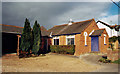
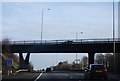
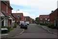
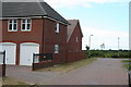
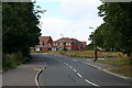
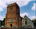
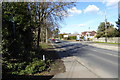
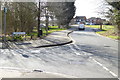
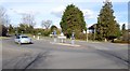
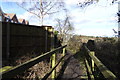
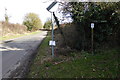
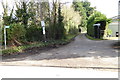
Photos of RG2 9DE
Area Information
RG2 9DE is a compact residential postcode area in England, covering just 1.2 hectares and home to 1993 residents. With a population density of 480 people per square kilometre, this small cluster of homes is tightly knit, offering a quiet, low-density living environment. The area is characterised by its focus on house ownership, with 83% of residents living in their own homes. Daily life here is shaped by proximity to practical amenities, including five retail outlets such as Asda Shinfield and Lidl Beke, and five rail stations, including Winnersh Triangle and Earley, which provide easy access to nearby towns and cities. The demographic profile suggests a mature, stable community, with a median age of 47 and a majority of residents aged between 30 and 64. This makes RG2 9DE a place where families and professionals seeking a settled lifestyle can thrive, supported by reliable transport links and a low crime rate.
- Area Type
- Postcode
- Area Size
- 1.2 hectares
- Population
- 1993
- Population Density
- 480 people/km²
The property market in RG2 9DE is dominated by owner-occupied homes, with 83% of residents living in their own properties. This indicates a community where long-term residency is common, and the housing stock is largely composed of houses rather than flats or apartments. Given the area’s small size—just 1.2 hectares—the number of properties is limited, making it a niche market for buyers seeking a quiet, residential environment. The high home ownership rate suggests that rental properties are less prevalent, which could mean fewer opportunities for tenants but a more stable market for homeowners. Proximity to rail stations such as Winnersh Triangle and Earley enhances the area’s appeal for commuters, while the low crime risk and reliable broadband connectivity further support its desirability. Buyers should consider the limited housing stock and the potential for limited price competition, though the area’s compact nature may also mean that properties are closely located to essential amenities.
House Prices in RG2 9DE
Showing 23 properties
| Address | Type | Beds | Baths | Last Sale Price | Last Sale Date | |
|---|---|---|---|---|---|---|
| 21 Ilbury Close, Shinfield, RG2 9DE | Detached | 3 | 1 | £480,000 | Jul 2025 | |
| 15 Ilbury Close, Shinfield, RG2 9DE | Detached | 3 | 1 | £400,000 | May 2025 | |
| 12 Ilbury Close, Shinfield, RG2 9DE | Semi-detached | 3 | 1 | £410,000 | Mar 2025 | |
| 9 Ilbury Close, Shinfield, RG2 9DE | Semi-detached | 4 | 2 | £520,000 | Nov 2023 | |
| 17 Ilbury Close, Shinfield, RG2 9DE | Semi-detached | 3 | 1 | £415,000 | Jun 2023 | |
| 16 Ilbury Close, Shinfield, RG2 9DE | house | 3 | 2 | £420,000 | Jun 2022 | |
| 23 Ilbury Close, Shinfield, RG2 9DE | Semi-detached | 4 | - | £360,000 | May 2018 | |
| 22 Ilbury Close, Shinfield, RG2 9DE | Terraced | 3 | 1 | £350,000 | Jul 2016 | |
| 18 Ilbury Close, Shinfield, RG2 9DE | Semi-detached | 3 | - | £315,255 | Jul 2016 | |
| 20 Ilbury Close, Shinfield, RG2 9DE | Semi-detached | 3 | 1 | £345,000 | Apr 2016 |
Energy Efficiency in RG2 9DE
Living in RG2 9DE offers access to a range of practical amenities within close reach. The area is served by five retail outlets, including Asda Shinfield and Lidl Beke, providing everyday shopping convenience. These stores cater to both household essentials and local needs, reducing the need for long journeys to larger centres. The presence of five rail stations, such as Winnersh Triangle and Earley, enhances mobility, allowing residents to connect easily with nearby towns and cities. While the data does not specify parks or leisure facilities, the rail links and retail options suggest a lifestyle that prioritises accessibility and practicality. The compact nature of the area means that amenities are closely clustered, supporting a convenient, low-stress daily routine. For those who value proximity to transport and retail, RG2 9DE offers a straightforward, functional living environment.
Amenities
Schools
| Rank | School | Type | Entry gender | Ages |
|---|
Explore more schools in this area
Go to Schools tabDemographics
The community in RG2 9DE is predominantly composed of adults aged 30 to 64, with a median age of 47. This suggests a mature population, likely with established careers and long-term commitments to the area. Home ownership is high, at 83%, indicating a strong sense of local investment and stability. The accommodation type is primarily houses, which aligns with the area’s small, residential character. The predominant ethnic group is White, reflecting a homogenous demographic profile. With a population density of 480 people per square kilometre, the area balances residential density with a sense of space. While no specific data on deprivation is provided, the high home ownership and low crime risk suggest a quality of life that is generally stable, though the absence of diverse demographic data means the community’s social fabric is less defined in terms of cultural or ethnic variety.
Household Size
Accommodation Type
Tenure
Ethnic Group
Religion
Household Composition
Age
Household Deprivation
NS-SEC
Explore more demographic insights in this area
Go to Demographics tabPlanning
Planning Constraints
- Flood RiskPremium
- Ramsar Wetland SitesPremium
- Area of Outstanding Natural BeautyPremium
- Protected Nature ReservePremium
- Protected WoodlandPremium