Area Overview for RG2 9BT
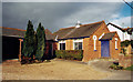
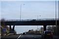
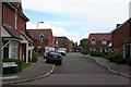
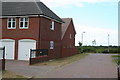
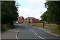
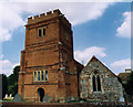
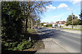
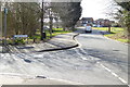
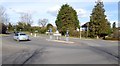
Photos of RG2 9BT
Area Information
RG2 9BT is a compact residential postcode in England, covering just 1.9 hectares and home to 1,709 residents. Its high population density of 88,021 people per square kilometre reflects a tightly knit community, where the majority of homes are owner-occupied. This area is defined by its small-scale, house-dominated housing stock, catering to a population skewed toward adults aged 30–64, with a median age of 47. Daily life here is shaped by proximity to essential services and transport links, though the area’s size means it is best suited for those prioritising convenience over expansive living spaces. The postcode’s location likely places it within reach of nearby towns, though its own amenities are limited to what is immediately accessible. With no significant natural or protected sites nearby, RG2 9BT focuses on practical living, blending residential stability with the logistical demands of a high-density environment. For buyers, this area offers a snapshot of a mature, settled community where home ownership is the norm, and the challenge lies in balancing limited space with the need for connectivity and local facilities.
- Area Type
- Postcode
- Area Size
- 1.9 hectares
- Population
- 1709
- Population Density
- 3688 people/km²
RG2 9BT is primarily an owner-occupied area, with 72% of residents living in their own homes. The housing stock consists entirely of houses, which is unusual for a high-density postcode and may indicate a mix of older properties and newer builds. Given the area’s small size—just 1.9 hectares—the property market is likely limited to a small number of homes, with limited scope for new developments. This makes the area attractive to buyers seeking established homes in a stable community, but it also means competition for available properties. The predominance of houses over flats or apartments suggests a preference for traditional, family-friendly housing. However, the high population density raises questions about the practicality of house ownership in such a confined space, potentially limiting appeal to those prioritising larger living areas. Buyers should consider the proximity to amenities and transport links, as the area’s small footprint means local facilities are critical to daily life.
House Prices in RG2 9BT
Showing 18 properties
| Address | Type | Beds | Baths | Last Sale Price | Last Sale Date | |
|---|---|---|---|---|---|---|
| 12 Hollow Lane, Shinfield, RG2 9BT | Detached | 4 | 3 | £580,000 | Aug 2022 | |
| Caretech Community Services Limited, Magnolia Lodge, 42 Hollow Lane, Shinfield, RG2 9BT | hospital_care_home | - | - | £550,000 | Apr 2019 | |
| 30 Hollow Lane, Shinfield, RG2 9BT | house | - | - | £370,000 | Nov 2018 | |
| 26 Hollow Lane, Shinfield, RG2 9BT | Detached | 4 | 3 | £775,000 | Oct 2018 | |
| 20 Hollow Lane, Shinfield, RG2 9BT | Detached | 4 | - | £595,000 | Apr 2015 | |
| 32 Hollow Lane, Shinfield, RG2 9BT | Semi-detached | - | - | £310,000 | Apr 2008 | |
| 14 Hollow Lane, Shinfield, RG2 9BT | Detached | - | - | £135,000 | Oct 1997 | |
| 40 Hollow Lane, Shinfield, RG2 9BT | Detached | - | - | £115,000 | Sep 1995 | |
| 24 Hollow Lane, Shinfield, RG2 9BT | Detached | 5 | 2 | - | - | |
| 8 Hollow Lane, Shinfield, RG2 9BT | Retail | 3 | 2 | - | - |
Energy Efficiency in RG2 9BT
Residents of RG2 9BT have access to a range of retail and transport amenities within practical reach. Five retail outlets are listed, including Lidl Beke, Asda Shinfield, and Co-op Former, providing everyday shopping needs. These stores cater to a variety of preferences, from budget-friendly options to established supermarket chains. The rail network is particularly well-developed, with five stations nearby, including Earley and Winnersh Triangle Railway Stations. This connectivity supports both daily commutes and access to broader regional services. While the area lacks dedicated parks or leisure facilities, the proximity to rail and retail suggests a focus on convenience over expansive recreational spaces. The compact nature of RG2 9BT means that amenities are tightly clustered, which can be both a benefit and a limitation—offering ease of access but potentially limiting diversity in local offerings.
Amenities
Schools
Residents of RG2 9BT have access to three schools within practical reach. Shinfield Infant and Nursery School serves as a primary school, while Shinfield St Mary’s CofE Junior School is also a primary school with an Ofsted rating of ‘good’. A second Shinfield Infant and Nursery School is listed as an academy, though its rating is not specified. The mix of school types offers families options between traditional state education and academy-led institutions, which may provide distinct curricula or governance structures. The presence of two primary schools suggests the area is well-served for younger children, though no secondary schools are mentioned in the data. For families, this proximity to multiple schools is a key consideration, though the absence of higher education institutions nearby may require commuting for older students. The ‘good’ rating at one school indicates a baseline quality of education, though parents should investigate further for detailed performance metrics.
| Rank | School | Type | Entry gender | Ages |
|---|
Explore more schools in this area
Go to Schools tabDemographics
The population of RG2 9BT is predominantly composed of adults aged 30–64, with a median age of 47. This suggests a community of established professionals and families, rather than a mix of younger or older demographics. Home ownership is high, with 72% of residents living in their own homes, indicating long-term residency and stability. The accommodation type is exclusively houses, reinforcing a suburban or semi-rural character, though the area’s small size means housing stock is limited. The predominant ethnic group is White, with no data provided on other demographics. The age profile and ownership rates imply a low turnover of residents, fostering a sense of continuity. However, the high population density—88,021 people per square kilometre—suggests that the area is intensely used, with limited space for expansion. This density may impact quality of life, particularly in terms of privacy and green space, though the absence of protected natural areas means development constraints are minimal.
Household Size
Accommodation Type
Tenure
Ethnic Group
Religion
Household Composition
Age
Household Deprivation
NS-SEC
Explore more demographic insights in this area
Go to Demographics tabPlanning
Planning Constraints
- Flood RiskPremium
- Ramsar Wetland SitesPremium
- Area of Outstanding Natural BeautyPremium
- Protected Nature ReservePremium
- Protected WoodlandPremium