Area Overview for RG2 9DJ
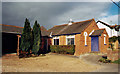
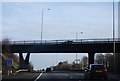
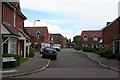
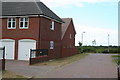
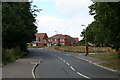
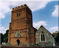
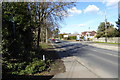
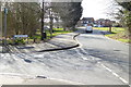
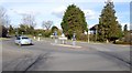
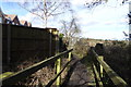
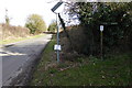
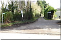
Photos of RG2 9DJ
Area Information
RG2 9DJ is a small, compact residential area in England, covering just 1.6 hectares and home to 1,993 residents. Its population density of 480 people per square kilometre suggests a tight-knit community, where proximity to local amenities and transport links shapes daily life. The area’s character is defined by its mix of houses, with 83% of residents owning their homes, indicating a stable, long-term demographic. While the postcode cluster is modest in size, it is well-served by nearby rail stations, including Earley, Winnersh Triangle, and Winnersh, offering easy access to surrounding towns. Retail options are practical, with Asda Shinfield, Lidl Beke, and Co-op Former within reach. The area’s low crime risk and absence of environmental constraints make it appealing for those seeking a quiet, secure place to live, close to both essential services and commuter routes.
- Area Type
- Postcode
- Area Size
- 1.6 hectares
- Population
- 1993
- Population Density
- 480 people/km²
The property market in RG2 9DJ is dominated by owner-occupied homes, with 83% of residents living in properties they own. The area’s housing stock is primarily composed of houses, which suggests a focus on family-friendly or semi-detached living. Given the small size of the postcode area—just 1.6 hectares—this implies a limited number of properties, likely concentrated in a single residential cluster. The high home ownership rate indicates a market where long-term residency is common, rather than a rental-driven environment. Buyers should consider the compact nature of the area, as expansion or new developments may be constrained by the existing layout. The presence of nearby rail stations also makes it attractive for commuters seeking a balance between residential space and connectivity.
House Prices in RG2 9DJ
Showing 26 properties
| Address | Type | Beds | Baths | Last Sale Price | Last Sale Date | |
|---|---|---|---|---|---|---|
| 5 Wychelm Road, Shinfield, RG2 9DJ | Retail | 3 | 1 | £490,000 | Mar 2022 | |
| 21 Wychelm Road, Shinfield, RG2 9DJ | Bungalow | - | - | £395,000 | Sep 2020 | |
| 15 Wychelm Road, Shinfield, RG2 9DJ | Detached | 3 | 1 | £540,000 | Apr 2019 | |
| 6 Wychelm Road, Shinfield, RG2 9DJ | house | - | - | £350,000 | May 2012 | |
| 5A Wychelm Road, Shinfield, RG2 9DJ | Bungalow | 2 | - | £265,000 | May 2012 | |
| 4A Wychelm Road, Shinfield, RG2 9DJ | house | - | - | £140,000 | Aug 2009 | |
| 2 Wychelm Road, Shinfield, RG2 9DJ | Bungalow | 2 | 1 | £249,000 | Jun 2009 | |
| 27 Wychelm Road, Shinfield, RG2 9DJ | house | - | - | £325,000 | Mar 2008 | |
| 23 Wychelm Road, Shinfield, RG2 9DJ | Bungalow | - | - | £340,000 | Sep 2007 | |
| 7 Wychelm Road, Shinfield, RG2 9DJ | house | - | - | £279,950 | Aug 2007 |
Energy Efficiency in RG2 9DJ
RG2 9DJ offers a practical lifestyle with accessible amenities. Within walking or short driving distance are five retail outlets, including Asda Shinfield, Lidl Beke, and Co-op Former, providing essentials like groceries and everyday goods. The rail stations—Earley, Winnersh Triangle, and Winnersh—connect residents to nearby towns, enhancing access to broader leisure, dining, and employment opportunities. While the area itself is small, its proximity to transport hubs means residents can easily reach larger centres for cultural or recreational activities. The mix of retail and rail services supports a convenient, self-sufficient daily life, particularly for those who value ease of access to both local and regional amenities.
Amenities
Schools
| Rank | School | Type | Entry gender | Ages |
|---|
Explore more schools in this area
Go to Schools tabDemographics
The population of RG2 9DJ has a median age of 47, with the majority of residents aged between 30 and 64. This suggests a community of middle-aged adults, many of whom may be established professionals or families. Home ownership is high, at 83%, reflecting a preference for long-term residency over rental properties. The accommodation type is predominantly houses, which aligns with the area’s character as a residential cluster rather than a high-density housing zone. The predominant ethnic group is White, though no further breakdown of diversity is provided. The age profile and ownership rates indicate a mature, stable population with lower turnover, which can contribute to a consistent local environment.
Household Size
Accommodation Type
Tenure
Ethnic Group
Religion
Household Composition
Age
Household Deprivation
NS-SEC
Explore more demographic insights in this area
Go to Demographics tabPlanning
Planning Constraints
- Flood RiskPremium
- Ramsar Wetland SitesPremium
- Area of Outstanding Natural BeautyPremium
- Protected Nature ReservePremium
- Protected WoodlandPremium