Area Overview for RG2 9AD
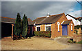
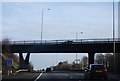
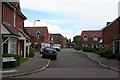
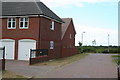
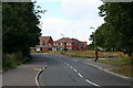
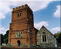
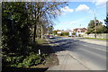
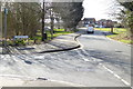
Photos of RG2 9AD
Area Information
RG2 9AD is a compact residential postcode in England, covering just 2.6 hectares and home to 1709 residents. Its high population density of 65,017 people per square kilometre reflects a tightly knit community, though the area remains small enough to feel intimate. The postcode is part of a residential cluster, with homes predominating as the primary accommodation type. Most residents are adults aged 30–64, and 72% own their homes, suggesting a stable, long-term population. Daily life here is shaped by proximity to local amenities, including retail outlets like Lidl and Asda, and nearby rail stations offering connections to surrounding towns. The area’s proximity to Shinfield schools and its low flood risk make it appealing for families, though crime rates are average, requiring standard security measures. Living in RG2 9AD means balancing urban convenience with a sense of community, where local shops and transport links provide practicality without overwhelming density.
- Area Type
- Postcode
- Area Size
- 2.6 hectares
- Population
- 1709
- Population Density
- 3688 people/km²
The property market in RG2 9AD is characterised by a high rate of home ownership, with 72% of residents owning their homes. This suggests a market skewed towards owner-occupied properties rather than rentals, which may influence availability for buyers. The accommodation type is predominantly houses, indicating a traditional, family-friendly housing stock. Given the area’s small size—just 2.6 hectares—property choices are limited, and buyers may need to consider nearby areas for more options. The compact nature of RG2 9AD means properties are likely to be in close proximity to local amenities, such as schools and rail stations. However, the data does not specify property prices or recent trends, so buyers should conduct further local inquiries. The focus on houses may appeal to those seeking space and stability, though the small area size could limit development potential.
House Prices in RG2 9AD
Showing 74 properties
| Address | Type | Beds | Baths | Last Sale Price | Last Sale Date | |
|---|---|---|---|---|---|---|
| 49 Skylark Way, Shinfield, RG2 9AD | Terraced | 2 | 1 | £335,000 | Oct 2024 | |
| 21 Skylark Way, Shinfield, RG2 9AD | Detached | 3 | 2 | £555,000 | Apr 2024 | |
| 27 Skylark Way, Shinfield, RG2 9AD | Maisonette | 2 | - | £310,000 | Dec 2023 | |
| 17 Skylark Way, Shinfield, RG2 9AD | Semi-detached | 4 | 3 | £428,000 | Nov 2022 | |
| 47 Skylark Way, Shinfield, RG2 9AD | Terraced | 2 | 1 | £326,500 | Nov 2022 | |
| 33 Skylark Way, Shinfield, RG2 9AD | Retail | 4 | 3 | £435,000 | Jul 2022 | |
| 127 Skylark Way, Shinfield, RG2 9AD | Retail | 2 | 1 | £315,000 | Jul 2022 | |
| 45 Skylark Way, Shinfield, RG2 9AD | Terraced | 2 | 1 | £307,000 | Jan 2022 | |
| 97 Skylark Way, Shinfield, RG2 9AD | Maisonette | - | - | £225,000 | Dec 2021 | |
| 51 Skylark Way, Shinfield, RG2 9AD | Terraced | 2 | 1 | £306,000 | Nov 2021 |
Energy Efficiency in RG2 9AD
Living in RG2 9AD offers access to essential amenities within walking or short driving distance. Retail options include Lidl Beke, Asda Shinfield, and Co-op Former, providing grocery and daily needs. The nearby rail stations—Earley, Winnersh Triangle, and Winnersh—connect residents to broader networks, facilitating travel to work, shopping, or leisure. While the data does not specify parks or leisure facilities, the area’s compact design suggests a focus on practicality over large-scale recreational spaces. The presence of multiple retail outlets and rail links contributes to a convenient lifestyle, particularly for those prioritising accessibility. However, the absence of detailed information on parks or dining options means buyers should explore the immediate surroundings for full lifestyle insights. The balance of retail and transport infrastructure supports a functional, community-oriented way of life.
Amenities
Schools
Residents of RG2 9AD have access to several schools within practical reach. Shinfield Infant and Nursery School serves as a primary school, while Shinfield St Mary’s CofE Junior School, rated ‘good’ by Ofsted, offers junior education. A second Shinfield Infant and Nursery School is listed as an academy, though its specific rating is not provided. This mix of school types provides families with options, from traditional state schools to academies, which may offer distinct curricula or governance models. The presence of two primary schools in the area suggests a strong focus on early education, which is crucial for young families. However, the data does not indicate secondary school options, so parents may need to look beyond RG2 9AD for comprehensive schooling. The quality of local primary education, particularly the ‘good’ rating at St Mary’s, is a key consideration for families prioritising educational standards.
| Rank | School | Type | Entry gender | Ages |
|---|
Explore more schools in this area
Go to Schools tabDemographics
The community in RG2 9AD is predominantly composed of adults aged 30–64, with a median age of 47. This suggests a mature population, likely with established careers and families. Home ownership is high, at 72%, indicating a mix of long-term residents and those with financial stability. The area is largely composed of houses, reflecting a traditional residential character. The predominant ethnic group is White, though specific data on diversity or deprivation is not provided. The age profile and ownership rates imply a community focused on stability, with fewer young families or transient populations. For quality of life, the high home ownership and low flood risk suggest resilience, but the average crime rate means residents should remain vigilant. The compact size of the area means social interactions are likely frequent, fostering a close-knit environment.
Household Size
Accommodation Type
Tenure
Ethnic Group
Religion
Household Composition
Age
Household Deprivation
NS-SEC
Explore more demographic insights in this area
Go to Demographics tabPlanning
Planning Constraints
- Flood RiskPremium
- Ramsar Wetland SitesPremium
- Area of Outstanding Natural BeautyPremium
- Protected Nature ReservePremium
- Protected WoodlandPremium