Area Overview for RG2 9AZ
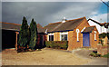
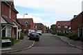
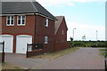
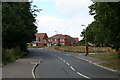
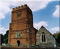
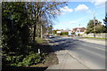
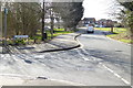
Photos of RG2 9AZ
Area Information
Living in RG2 9AZ offers a compact, tightly knit residential experience within a small cluster of homes. The area covers just 5,884 square metres, yet it accommodates 1,709 residents, resulting in a remarkably high population density of 290,429 people per square kilometre. This density reflects a community where proximity to amenities and services is a defining feature. The area’s character is shaped by its mix of housing types and its strategic location near key infrastructure. Residents benefit from nearby rail links, including Earley, Winnersh Triangle, and Winnersh stations, which provide easy access to surrounding towns. Daily life here is influenced by the presence of schools, retail outlets, and the relatively low flood risk. While the area is small, its connectivity to transport networks and local services makes it a practical choice for those prioritising convenience. However, the high density and limited space mean the environment is more urban than rural, with a focus on immediate accessibility over expansive open spaces. For buyers seeking a compact, well-serviced area with a strong sense of community, RG2 9AZ presents a distinct proposition.
- Area Type
- Postcode
- Area Size
- 5884 m²
- Population
- 1709
- Population Density
- 3688 people/km²
The property market in RG2 9AZ is dominated by owner-occupied homes, with 72% of residents living in properties they own. This contrasts with rental markets, which are less prominent in the area. The accommodation type is primarily houses, indicating a lack of high-rise or apartment developments. Given the area’s small size—just 5,884 square metres—and its high population density, the housing stock is limited, making it a niche market for buyers seeking a compact, well-serviced environment. The focus on houses suggests a preference for traditional, family-friendly homes, which may appeal to those prioritising space and privacy over urban density. However, the limited land area means there is little scope for expansion or new developments, which could affect long-term property value growth. For buyers, the key consideration is the proximity to essential services and transport links, which are within practical reach. The market’s character is defined by its stability, with a strong emphasis on existing homes rather than speculative investment.
House Prices in RG2 9AZ
Showing 11 properties
| Address | Type | Beds | Baths | Last Sale Price | Last Sale Date | |
|---|---|---|---|---|---|---|
| 4 Teal Grove, Shinfield, RG2 9AZ | Detached | 5 | 3 | £700,000 | Feb 2025 | |
| 10 Teal Grove, Shinfield, RG2 9AZ | Detached | 5 | 3 | £700,000 | Jul 2024 | |
| 1 Teal Grove, Shinfield, RG2 9AZ | Terraced | 2 | 1 | £330,000 | Oct 2021 | |
| 2 Teal Grove, Shinfield, RG2 9AZ | Detached | 4 | - | £530,000 | Feb 2021 | |
| 8 Teal Grove, Shinfield, RG2 9AZ | Detached | 4 | 2 | £493,000 | Jan 2020 | |
| 6 Teal Grove, Shinfield, RG2 9AZ | Detached | 4 | 2 | £525,000 | Aug 2017 | |
| 12 Teal Grove, Shinfield, RG2 9AZ | Detached | 3 | - | £353,500 | Sep 2014 | |
| 7 Teal Grove, Shinfield, RG2 9AZ | Detached | - | - | £424,000 | Nov 2005 | |
| 9 Teal Grove, Shinfield, RG2 9AZ | Detached | - | - | £439,950 | Oct 2005 | |
| 5 Teal Grove, Shinfield, RG2 9AZ | Flat | - | - | £180,992 | Sep 2004 |
Energy Efficiency in RG2 9AZ
The lifestyle in RG2 9AZ is shaped by its proximity to essential amenities and services. Nearby retail options include Lidl Beke, Asda Shinfield, and Co-op Former, providing access to everyday shopping needs. These stores cater to a range of preferences, from budget-friendly groceries to more comprehensive supermarket services. The area’s rail stations—Earley, Winnersh Triangle, and Winnersh—enhance mobility, allowing residents to reach broader destinations quickly. While the data does not specify parks or leisure facilities, the presence of schools and retail suggests a community-oriented environment. The compact nature of RG2 9AZ means that amenities are within practical walking or driving distance, reducing the need for long commutes. This convenience is balanced by the high population density, which may lead to a more urban feel compared to suburban or rural areas. For residents, the lifestyle combines accessibility with a focus on immediate needs, though the limited space may mean fewer large-scale recreational options.
Amenities
Schools
Residents of RG2 9AZ have access to a range of educational institutions, including primary schools and an academy. Shinfield Infant and Nursery School serves as a primary school, while Shinfield St Mary’s CofE Junior School, rated ‘good’ by Ofsted, provides another primary option. A second Shinfield Infant and Nursery School is listed as an academy, though its specific rating is not provided. The presence of both traditional state schools and academies offers families a choice between different educational approaches. The ‘good’ rating at St Mary’s CofE Junior School suggests a reliable standard of education, which may be a key factor for families prioritising school quality. However, the limited number of schools—only three in total—means competition for places could be intense, particularly for popular institutions. The proximity of these schools to residential areas underscores the area’s suitability for families, though the absence of secondary schools necessitates travel for older students.
| Rank | School | Type | Entry gender | Ages |
|---|
Explore more schools in this area
Go to Schools tabDemographics
The community in RG2 9AZ is predominantly composed of adults aged 30 to 64, with a median age of 47. This suggests a mature population, likely with established careers and families. Home ownership is high, with 72% of residents owning their homes, indicating a stable, long-term demographic. The area is characterised by houses rather than flats, reflecting a preference for traditional housing stock. The predominant ethnic group is White, though no specific data on diversity or deprivation is provided. The high population density—290,429 people per square kilometre—suggests a tightly packed residential environment, which may influence the character of local interactions and the availability of shared spaces. For those considering RG2 9AZ, the demographic profile points to a community that values stability, with a focus on family-oriented living and established neighbourhoods. The absence of detailed data on income or deprivation means the area’s economic profile remains less defined, though the high home ownership rate implies a degree of financial security among residents.
Household Size
Accommodation Type
Tenure
Ethnic Group
Religion
Household Composition
Age
Household Deprivation
NS-SEC
Explore more demographic insights in this area
Go to Demographics tabPlanning
Planning Constraints
- Flood RiskPremium
- Ramsar Wetland SitesPremium
- Area of Outstanding Natural BeautyPremium
- Protected Nature ReservePremium
- Protected WoodlandPremium