Area Overview for RG2 9RG
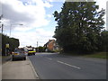
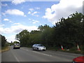
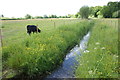
Photos of RG2 9RG

Area Information
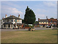
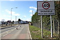
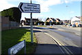
RG2 9RG is a defined residential cluster covering just 1.4 hectares. This small footprint supports a population of 1,709 people, resulting in a high population density of 122,522 per square kilometre. You will find this postcode serves as a compact living environment where every parcel of land is utilised. The area represents a specific slice of the broader Reading landscape, situated near Farnham Royal and Earley. Living here means you are part of a tightly knit residential zone rather than a sprawling suburban district. The limited size of the land restricts the spread of housing, creating a focused community feel. You can expect a setting that prioritises home environments over extensive public spaces due to the sheer concentration of residents. This specific postcode area reflects the typical characteristics of denser housing clusters found in the RG2 postcode region. The location offers a blend of residential practicality and proximity to key transport nodes nearby.
- Area Type
- Postcode
- Area Size
- 1.4 hectares
- Population
- 1709
- Population Density
- 3688 people/km²
RG2 9RG functions primarily as an owner-occupied area with a 72% home ownership rate. This statistic indicates that the local property market is driven by existing homeowners rather than landlords or short-term rentals. Houses make up the accommodation type, meaning you will mostly encounter detached or semi-detached properties rather than flats or terraced blocks common in high-density city centres. This housing stock suits the median age of 47, appealing to those seeking stability and space as they progress through different life stages. The small 1.4-hectare area size means the housing supply is finite, potentially creating competition for specific properties within the postcode. Buyers considering RG2 9RG should understand they are entering a managed market with a strong base of permanent residents. The high ownership figure suggests a community where property values tend to be protected by long-term investment rather than speculative rental yields. When searching for homes in this area, expect to find substantial residential units designed for family living.
House Prices in RG2 9RG
Showing 40 properties
| Address | Type | Beds | Baths | Last Sale Price | Last Sale Date | |
|---|---|---|---|---|---|---|
| 11 Parker Close, Shinfield, RG2 9RG | Detached | 2 | 2 | £475,000 | Nov 2022 | |
| 15 Parker Close, Shinfield, RG2 9RG | Retail | 2 | 2 | £465,000 | Sep 2022 | |
| 16 Parker Close, Shinfield, RG2 9RG | house | - | - | £362,000 | Oct 2021 | |
| 6 Parker Close, Shinfield, RG2 9RG | house | - | - | £469,950 | Jun 2021 | |
| 26 Parker Close, Shinfield, RG2 9RG | house | - | - | £455,000 | Apr 2021 | |
| 20 Parker Close, Shinfield, RG2 9RG | Semi-detached | 4 | 3 | £470,000 | Jun 2018 | |
| 30 Parker Close, Shinfield, RG2 9RG | Terraced | 2 | 2 | £350,000 | Jun 2018 | |
| 2 Parker Close, Shinfield, RG2 9RG | house | - | - | £500,000 | Jun 2018 | |
| 24 Parker Close, Shinfield, RG2 9RG | Semi-detached | 3 | 2 | £475,000 | May 2018 | |
| 10 Parker Close, Shinfield, RG2 9RG | house | - | - | £480,000 | May 2018 |
Energy Efficiency in RG2 9RG
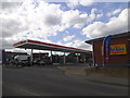
Your daily life in RG2 9RG extends easily to practical amenities within a short reach. Three main retail outlets serve the area, including Lidl Beke, Co-op Former, and Asda Shinfield. These supermarkets provide essential goods and weekly shop options without requiring a long journey. Local transport links are well developed with five nearby rail stations, including Earley Railway Station, Winnersh Triangle Railway Station, and Winnersh Railway Station. These stations offer convenient access to Reading, Slough, and London Paddington for commuters. You can combine your local grocery shopping with efficient train travel to reach wider employment hubs. The proximity to these five retail and rail nodes makes daily errands and commuting manageable. Living in RG2 9RG places you near established commercial and transport services that support a standard of convenience. Asda Shinfield and Lidl Beke are key landmarks for practical shopping needs.
Amenities
Schools
Families living in RG2 9RG have access to specific educational institutions within the immediate vicinity. Shinfield Infant and Nursery School operates as an academy and also serves as a primary school for younger children. Adjacent to this is Shinfield St Mary's CofE Junior School, which holds an Ofsted rating of good. This primary education setup caters to children from early years through to the middle stages of junior schooling. The presence of both an academy and a Church of England voluntary aided school provides parents with distinct educational philosophies to choose from. You will find two primary institutions listed in the local directory, ensuring coverage for the school-age population. These schools are situated close enough to serve the 1,709 residents of this postcode effectively. The good rating for Shinfield St Mary's CofE Junior School offers a specific assurance of educational quality for families moving into the area.
| Rank | School | Type | Entry gender | Ages |
|---|
Explore more schools in this area
Go to Schools tabDemographics
The community within RG2 9RG reflects a mature settlement with a median age of 47 years. The most common age range comprises adults between 30 and 64 years old, indicating a population dominated by working families and established households. Home ownership stands at a significant 72%, suggesting that the majority of residents have purchased their properties over time. This high level of tenure stability contrasts with areas heavily reliant on the private rental sector. Houses represent the predominant accommodation type, aligning with the older age profile and ownership rates. The predominant ethnic group is White, consistent with the broader demographic trends of many established English towns. You are looking at an area where families and adults form the core of the social fabric. The age distribution suggests a neighbourhood where children and young adults make up a smaller proportion compared to middle-aged residents. This demographic structure implies a community focused on long-term living standards rather than transient population movements.
Household Size
Accommodation Type
Tenure
Ethnic Group
Religion
Household Composition
Age
Household Deprivation
NS-SEC
Explore more demographic insights in this area
Go to Demographics tabPlanning
Planning Constraints
- Flood RiskPremium
- Ramsar Wetland SitesPremium
- Area of Outstanding Natural BeautyPremium
- Protected Nature ReservePremium
- Protected WoodlandPremium