Area Overview for RG2 9UW
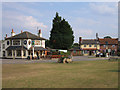
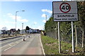
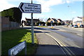
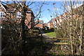
Photos of RG2 9UW

Area Information
RG2 9UW is a compact residential cluster situated within England, covering an area of just 1.8 hectares. This specific postcode serves a population of 1,709 people, creating a tightly knit environment where neighbours often know one another. With a population density of 97,138 people per square kilometre, the area offers a sense of community typical of smaller clusters near larger towns rather than dense city centres. Living in RG2 9UW means navigating a space designed primarily for households rather than commercial activity. The layout supports a quiet domestic life, removing the chaos of high-density urban living while maintaining proximity to essential services. You are part of a distinct pocket within the wider local authority, enjoying the benefits of a defined neighbourhood without the overwhelm of a sprawling suburb. This small footprint ensures that walks to local points often cover only a few metres, fostering a self-contained daily routine. The area functions as a residential enclave where privacy coexists with community connection.
- Area Type
- Postcode
- Area Size
- 1.8 hectares
- Population
- 1709
- Population Density
- 3688 people/km²
Homes in RG2 9UW form a market defined almost entirely by owner-occupied housing stock. The accommodation type is listed as houses, meaning you will not find new builds or converted flats in this specific cluster. With 72 percent home ownership, the area feels entrenched and stable, attracting buyers who intend to settle down rather than rent. This high ownership rate typically correlates with properties that have been cherished and upgraded over decades. When searching for residences here, you are entering a market where sellers are permanent residents rather than landlords flipping assets. The small size of the area, covering just 1.8 hectares, limits supply significantly, meaning every transaction involves a local household moving trades with another neighbour. This creates a unique dynamic where community reputation often influences property value alongside physical attributes. You are purchasing a piece of a very small, private residential ecosystem.
House Prices in RG2 9UW
Showing 44 properties
| Address | Type | Beds | Baths | Last Sale Price | Last Sale Date | |
|---|---|---|---|---|---|---|
| 5 Beke Avenue, Shinfield, RG2 9UW | Terraced | 2 | 2 | £410,000 | Dec 2024 | |
| 3 Beke Avenue, Shinfield, RG2 9UW | Semi-detached | 3 | 2 | £501,000 | Nov 2024 | |
| 7 Beke Avenue, Shinfield, RG2 9UW | Terraced | 2 | 2 | £412,500 | Mar 2024 | |
| 11 Beke Avenue, Shinfield, RG2 9UW | Semi-detached | - | - | £455,000 | May 2023 | |
| 9 Beke Avenue, Shinfield, RG2 9UW | Semi-detached | 3 | 2 | £450,000 | Dec 2022 | |
| 15 Beke Avenue, Shinfield, RG2 9UW | house | - | - | £500,000 | May 2019 | |
| 17 Beke Avenue, Shinfield, RG2 9UW | house | - | - | £500,000 | Apr 2019 | |
| Flat 2, Osbern Court, 1 Beke Avenue, Shinfield, RG2 9UW | Flat | 2 | 2 | - | - | |
| Flat 4, Osbern Court, 1 Beke Avenue, Shinfield, RG2 9UW | Flat | 2 | 2 | - | - | |
| Flat 7, Osbern Court, 1 Beke Avenue, Shinfield, RG2 9UW | Flat | 2 | 2 | - | - |
Energy Efficiency in RG2 9UW
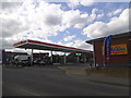
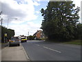
Your daily life in RG2 9UW benefits from immediate access to five nearby retail outlets and five railway stations within practical reach. You can shop at Lidl Beke, visit the Co-op Former, or travel to Asda Shinfield for larger grocery needs without long commutes. For rail connections, Earley Railway Station, Winnersh Triangle Railway Station, and Winnersh Railway Station offer five distinct options for commuting to London or other towns. This density of transport links means you are rarely stranded by a single line closure. When you need to run errands or visit family in the wider region, these stations provide rapid departure options. The combination of supermarkets and rail hubs creates a convenient lifestyle where basic necessities and regional travel are both accessible within minutes. You live where modern convenience meets local charm.
Amenities
Schools
Families living near RG2 9UW have access to specific educational institutions immediately adjacent to their homes. Shinfield Infant and Nursery School stands nearby, serving as an academy and providing early years education. Just further along, Shinfield St Mary's CofE Junior School operates as a primary institution currently rated as good by Ofsted. This mix of academy and voluntary-aided church schools provides parents with a choice between different philosophical approaches to education while maintaining high local standards. Both schools cater to the primary age range, which aligns well with the dominant adult demographic in the area. You do not need to look far to secure schooling for young children, as these facilities are embedded in the local landscape. The presence of a good-rated school adds a layer of security and confidence for parents considering the area for their families.
| Rank | School | Type | Entry gender | Ages |
|---|
Explore more schools in this area
Go to Schools tabDemographics
The community within RG2 9UW reflects an established residential pattern dominated by adults between the ages of 30 and 64 years. The median age for residents here is 47, indicating a shift away from young families or empty-nesters towards a demographic in the middle of adult life. A significant proportion of residents own their homes, with home ownership standing at 72 percent of the total population. This high level of equity suggests stability and long-term commitment to the locality. The accommodation type in this postcode is exclusively houses, confirming that the area lacks flats or high-rise apartment blocks. Ethnically, the predominant group is White, which defines the cultural makeup of the immediate neighbourhood. This area appeals to those seeking a traditional suburban environment where property tenure is secured. You are not looking at a student village or a transient rental block. The population structure supports a quiet家庭生活 where neighbours share similar life stages and interests.
Household Size
Accommodation Type
Tenure
Ethnic Group
Religion
Household Composition
Age
Household Deprivation
NS-SEC
Explore more demographic insights in this area
Go to Demographics tabPlanning
Planning Constraints
- Flood RiskPremium
- Ramsar Wetland SitesPremium
- Area of Outstanding Natural BeautyPremium
- Protected Nature ReservePremium
- Protected WoodlandPremium