Area Overview for RG2 9AJ
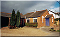
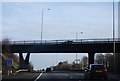
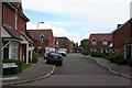
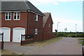
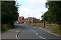
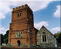
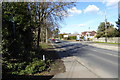
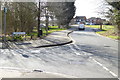
Photos of RG2 9AJ
Area Information
RG2 9AJ is a compact residential postcode in England, covering just 7,914 square metres and home to 1,709 residents. Its high population density of 215,948 people per square kilometre reflects a tightly knit community. This area is characterised by its focus on family-oriented living, with a median age of 47 and a majority of residents aged 30–64. The cluster of homes here suggests a mature, stable population, likely drawn to the area’s proximity to local amenities and transport links. Daily life in RG2 9AJ balances suburban tranquillity with practical access to nearby services. While the area is small, it is strategically positioned near rail networks and retail hubs, offering a mix of convenience and space. For those seeking a community with a clear identity, RG2 9AJ’s density and demographics suggest a place where neighbours are familiar, and local needs are met within walking or short driving distance.
- Area Type
- Postcode
- Area Size
- 7914 m²
- Population
- 1709
- Population Density
- 3688 people/km²
RG2 9AJ is a predominantly owner-occupied area, with 72% of homes owned by residents rather than rented. The accommodation types here are largely houses, which suggests a market skewed towards family homes and private living rather than apartments or shared housing. This makes the area appealing to buyers seeking long-term stability, though the small size of the postcode means the housing stock is limited. The high home ownership rate indicates strong local demand, potentially supporting property values. For buyers, this means a focus on individual properties rather than rental opportunities. The concentration of houses also implies a quieter, more residential character, which may align with those prioritising space and privacy over urban density.
House Prices in RG2 9AJ
Showing 25 properties
| Address | Type | Beds | Baths | Last Sale Price | Last Sale Date | |
|---|---|---|---|---|---|---|
| 50 Skylark Way, Shinfield, RG2 9AJ | Detached | 4 | 3 | £580,000 | Aug 2021 | |
| 8 Skylark Way, Shinfield, RG2 9AJ | house | - | - | £415,000 | Aug 2021 | |
| 16 Skylark Way, Shinfield, RG2 9AJ | house | - | - | £545,000 | Jun 2021 | |
| 30 Skylark Way, Shinfield, RG2 9AJ | Terraced | 3 | - | £355,000 | Apr 2021 | |
| 48 Skylark Way, Shinfield, RG2 9AJ | Detached | 4 | - | £475,000 | Mar 2021 | |
| 26 Skylark Way, Shinfield, RG2 9AJ | Terraced | 3 | - | £367,500 | Feb 2021 | |
| 32 Skylark Way, Shinfield, RG2 9AJ | Terraced | 4 | 3 | £370,000 | Dec 2020 | |
| 6 Skylark Way, Shinfield, RG2 9AJ | Detached | 5 | 3 | £472,500 | Mar 2020 | |
| 36 Skylark Way, Shinfield, RG2 9AJ | Terraced | 3 | 2 | £380,000 | Jul 2019 | |
| 12 Skylark Way, Shinfield, RG2 9AJ | Detached | 4 | 2 | £592,500 | Mar 2018 |
Energy Efficiency in RG2 9AJ
The lifestyle in RG2 9AJ is shaped by its proximity to retail and transport hubs. Within reach are five retail venues, including Lidl Beke, Asda Shinfield, and Co-op Former, offering everyday shopping needs. The area’s rail network, with stations such as Earley and Winnersh, provides direct links to nearby towns, enhancing access to broader leisure and employment opportunities. While the data does not specify parks or recreational spaces, the absence of environmental constraints like protected woodlands or AONB status suggests open space may be available nearby. The combination of local shops and rail connectivity supports a convenient, self-contained lifestyle, allowing residents to balance daily errands with easy travel beyond the immediate area.
Amenities
Schools
Residents of RG2 9AJ have access to three schools within practical reach. Shinfield Infant and Nursery School serves primary education, with a second branch operating as an academy. Shinfield St Mary’s CofE Junior School is also a primary school, rated ‘good’ by Ofsted. The mix of school types offers families options, from traditional state education to academy-led provision. The presence of two primary schools within the area suggests a focus on early education, which may be a key consideration for families with young children. While no secondary schools are listed, the proximity to nearby towns likely provides additional options. This clustering of primary education supports a community where local schooling is a priority.
| Rank | School | Type | Entry gender | Ages |
|---|
Explore more schools in this area
Go to Schools tabDemographics
The community in RG2 9AJ is predominantly composed of adults aged 30–64, with a median age of 47. This suggests a mature population, likely with established careers and families. Home ownership is high, at 72%, indicating a stable housing market where many residents are long-term owners rather than renters. The area is primarily made up of houses, reflecting a preference for private, detached living over flats or apartments. The predominant ethnic group is White, which aligns with broader regional trends. The data does not specify deprivation levels, but the high home ownership and age profile imply a relatively affluent, settled population. This demographic profile shapes a community focused on continuity, with residents likely prioritising stability and proximity to essential services.
Household Size
Accommodation Type
Tenure
Ethnic Group
Religion
Household Composition
Age
Household Deprivation
NS-SEC
Explore more demographic insights in this area
Go to Demographics tabPlanning
Planning Constraints
- Flood RiskPremium
- Ramsar Wetland SitesPremium
- Area of Outstanding Natural BeautyPremium
- Protected Nature ReservePremium
- Protected WoodlandPremium