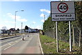
Area Overview for RG2 9EE
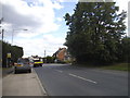
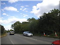
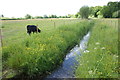
Photos of RG2 9EE

Area Information
RG2 9EE represents a specific residential cluster covering 9,670 square metres within the wider RG2 postcode region. This small, defined area serves a population of 1,709 individuals, creating a tight-knit community environment compared to broader suburban sprawls. You are buying into a neighbourhood where space is quantified and boundaries are clear, offering a sense of locality that larger districts often dilute. The demographic profile suggests a mature settlement where the majority of residents are adults aged between 30 and 64 years. This age concentration typically indicates families with established roots or professionals settled into long-term housing. The area functions as a focused living zone rather than a sprawling commuter belt, meaning daily life revolves around immediate surroundings. When you consider homes in RG2 9EE, you are selecting property located within a compact footprint where neighbours are likely to be known. The high population density within these specific boundaries results in a vibrant yet concentrated setting. Living in RG2 9EE means you benefit from the established nature of the settlement while remaining aware that the amenities and transit hubs required are situated just beyond the immediate perimeter of this postcode.
- Area Type
- Postcode
- Area Size
- 9670 m²
- Population
- 1709
- Population Density
- 3688 people/km²
The property market in RG2 9EE is driven by the fact that 72% of homes are owner-occupied. This high rate of ownership creates an environment dominated by private landlords rather than large-scale rental providers. The accommodation type data confirms that houses constitute the primary stock within this postcode. This predominance of houses suggests a market focused on family-sized dwellings and detached living rather than urban apartments or studio flats. When you look for homes in RG2 9EE, you are accessing a pool of properties largely untouched by the rental boom seen in city centres. The small area size of 9,670 square metres limits the total inventory, meaning availability will be constrained. This scarcity is typical of specific postcodes where land cannot accommodate new builds easily. The market here reflects a classic suburban model where families buy to stay. There is little evidence to suggest a speculative investor presence is distorting prices. Instead, the market relies on genuine residents seeking quality housing. If you are buying here, you are joining a community of owners who value the stability of home ownership over the flexibility of renting.
House Prices in RG2 9EE
Showing 22 properties
| Address | Type | Beds | Baths | Last Sale Price | Last Sale Date | |
|---|---|---|---|---|---|---|
| 43 School Green, Shinfield, RG2 9EE | Detached | 3 | 2 | £475,000 | Nov 2025 | |
| 3-3-A School Green, Shinfield, RG2 9EE | house | - | - | £240,000 | Oct 2023 | |
| 17 School Green, Shinfield, RG2 9EE | house | - | - | £360,000 | Feb 2021 | |
| 5A School Green, Shinfield, RG2 9EE | Flat | 2 | 1 | £187,500 | Jan 2021 | |
| 33 School Green, Shinfield, RG2 9EE | Semi-detached | 2 | - | £280,000 | Apr 2015 | |
| 11 School Green, Shinfield, RG2 9EE | Terraced | 2 | 1 | £170,000 | Aug 2010 | |
| 15 School Green, Shinfield, RG2 9EE | Terraced | 3 | - | £199,950 | Feb 2006 | |
| 21 School Green, Shinfield, RG2 9EE | house | - | - | £175,000 | Jun 2002 | |
| 27 School Green, Shinfield, RG2 9EE | Semi-detached | - | - | £79,000 | Apr 1997 | |
| Flat, The Bell And Bottle, School Green, Shinfield, RG2 9EE | Flat | - | - | - | - |
Energy Efficiency in RG2 9EE
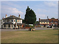
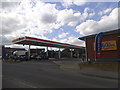
Daily life in RG2 9EE offers practical access to essential amenities within a walkable or short-drive radius. The local retail landscape includes a Co-op Former, Asda Shinfield, and Lidl Beke. These three outlets provide comprehensive grocery and shopping needs without requiring a trip into central Reading. You can complete weekly shopping and household errands locally with high convenience. For travel, the area is backed by 5 nearby rail stations. Earley, Winnersh Triangle, and Winnersh stations facilitate easy access to the wider region. This combination of local retail and regional rail connectivity defines the convenience of living here. You do not need to drive far for basics, but you have excellent public transport options for leisure or work. The proximity of these major retailers means you stay on budget while saving time. The lifestyle is one of balanced independence where local services meet the demands of a weekday household.
Amenities
Schools
Families living in RG2 9EE are supported by a selection of educational institutions located nearby. Shinfield Infant and Nursery School operates as both a primary school and an academy, providing a dual pathway for early education. For secondary-aged children requiring primary education, Shinfield St Mary's CofE Junior School is a key option. This institution holds a 'good' Ofsted rating, confirming its standard of provision meets government expectations. The presence of both mainstream primary and academy-linked schools indicates a mixed but functional educational landscape. You will find two distinct primary options immediately accessible to residents of this postcode. The mix of academy and voluntary-controlled schools provides a choice for parents regarding curriculum and governance. While secondary school names are not listed in the provided data, the primary education catchments are clearly established in your immediate vicinity. These schools serve the local cluster effectively, reducing the need for long-distance commuting to education. The availability of these specific institutions means you do not need to travel far to ensure your children have access to recognised education.
| Rank | School | Type | Entry gender | Ages |
|---|
Explore more schools in this area
Go to Schools tabDemographics
The community character of RG2 9EE is defined by a significant level of tenure stability. House ownership stands at 72%, indicating that the vast majority of residents have purchased their homes rather than renting. This figure implies a settled population less likely to move frequently. The predominant dwelling type is houses, which aligns with the owner-occupied status and suggests a landscape of detached or semi-detached family properties rather than terraced flats or high-density apartments. Ethnic diversity centres around a White population, reflecting the traditional demographic make-up of this specific English locale. Age data reveals a median age of 47 years, with adults between 30 and 64 years forming the most common age range. This profile points to households that may have disposable income and a focus on stability over transient living arrangements. There are no indications of transient populations or student accommodation dominating the stock. The maturity of the age cohort suggests a neighbourhood where families have raised children and are now potentially focused on retirement planning or downsizing, though the high home ownership rate also supports families staying put. You are entering a market where social cohesion is likely strong due to long-term residency.
Household Size
Accommodation Type
Tenure
Ethnic Group
Religion
Household Composition
Age
Household Deprivation
NS-SEC
Explore more demographic insights in this area
Go to Demographics tabPlanning
Planning Constraints
- Flood RiskPremium
- Ramsar Wetland SitesPremium
- Area of Outstanding Natural BeautyPremium
- Protected Nature ReservePremium
- Protected WoodlandPremium