Area Overview for RG2 9DN
Photos of RG2 9DN
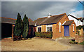
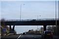
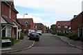
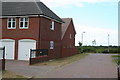
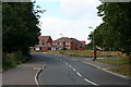
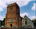
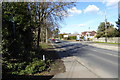
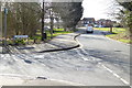
55 photos from this area
Area Information
Key information about the RG2 9DN including its size, population, and administrative classification.
- Area Type
- Postcode
- Area Size
- 4.3 hectares
- Population
- 1993
- Population Density
- 480 people/km²
House Prices in RG2 9DN
58
Properties
£459,210
Average Sold Price
£64,000
Lowest Price
£945,000
Highest Price
Showing 58 properties
| Address | Type | Beds | Baths | Last Sale Price | Last Sale Date | |
|---|---|---|---|---|---|---|
| 55 Oatlands Road, Shinfield, RG2 9DN | Bungalow | 3 | 2 | £480,000 | Jul 2025 | |
| 61 Oatlands Road, Shinfield, RG2 9DN | Chalet | 4 | 2 | £615,000 | Jan 2025 | |
| 62 Oatlands Road, Shinfield, RG2 9DN | Detached | 5 | 4 | £850,500 | May 2024 | |
| 36 Oatlands Road, Shinfield, RG2 9DN | Bungalow | 2 | 1 | £400,000 | Mar 2024 | |
| 52 Oatlands Road, Shinfield, RG2 9DN | Detached | 4 | 3 | £580,000 | Nov 2023 | |
| 77 Oatlands Road, Shinfield, RG2 9DN | Bungalow | 4 | 2 | £710,000 | Feb 2023 | |
| 80 Oatlands Road, Shinfield, RG2 9DN | Bungalow | - | - | £485,000 | Sep 2022 | |
| 70 Oatlands Road, Shinfield, RG2 9DN | house | - | - | £730,000 | Aug 2021 | |
| 34 Oatlands Road, Shinfield, RG2 9DN | house | - | - | £401,000 | Jul 2021 | |
| 35 Oatlands Road, Shinfield, RG2 9DN | house | 3 | - | £490,000 | Mar 2021 |
Page 1 of 6
Energy Efficiency in RG2 9DN
Amenities
Schools
| Rank | School | Type | Entry gender | Ages |
|---|
Explore more schools in this area
Go to Schools tabDemographics
Household Size
Family (3-5 people)
most common
Accommodation Type
Houses
most common
Tenure
83
majority
Ethnic Group
White
most common
Religion
N/A
most common
Household Composition
N/A
most common
Age
47
median
Adults (30-64 years)
most common
Household Deprivation
N/A
with no deprivation
NS-SEC
54
in Lower managerial occupations
Explore more demographic insights in this area
Go to Demographics tabPlanning
Planning Constraints
- Flood RiskPremium
- Ramsar Wetland SitesPremium
- Area of Outstanding Natural BeautyPremium
- Protected Nature ReservePremium
- Protected WoodlandPremium