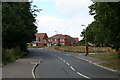
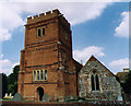
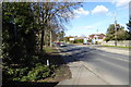
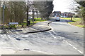
Area Overview for RG2 9DG
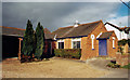
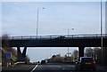
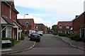
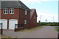
Photos of RG2 9DG
Area Information
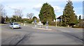
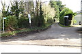
RG2 9DG is a small, tightly knit residential postcode in England, covering just 1.2 hectares and home to 1,993 residents. Its compact size means it feels more like a close-knit village than a sprawling suburb, with a population density of 480 people per square kilometre. This area is characterised by its stability, with most residents falling within the 30-64 age range and a high rate of home ownership—83% of properties are owner-occupied. The housing stock is predominantly family homes, reflecting the area’s appeal to established households. Daily life here is shaped by proximity to local amenities and transport links, with easy access to shops, rail services, and the surrounding countryside. While the area lacks large-scale commercial or industrial features, its quiet, residential nature offers a peaceful alternative to busier urban centres. For those seeking a balance between convenience and tranquillity, RG2 9DG provides a self-contained environment where community ties are strong and the pace of life remains measured.
- Area Type
- Postcode
- Area Size
- 1.2 hectares
- Population
- 1993
- Population Density
- 480 people/km²
The property market in RG2 9DG is dominated by owner-occupied homes, with 83% of properties in private hands. This high rate of home ownership points to a community where long-term residency is common, and property values are likely to be stable. The accommodation type is primarily houses, which is unusual for a small postcode area but aligns with the low population density. This suggests that the housing stock is designed for families, offering more space than typical flats or apartments. For buyers, this means a limited number of properties available, but those that are listed are likely to be in good condition and well-maintained. The small size of the area means that properties are closely spaced, and the immediate surroundings may offer more options. However, the high home ownership rate could indicate a competitive market, with fewer properties coming up for sale. Buyers should consider the area’s proximity to transport links and amenities when evaluating its appeal.
House Prices in RG2 9DG
Showing 26 properties
| Address | Type | Beds | Baths | Last Sale Price | Last Sale Date | |
|---|---|---|---|---|---|---|
| 28 Wheatfields Road, Shinfield, RG2 9DG | Semi-detached | 3 | 1 | £432,000 | Oct 2024 | |
| 5 Wheatfields Road, Shinfield, RG2 9DG | Semi-detached | 4 | 2 | £622,000 | Oct 2024 | |
| 8 Wheatfields Road, Shinfield, RG2 9DG | Semi-detached | 3 | 2 | £478,000 | Oct 2024 | |
| 15 Wheatfields Road, Shinfield, RG2 9DG | Semi-detached | 3 | 2 | £405,000 | Sep 2024 | |
| 12 Wheatfields Road, Shinfield, RG2 9DG | Maisonette | 2 | 2 | £290,000 | Jul 2024 | |
| 3 Wheatfields Road, Shinfield, RG2 9DG | Semi-detached | 4 | 2 | £612,000 | Jul 2024 | |
| 34 Wheatfields Road, Shinfield, RG2 9DG | Semi-detached | 4 | 2 | £425,000 | Jun 2024 | |
| 38 Wheatfields Road, Shinfield, RG2 9DG | Semi-detached | 3 | 2 | £425,000 | May 2023 | |
| 2 Wheatfields Road, Shinfield, RG2 9DG | Semi-detached | 4 | 3 | £495,000 | Feb 2021 | |
| 24 Wheatfields Road, Shinfield, RG2 9DG | Semi-detached | 3 | 1 | £355,000 | Dec 2020 |
Energy Efficiency in RG2 9DG
Residents of RG2 9DG have access to a range of local amenities within practical reach. The retail sector includes well-known names such as Asda Shinfield, Lidl Beke, and Co-op Former, providing everyday shopping needs without the need to travel far. These stores cater to a variety of budgets and preferences, from supermarket essentials to convenience items. The area’s rail network is another key feature, with five stations offering connections to nearby towns and cities. This makes it easy to access larger retail centres, cultural attractions, and employment opportunities. While the area itself is small, the surrounding region likely offers more extensive leisure options, such as parks or recreational facilities. The presence of multiple rail stations also enhances the area’s appeal for commuters, reducing reliance on cars. Overall, the combination of local shops and transport links creates a convenient lifestyle, allowing residents to balance daily needs with the quiet, residential character of the postcode.
Amenities
Schools
| Rank | School | Type | Entry gender | Ages |
|---|
Explore more schools in this area
Go to Schools tabDemographics
The population of RG2 9DG skews towards middle-aged adults, with a median age of 47 and the majority of residents aged between 30 and 64. This age group dominates the area, suggesting a community of long-term residents rather than a transient population. Home ownership is high at 83%, indicating a stable housing market and a preference for long-term investment in property. The accommodation type is primarily houses, which aligns with the area’s low density and family-oriented character. The predominant ethnic group is White, reflecting broader demographic patterns in the region. With a population of 1,993 spread over 1.2 hectares, the area maintains a moderate density that avoids overcrowding while ensuring proximity to amenities. This balance supports a lifestyle where daily needs are met locally, reducing the need for long commutes. The demographic profile suggests a community focused on stability, with residents likely prioritising security, family-friendly environments, and established local services.
Household Size
Accommodation Type
Tenure
Ethnic Group
Religion
Household Composition
Age
Household Deprivation
NS-SEC
Explore more demographic insights in this area
Go to Demographics tabPlanning
Planning Constraints
- Flood RiskPremium
- Ramsar Wetland SitesPremium
- Area of Outstanding Natural BeautyPremium
- Protected Nature ReservePremium
- Protected WoodlandPremium