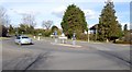
Area Overview for RG2 9AH
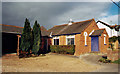
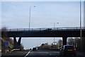
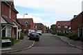
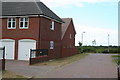
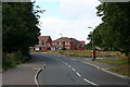
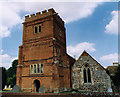
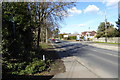
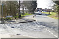
Photos of RG2 9AH
Area Information
RG2 9AH is a small, compact residential area in England, covering just 1.9 hectares and home to 1,993 people. Its density—480 people per square kilometre—suggests a tight-knit community, where daily life is shaped by proximity to local amenities. The area’s appeal lies in its balance of practicality and accessibility. Residents benefit from nearby retail options, including Asda Shinfield and Lidl Beke, and multiple rail connections, such as Earley and Winnersh Triangle stations, which link the area to broader transport networks. With a median age of 47 and a population skewed toward adults aged 30–64, RG2 9AH reflects a mature, stable demographic. This is not a young, transient community but one rooted in long-term residency, with 83% of homes owned by occupants. The area’s low flood risk and crime score of 73—well below average—add to its appeal as a safe, secure place to live. While it lacks natural reserves or protected landscapes, its strategic location near retail and rail hubs makes it a pragmatic choice for those prioritising convenience over scenic vistas.
- Area Type
- Postcode
- Area Size
- 1.9 hectares
- Population
- 1993
- Population Density
- 480 people/km²
The property market in RG2 9AH is characterised by high home ownership—83% of residents own their homes—and a predominance of houses over flats. This suggests a community where long-term residency is the norm, with limited rental availability. The small area size (1.9 hectares) means the housing stock is constrained, potentially increasing competition for properties. Given the high proportion of owner-occupied homes, buyers should consider that the market may be less dynamic than in areas with higher rental turnover. The focus on houses, rather than apartments, aligns with the demographic profile of older, established residents who prioritise space and privacy. For those seeking investment opportunities, the area’s proximity to rail links and retail amenities may enhance property value, though the small size means buyers must act quickly. The lack of protected landscapes or planning constraints could also make the area more attractive for development, though this is not explicitly stated in the data.
House Prices in RG2 9AH
Showing 22 properties
| Address | Type | Beds | Baths | Last Sale Price | Last Sale Date | |
|---|---|---|---|---|---|---|
| 32 Cutbush Lane, Shinfield, RG2 9AH | house | 4 | 2 | £590,000 | Oct 2025 | |
| 18 Cutbush Lane, Shinfield, RG2 9AH | Detached | 4 | 3 | £650,000 | Dec 2024 | |
| 24 Cutbush Lane, Shinfield, RG2 9AH | house | - | - | £475,000 | Sep 2022 | |
| 12 Cutbush Lane, Shinfield, RG2 9AH | Detached | 4 | 2 | £771,000 | Feb 2021 | |
| 28 Cutbush Lane, Shinfield, RG2 9AH | Detached | 4 | - | £674,000 | Aug 2018 | |
| 30 Cutbush Lane, Shinfield, RG2 9AH | Semi-detached | 5 | 3 | £555,000 | Aug 2018 | |
| 46 Cutbush Lane, Shinfield, RG2 9AH | Detached | 4 | - | £650,000 | Aug 2017 | |
| 22 Cutbush Lane, Shinfield, RG2 9AH | house | 3 | - | £333,000 | Dec 2014 | |
| 42 Cutbush Lane, Shinfield, RG2 9AH | house | - | - | £467,500 | Nov 2013 | |
| 44 Cutbush Lane, Shinfield, RG2 9AH | Detached | - | - | £470,000 | Nov 2013 |
Energy Efficiency in RG2 9AH
RG2 9AH offers a mix of practical amenities within easy reach, including five retail outlets such as Asda Shinfield, Lidl Beke, and Co-op Former. These stores provide essential shopping options, reducing the need for long trips to larger centres. The area’s rail network, with stations like Earley and Winnersh Triangle, connects residents to broader leisure and employment opportunities. While there is no mention of parks or recreational spaces in the data, the presence of multiple retail and transport hubs suggests a lifestyle focused on convenience and accessibility. The compact nature of the area means amenities are closely clustered, making daily errands efficient. However, the lack of detailed information on dining, cultural venues, or green spaces leaves gaps in understanding the full range of lifestyle options. For those prioritising proximity to shops and transport, RG2 9AH delivers, though it may not cater to those seeking extensive leisure or natural environments.
Amenities
Schools
| Rank | School | Type | Entry gender | Ages |
|---|
Explore more schools in this area
Go to Schools tabDemographics
RG2 9AH’s population is predominantly adults aged 30–64, with a median age of 47. This suggests a community of established professionals, families, and retirees, rather than a mix of younger or older demographics. Home ownership is high at 83%, indicating a strong preference for long-term residency over rental living. The area is largely composed of houses, not flats, which aligns with the higher proportion of owner-occupied properties. The predominant ethnic group is White, though no specific data on diversity or deprivation levels is provided. The age profile implies a demand for schools, healthcare, and community services tailored to middle-aged and older residents. With no mention of social housing or rental properties, the area appears to cater to those seeking stability and security in a low-density, family-oriented setting. The absence of detailed diversity metrics means the community’s cultural composition remains unexplored in the data, but the demographic focus on adults suggests a mature, low-turnover environment.
Household Size
Accommodation Type
Tenure
Ethnic Group
Religion
Household Composition
Age
Household Deprivation
NS-SEC
Explore more demographic insights in this area
Go to Demographics tabPlanning
Planning Constraints
- Flood RiskPremium
- Ramsar Wetland SitesPremium
- Area of Outstanding Natural BeautyPremium
- Protected Nature ReservePremium
- Protected WoodlandPremium