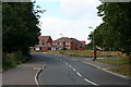
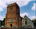
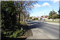
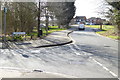
Area Overview for RG2 9AR
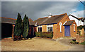
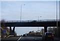
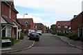
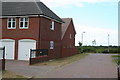
Photos of RG2 9AR
Area Information
RG2 9AR is a compact residential postcode in England, covering just 1.1 hectares and home to 1,709 residents. Its high population density of 160,645 people per square kilometre reflects a tightly knit community, typical of smaller urban clusters. The area’s character is shaped by its proximity to key infrastructure, including multiple rail stations and retail hubs. Daily life here is influenced by the surrounding amenities, with schools, shops, and transport links within easy reach. The postcode’s small size means it is likely to be part of a larger neighbourhood, where residents share access to shared spaces and services. While the area lacks natural conservation designations, its practical connectivity and established residential stock make it a viable option for those seeking a balanced lifestyle. The presence of primary schools and nearby rail networks suggests it is well-suited for families and commuters alike.
- Area Type
- Postcode
- Area Size
- 1.1 hectares
- Population
- 1709
- Population Density
- 3688 people/km²
RG2 9AR is predominantly an owner-occupied area, with 72% of homes owned by residents rather than rented. The accommodation type is largely houses, which contrasts with areas dominated by flats or apartments. This suggests a housing stock that may appeal to families or those seeking more space. The small area size means the property market is limited, with fewer options available compared to larger neighbourhoods. Buyers should consider the proximity to nearby amenities, such as schools and rail stations, which may enhance the area’s desirability. The focus on owner-occupation also means the market could be less influenced by short-term rental trends. However, the compact nature of the postcode may lead to competition for available properties, particularly for those prioritising proximity to key services.
House Prices in RG2 9AR
Showing 20 properties
| Address | Type | Beds | Baths | Last Sale Price | Last Sale Date | |
|---|---|---|---|---|---|---|
| 19 Kendal Avenue, Shinfield, RG2 9AR | Bungalow | 2 | 1 | £390,000 | Dec 2025 | |
| 10 Kendal Avenue, Shinfield, RG2 9AR | Detached | 3 | 1 | £440,000 | Mar 2024 | |
| 2 Kendal Avenue, Shinfield, RG2 9AR | house | 4 | 3 | £620,000 | Jan 2023 | |
| 3 Kendal Avenue, Shinfield, RG2 9AR | Detached | 3 | 1 | £395,000 | Jan 2019 | |
| 6 Kendal Avenue, Shinfield, RG2 9AR | Semi-detached | 3 | 2 | £392,500 | Nov 2018 | |
| 12 Kendal Avenue, Shinfield, RG2 9AR | house | - | - | £425,000 | Nov 2018 | |
| 7 Kendal Avenue, Shinfield, RG2 9AR | Detached | 3 | 2 | £370,000 | Jun 2018 | |
| 18 Kendal Avenue, Shinfield, RG2 9AR | Semi-detached | 2 | 1 | £325,000 | Mar 2018 | |
| 13 Kendal Avenue, Shinfield, RG2 9AR | Semi-detached | 3 | 2 | £375,000 | Jul 2016 | |
| 14 Kendal Avenue, Shinfield, RG2 9AR | house | - | - | £540,000 | Apr 2016 |
Energy Efficiency in RG2 9AR
Residents of RG2 9AR have access to a range of retail and transport amenities within practical reach. Five retail venues are nearby, including Asda Shinfield, Lidl Beke, and Co-op Former, providing everyday shopping options. The area’s rail network includes stations such as Earley and Winnersh, offering direct links to surrounding regions. While the postcode itself is small, the proximity to these amenities suggests a lifestyle that balances convenience with community. The availability of multiple retail outlets and transport hubs means residents can meet daily needs without extensive travel. The compact nature of the area may foster a sense of local identity, with shared spaces and services contributing to a cohesive neighbourhood feel.
Amenities
Schools
Residents of RG2 9AR have access to several primary schools, including Shinfield Infant and Nursery School, which operates as both a primary school and an academy. Nearby is Shinfield St Mary’s CofE Junior School, a primary school with a ‘good’ Ofsted rating. These institutions provide a mix of state and academy-led education, offering families choice in schooling. The presence of two primary schools within the area suggests a focus on early education, which is likely to be a priority for local families. The ‘good’ rating at St Mary’s indicates a school performing above average, which could be a key factor for parents evaluating the area. The proximity of these schools to residential properties may also influence property values and community cohesion.
| Rank | School | Type | Entry gender | Ages |
|---|
Explore more schools in this area
Go to Schools tabDemographics
The population of RG2 9AR has a median age of 47, with the majority of residents aged between 30 and 64. This suggests a community skewed towards middle-aged adults, potentially reflecting a mix of long-term residents and families. Home ownership is high, with 72% of households owning their properties, indicating a stable, settled population. The predominant accommodation type is houses, which aligns with the area’s residential character. The predominant ethnic group is White, though specific data on diversity is not provided. The age profile suggests a community that may prioritise family-oriented living, with services and amenities tailored to adult needs. The high home ownership rate also implies lower rental demand, which could influence property values and local investment trends.
Household Size
Accommodation Type
Tenure
Ethnic Group
Religion
Household Composition
Age
Household Deprivation
NS-SEC
Explore more demographic insights in this area
Go to Demographics tabPlanning
Planning Constraints
- Flood RiskPremium
- Ramsar Wetland SitesPremium
- Area of Outstanding Natural BeautyPremium
- Protected Nature ReservePremium
- Protected WoodlandPremium