Area Overview for Rushcliffe District (B)
Photos of Rushcliffe District (B)
Area Information
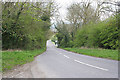
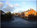
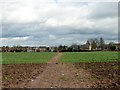
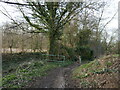
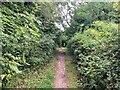
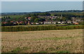
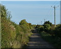
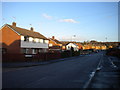
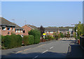
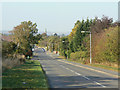
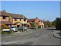
Rushcliffe District (B) stands as a significant local authority within Nottinghamshire, covering an expansive area of 409.5 km². This large jurisdiction offers residents a diverse landscape ranging from urban centres to rural countryside. Living in Rushcliffe District (B) provides a distinct experience shaped by its varied terrain and substantial size. The district appeals to those seeking space and a mix of environments rather than a compact city environment. You will find a community defined by its demographic makeup and established character. The median age of 70 across the district indicates a population heavily weighted towards older residents. This statistical reality defines the daily rhythm of life, influencing local services, community groups, and the general atmosphere. Homes in Rushcliffe District (B) cater primarily to this age profile, with property sizes and neighbourhood layouts reflecting the needs of a mature population. The sheer scale of the 409.5 km² area ensures that you can find specific pockets of life within the wider district. Whether you are exploring school locations, accessing green spaces, or commuting, the vast geography of the area plays a central role in your experience. Understanding the layout of this large district is essential before purchasing a property here. Your days will be shaped by the rural and semi-rural nature of much of this territory. The district does not offer the density of a major city centre but provides a quieter, more spread-out way of life for its inhabitants.
- Area Type
- District/Borough
- Area Size
- 409.5 km²
- Population
- Not available
- Population Density
- Not available
Demographics
The community within Rushcliffe District (B) is characterised by a very mature population structure. With a median age of 70, the area contains a significantly older demographic than the national average. This age skew defines the social fabric of the district, where residents of varying older age groups form the core of society. You will find that services and community activities are tailored to this older population. The high median age suggests a quiet, settled neighbourhood rather than a youthful suburb. Home ownership rates stand at an impressive 77 per cent, indicating that the vast majority of households own their living spaces wholly or through residential mortgage schemes with high equity. This level of homeownership is far above the national trend for such an age-heavy region. The data shows that most households are comprised of owners rather than renters. This stability often correlates with the district's median age, as older generations frequently downsize or remain in family homes. The accommodation types reflect this stability, with a focus on properties suitable for retired living or older families. Diversity metrics and religious statistics are not detailed in current records, but the age profile alone offers a clear picture of the demographic makeup. Living in Rushcliffe District (B) means joining a community where the typical neighbour is likely to be middle-aged or elderly. The low percentage of young families or young professionals is directly linked to the 70-year median age. This demographic reality influences everything from local pub culture to council funding priorities.
Household Size
Accommodation Type
Tenure
Ethnic Group
Religion
Household Composition
Age
Household Deprivation
NS-SEC
Explore more demographic insights in this area
Go to Demographics tabPlanning
Planning Constraints
- Flood RiskPremium
- Ramsar Wetland SitesPremium
- Area of Outstanding Natural BeautyPremium
- Protected Nature ReservePremium
- Protected WoodlandPremium
- Crime RiskPremium