Area Overview for Newark and Sherwood District
Photos of Newark and Sherwood District
Area Information
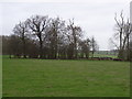
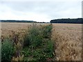
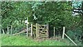
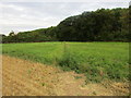
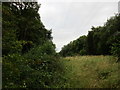
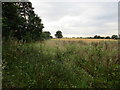
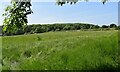
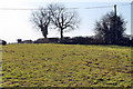
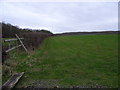
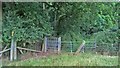
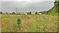
Living in Newark and Sherwood District offers a life defined by vast green spaces and a distinct rural character. This unitary authority covers 652.2 km², making it a sprawling area where daily routines often involve longer travel distances between home and work. You will find a community that feels quite different from densely populated city centres, with a sense of place shaped by its significant landmass and historical towns. The district serves as a self-contained local authority, handling its own governance while maintaining strong regional links. Residents here experience a pace of life influenced by the surrounding countryside rather than the immediate bustle of a major urban metropolis. Daily life in Newark and Sherwood District revolves around practical considerations, such as accessing local amenities or travelling to larger hubs for work. The sheer size of the area means that planning your day requires attention to transport options. You are entering a region where the landscape dictates much of the rhythm, from scenic drives along its roads to quiet neighbourhoods nestled within the district boundaries. This locality attracts those seeking space and tranquility over urban convenience. Understanding the layout of this borough is essential for anyone considering a move, as the population density is low compared to other English districts. The area stands as a significant geographical entity in Nottinghamshire, offering a backdrop of open fields and historic settlements that define the local identity.
- Area Type
- District/Borough
- Area Size
- 652.2 km²
- Population
- Not available
- Population Density
- Not available
Demographics
The community profile of Newark and Sherwood District reveals a population with a notably older average age. Census data indicates a median age of 70, which suggests the area is predominately inhabited by retirees or long-term residents. This demographic shift shapes the local culture and service requirements, with a quieter atmosphere compared to areas with younger families. Most residents fall into the older age bracket, creating a settled neighbourhood environment where neighbourly ties often run deep due to decades of residency. You will likely encounter a community where life stages focus on retirement rather than raising children or building careers. Home ownership stands at an impressive 70% within the district. This high figure indicates that the majority of locals call these homes their own, fostering a sense of stability and investment in the neighbourhood. The high rate of ownership aligns with the older demographic, as many families have downgraded to downsized properties or given their second homes to children. Household composition reflects this stability, with fewer new households forming compared to other regions. Diversity and specific religious breakdowns are not detailed in the current statistics, but the homogeneity of tenure suggests a community rooted in traditional settlement patterns. Living in Neward and Sherwood District means joining an area where the demographic weight is heavily skewed toward those further down the life cycle. The social fabric is built on established roots rather than transient populations.
Household Size
Accommodation Type
Tenure
Ethnic Group
Religion
Household Composition
Age
Household Deprivation
NS-SEC
Explore more demographic insights in this area
Go to Demographics tabPlanning
Planning Constraints
- Flood RiskPremium
- Ramsar Wetland SitesPremium
- Area of Outstanding Natural BeautyPremium
- Protected Nature ReservePremium
- Protected WoodlandPremium
- Crime RiskPremium