Area Overview for Gedling District (B)
Photos of Gedling District (B)


Area Information
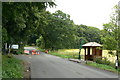
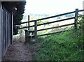
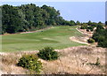
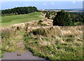
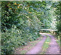
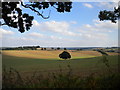
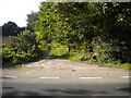
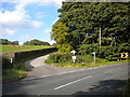
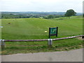
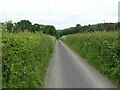
Gedling District lies in east-central England, roughly five miles north-east of Nottingham city centre. This borough covers an area of 120 square kilometres and extends from the River Trent in the south to Sherwood Forest in the north. The district encompasses the Nottingham suburbs of Arnold and Carlton alongside significant rural sections. You will find that the name Gedling now refers to a smaller settlement that was absorbed during the expansion of Nottingham's eastern suburbs. Historical records dating back to the Domesday Book of 1086 highlight the longevity of this distinct location. The landscape preserves remnants of industrial history, most famously the site of Gedling Colliery. This colliery operated until 1991 and was once renowned for its diverse workforce. Today, the former mining site has transformed into Gedling Country Park. Opened in March 2015, the park offers expansive views across Nottinghamshire towards Lincoln Cathedral on clear days. Residents can also enjoy access to the older nature reserves at Gedling House Woods and Gedling House Meadows. Daily life for anyone considering homes in Gedling District involves navigating a mix of suburban便利性 and countryside quiet. Buses connect the area to Nottingham through routes such as the 26A, 26B, and the N26. The district previously operated its own railway station until 1960, though current transport relies heavily on road networks.
- Area Type
- District/Borough
- Area Size
- 120.1 km²
- Population
- Not available
- Population Density
- Not available
Demographics
The community within Gedling District has a distinct age profile with a median age of 70. This indicates an older population structure compared to many other English districts. Household composition and predominant ethnic group statistics are recorded for the area but specific breakdown percentages are not detailed in the available profiles. Despite the high median age, the district maintains a high level of residential stability with a home ownership rate of 74 per cent. This figure suggests that three out of four residents invest in their own properties rather than renting. Accommodation types vary across the borough, reflecting both the rural fringes inhabited in 1931 and the modern urban expansion near Nottingham. The historical population of the parish in 1931 was 2,822, though this figure has shifted significantly over the last century. Current census data from 2011 recorded a district population of 113,543. Every claim regarding this community reflects these specific recorded numbers. Living in Gedling District means residing in an area where ownership is the norm. The demographic reality is one of an established, older demographic that has remained in the location for extended periods.
Household Size
Accommodation Type
Tenure
Ethnic Group
Religion
Household Composition
Age
Household Deprivation
NS-SEC
Explore more demographic insights in this area
Go to Demographics tabPlanning
Planning Constraints
- Flood RiskPremium
- Ramsar Wetland SitesPremium
- Area of Outstanding Natural BeautyPremium
- Protected Nature ReservePremium
- Protected WoodlandPremium
- Crime RiskPremium