Area Overview for Broxtowe District (B)
Photos of Broxtowe District (B)
Area Information
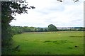
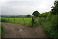
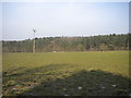
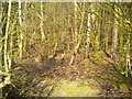
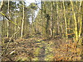
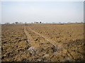
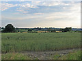
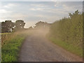
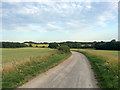
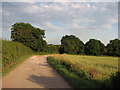
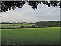
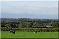
Living in Broxtowe District (B) means residing within a unitary authority in Nottinghamshire that spans 80.2 square kilometres. The area functions as a hinterland for Nottingham city, bounded by the River Erewash to the west and the River Trent to the south. Principal towns include Beeston, which serves as the administrative centre, alongside Stapleford, Kimberley, and Eastwood. Smaller communities such as Attenborough, Awsworth, and Chilwell dot the landscape, with nearly two-thirds of the borough consisting of open countryside. This large rural component offers space and quiet that differs from the inner city. The district possesses significant historical depth, including an Early Iron Age settlement discovered in 1937. You will find cultural landmarks like the D.H. Lawrence Birthplace Museum in Eastwood, acknowledging the author's working-class roots. Further exploration leads to Attenborough Nature Centre, a designated feature near Beeston for bird-watching and walking. Greasley Castle also stands as a fortified medieval manor house. The borough was formed on 1 April 1974 to merge several urban and rural districts. Daily life here balances town amenities with extensive natural spaces. The administrations rely on Council House One in Beeston. The area contains notable conservation areas, such as Beeston West End, which was designated in 1976. This mix of preserved heritage and rural land defines the living experience. Whether you seek the bustle of the principal towns or the quiet of the parish of Nuthall, Broxtowe District (B) accommodates diverse lifestyles within its administrative borders.
- Area Type
- District/Borough
- Area Size
- 80.2 km²
- Population
- Not available
- Population Density
- Not available
Demographics
The community profile in Broxtowe District (B) shows a mature population. The median age is 70, indicating an older demographic compared to many other English districts. Over half the residents fall into the older age brackets, suggesting a retirement-friendly environment. Home ownership stands at 71%, which is a high figure for the region. This statistic points to a stable community where the majority of households own their accommodation rather than renting. Household composition reflects families and individuals within this higher-age context. The data indicates a predominance of owner-occupied dwellings across various settlement types within the borough. This ownership rate provides an indication of financial stability among residents living in Stapleford, Beeston, and the surrounding villages. The ethnic composition and religious data are recorded as part of the total census figures, reflecting the diversity within the district's boundaries. Ages 65 and over form a significant portion of the population. This demographic shift impacts local services and retail choices. The high rate of home ownership often correlates with longer-term residents. Families in areas like Chilwell and Toton coexist with pensioners in places like Bramcote. The demographic profile suggests a quiet, established neighbourhood rather than a transient urban zone. These factors combine to create a settled atmosphere where residents have deep roots in their local streets and schools.
Household Size
Accommodation Type
Tenure
Ethnic Group
Religion
Household Composition
Age
Household Deprivation
NS-SEC
Explore more demographic insights in this area
Go to Demographics tabPlanning
Planning Constraints
- Flood RiskPremium
- Ramsar Wetland SitesPremium
- Area of Outstanding Natural BeautyPremium
- Protected Nature ReservePremium
- Protected WoodlandPremium
- Crime RiskPremium