Area Overview for Erewash District (B)
Photos of Erewash District (B)
Area Information
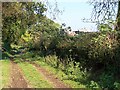
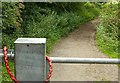
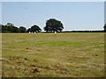
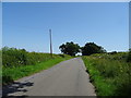
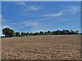
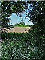
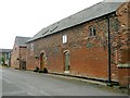
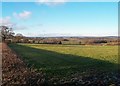
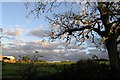
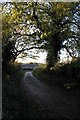
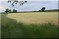
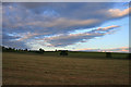
Erewash District is a local authority district in Derbyshire, England, covering an area of 109.7 km². This borough unitary area combines established market towns with scattered rural settlements. The River Erewash forms the district's eastern boundary, separating it from neighbouring areas in the East Midlands. Since its formation on 1 April 1974, the borough has grown into a densely populated region with a mix of industrial history and modern community life. Long Eaton and Ilkeston serve as the main commercial centres within the district. Some of the built-up areas in the eastern section connect with the larger Nottingham Urban Area, blending suburban living with proximity to a major city. You are looking at a landscape defined by the Erewash Valley and key transport links, including a large railway freight terminal at Toton. The population stands at approximately 113,047 based on the 2023 estimate. This figure reflects a predominantly urban character with significant housing density. The area sits at coordinates roughly 52.92°N 1.32°W, placing it centrally within the East Midlands transport network. Residents benefit from access to various civil parishes across the fourteen found within the borough boundaries. Whether you prefer the pace of a market town or the quiet of a village, Erewash District (B) offers distinct pockets of residential settlement. The district's identity remains rooted in its industrial past while adapting to contemporary living standards.
- Area Type
- District/Borough
- Area Size
- 109.7 km²
- Population
- Not available
- Population Density
- Not available
Demographics
The community in Erewash District (B) presents a clearly defined age profile. The median age for residents is 70 years, indicating a population skewed significantly towards older age groups. This demographic structure suggests a retirement-focused community or an area where many families have moved out. The most common age range data listed simply states "Total" without breaking down specific decade cohorts in the provided figures. Despite this lack of granular age segmentation, the high median age strongly points to a community with fewer young children and likely an older household composition. Home ownership levels in the district stand at 70 per cent. This high percentage means the majority of residents own their homes outright or with a mortgage. The data does not specify the split between outright owners and those with mortgages, nor does it detail the breakdown of accommodation types between houses, flats, or mobile homes. You will find a predominantly owner-occupied stock rather than a renter-heavy market. The ethnic diversity and religious makeup of the area are noted in the source data as "total" without specific breakdowns or percentages provided for particular groups. When considering living in Erewash District (B), you are entering a neighbourhood where long-term residents dominate the housing market, creating stability for home buyers.
Household Size
Accommodation Type
Tenure
Ethnic Group
Religion
Household Composition
Age
Household Deprivation
NS-SEC
Explore more demographic insights in this area
Go to Demographics tabPlanning
Planning Constraints
- Flood RiskPremium
- Ramsar Wetland SitesPremium
- Area of Outstanding Natural BeautyPremium
- Protected Nature ReservePremium
- Protected WoodlandPremium
- Crime RiskPremium