Area Overview for North West Leicestershire District
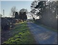
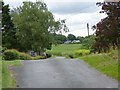
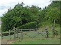
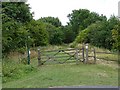
Photos of North West Leicestershire District
Area Information
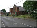
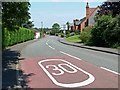
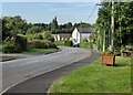
Living in North West Leicestershire District offers a distinctly different pace of life compared to the denser urban centres of the United Kingdom. This local authority district covers a vast geographical footprint of 279.5 km², which means distance is a constant factor in daily planning. The area is defined by its rural character and relative isolation rather than urban convenience. You will find large open spaces and scattered settlements rather than high-rise developments or busy city streets. The sheer size of the district implies that travel times to major employment hubs or cultural attractions will be longer than in more compact boroughs. Daily life here revolves around self-sufficiency and a connection to the natural environment. The demographic profile suggests a community that values quiet over neighbourly proximity. Prospective homebuyers should understand that lifestyle in North West Leicestershire District is shaped by limited public transport options and a reliance on personal vehicles. There is no central urban core to anchor the geography; instead, services are spread out across the 279.5 km² landscape. This layout supports a tranquil existence but requires careful consideration of commuting distances if your work is not located within the immediate vicinity. The area prioritises space and nature, making it suitable for those who can accommodate longer journeys for errands or leisure. ### The community in North West Leicestershire District presents a clear demographic picture distinct from younger, more metropolitan areas. The median age stands at 70, which indicates a population skewed significantly towards older residents. This age profile shapes the local economy, social services, and the types of amenities required in villages and towns across the district. With 73% of the population owning their homes, you are looking at an established area where long-term residents have succeeded in purchasing property. This high level of home ownership contrasts sharply with major cities where rental markets often dominate. Household composition data confirms this trend, as the total household patterns align with a slower-paced, settled community. Accommodation types reflect the housing stock built over several decades rather than modern high-density developments. While specific figures on predominant ethnicity and religion are not detailed in the current records, the age and ownership data alone paint a portrait of stability. Fewer young families or students populate the district compared to urban hubs, meaning you will encounter a quieter social environment. This demographic reality means local businesses may cater to the needs of the over-60s demographic, and community events often reflect the interests of this age group. Understanding these numbers helps you gauge whether the social atmosphere aligns with your own life stage and preferences. ### The property market in North West Leicestershire District is heavily influenced by the fact that 73% of residents own their homes. This statistic signals a territory where the majority of households have achieved ownership through long-term residence rather than entering a fragmented rental sector. You will find that the housing stock is primarily occupied by owners seeking stability, whether in semi-detached houses, cottages, or larger family properties suited to an older demographic. The high ownership rate suggests that looking for cheap rent in North West Leicestershire District is more difficult than finding a home to buy, although initial purchase prices may vary based on location within the 279.5 km² area. Accommodation types in the district cater to the needs of established families and retirees rather than transient workers or students. The lack of a dominant rental market means landlords are less common, reducing the likelihood of unstable tenants or short-term lease arrangements. For buyers entering North West Leicestershire District, this environment offers security of tenure and a community invested in property maintenance. However, you must consider that the stock being sold has been available for longer, meaning carpets, roofs, and boilers may not have been updated by the current owners. The market here rewards thorough inspections and realistic budgeting, as buyers often face properties that require immediate attention due to the age of the dwellings and the stability of the owner-occupier base. ### Connectivity in North West Leicestershire District presents a mixed picture that potential residents must assess carefully. Mobile coverage scores an impressive result with a network quality index of 83 out of 100. You can expect strong signal levels for personal phones, allowing you to stay connected while walking in the countryside or driving along local roads. This is a reliable factor for daily communication and personal safety. However, fixed broadband quality presents a significant challenge, scoring only 23 out of 100. This low score indicates that high-speed internet access is difficult to secure in many parts of the district. If you plan to work from home, you must verify the infrastructure at any specific address you are considering. A broadband score of 23 suggests that standard Wi-Fi speeds may be slow or unreliable, which could hinder video conferencing or cloud-based working. Digital connectivity in North West Leicestershire District is therefore not equally distributed. While your mobile phone will function well, relying on the internet for professional duties may require investment in alternative solutions like satellite connections or mobile broadband routers. This disparity means that digital nomads or remote workers should not assume a uniform service quality across the 279.5 km² area. You might find excellent connectivity within a specific village, only to find your connection drops as soon as you move the car a few kilometres away. ### Safety in North West Leicestershire District demonstrates a generally low risk for crime, yet environmental hazards require your attention. The crime risk assessment scores 67 out of 100, with the safety level rated as PASS. This confirms that the district has below-average crime rates, making it a relatively secure neighbourhood compared to national standards. You can expect a low likelihood of theft or violent incidents in your daily life. However, flood risk presents a more serious concern with a score of 16.55 and a WARNING level. This indicates a medium flood risk coverage across the district, meaning you cannot assume immunity from water-related issues during heavy rainfall or river overflow. Planning constraints also influence development and land use. The area contains protected woodland, which triggers a WARNING level with a score of 1.36. This restriction limits where new buildings can be constructed and may affect your ability to build extensions or convert land in North West Leicestershire District. Conversely, there are no Ramsar wetland sites or Areas of Outstanding Natural Beauty imposing on the land, resulting in PASS scores for those categories. These passing grades indicate fewer planning hurdles regarding designated natural beauty spots. When evaluating a specific plot, you must check for flood risks and woodland protections rather than assuming the entire district is free from such constraints. The combination of low crime with medium flood risk creates a safety profile that is reassuring in one area but demands caution in another. ### Is North West Leicestershire District suitable for someone working remotely?While you should experience strong mobile coverage with a network quality score of 83, fixed broadband presents a significant hurdle scoring only 23. This low broadband score suggests slow internet speeds, which could disrupt video calls. You must verify fixed-line options in the specific property address before relocating for remote work. Who is the primary demographic living in this area?The community is defined by an older population with a median age of 70. This age profile is reflected in the design and availability of homes suited to retirees and established families rather than young professionals or students. What are the ownership trends for homes in North West Leicestershire District?Home ownership is the norm with 73% of residents owning their property. You will find a very stable market driven by long-term owners rather than a transient rental sector populated by landlords or short-term tenants. What are the main environmental or planning concerns for buyers?You must consider a medium flood risk, indicated by a warning level score of 16.55, and the presence of protected woodland with a score of 1.36. These constraints may limit building potential in certain locations across the 279.5 km² district.
- Area Type
- District/Borough
- Area Size
- 279.5 km²
- Population
- Not available
- Population Density
- Not available
Demographics
The community in North West Leicestershire District presents a clear demographic picture distinct from younger, more metropolitan areas. The median age stands at 70, which indicates a population skewed significantly towards older residents. This age profile shapes the local economy, social services, and the types of amenities required in villages and towns across the district. With 73% of the population owning their homes, you are looking at an established area where long-term residents have succeeded in purchasing property. This high level of home ownership contrasts sharply with major cities where rental markets often dominate. Household composition data confirms this trend, as the total household patterns align with a slower-paced, settled community. Accommodation types reflect the housing stock built over several decades rather than modern high-density developments. While specific figures on predominant ethnicity and religion are not detailed in the current records, the age and ownership data alone paint a portrait of stability. Fewer young families or students populate the district compared to urban hubs, meaning you will encounter a quieter social environment. This demographic reality means local businesses may cater to the needs of the over-60s demographic, and community events often reflect the interests of this age group. Understanding these numbers helps you gauge whether the social atmosphere aligns with your own life stage and preferences. ### The property market in North West Leicestershire District is heavily influenced by the fact that 73% of residents own their homes. This statistic signals a territory where the majority of households have achieved ownership through long-term residence rather than entering a fragmented rental sector. You will find that the housing stock is primarily occupied by owners seeking stability, whether in semi-detached houses, cottages, or larger family properties suited to an older demographic. The high ownership rate suggests that looking for cheap rent in North West Leicestershire District is more difficult than finding a home to buy, although initial purchase prices may vary based on location within the 279.5 km² area. Accommodation types in the district cater to the needs of established families and retirees rather than transient workers or students. The lack of a dominant rental market means landlords are less common, reducing the likelihood of unstable tenants or short-term lease arrangements. For buyers entering North West Leicestershire District, this environment offers security of tenure and a community invested in property maintenance. However, you must consider that the stock being sold has been available for longer, meaning carpets, roofs, and boilers may not have been updated by the current owners. The market here rewards thorough inspections and realistic budgeting, as buyers often face properties that require immediate attention due to the age of the dwellings and the stability of the owner-occupier base. ### Connectivity in North West Leicestershire District presents a mixed picture that potential residents must assess carefully. Mobile coverage scores an impressive result with a network quality index of 83 out of 100. You can expect strong signal levels for personal phones, allowing you to stay connected while walking in the countryside or driving along local roads. This is a reliable factor for daily communication and personal safety. However, fixed broadband quality presents a significant challenge, scoring only 23 out of 100. This low score indicates that high-speed internet access is difficult to secure in many parts of the district. If you plan to work from home, you must verify the infrastructure at any specific address you are considering. A broadband score of 23 suggests that standard Wi-Fi speeds may be slow or unreliable, which could hinder video conferencing or cloud-based working. Digital connectivity in North West Leicestershire District is therefore not equally distributed. While your mobile phone will function well, relying on the internet for professional duties may require investment in alternative solutions like satellite connections or mobile broadband routers. This disparity means that digital nomads or remote workers should not assume a uniform service quality across the 279.5 km² area. You might find excellent connectivity within a specific village, only to find your connection drops as soon as you move the car a few kilometres away. ### Safety in North West Leicestershire District demonstrates a generally low risk for crime, yet environmental hazards require your attention. The crime risk assessment scores 67 out of 100, with the safety level rated as PASS. This confirms that the district has below-average crime rates, making it a relatively secure neighbourhood compared to national standards. You can expect a low likelihood of theft or violent incidents in your daily life. However, flood risk presents a more serious concern with a score of 16.55 and a WARNING level. This indicates a medium flood risk coverage across the district, meaning you cannot assume immunity from water-related issues during heavy rainfall or river overflow. Planning constraints also influence development and land use. The area contains protected woodland, which triggers a WARNING level with a score of 1.36. This restriction limits where new buildings can be constructed and may affect your ability to build extensions or convert land in North West Leicestershire District. Conversely, there are no Ramsar wetland sites or Areas of Outstanding Natural Beauty imposing on the land, resulting in PASS scores for those categories. These passing grades indicate fewer planning hurdles regarding designated natural beauty spots. When evaluating a specific plot, you must check for flood risks and woodland protections rather than assuming the entire district is free from such constraints. The combination of low crime with medium flood risk creates a safety profile that is reassuring in one area but demands caution in another. ### Is North West Leicestershire District suitable for someone working remotely?While you should experience strong mobile coverage with a network quality score of 83, fixed broadband presents a significant hurdle scoring only 23. This low broadband score suggests slow internet speeds, which could disrupt video calls. You must verify fixed-line options in the specific property address before relocating for remote work. Who is the primary demographic living in this area?The community is defined by an older population with a median age of 70. This age profile is reflected in the design and availability of homes suited to retirees and established families rather than young professionals or students. What are the ownership trends for homes in North West Leicestershire District?Home ownership is the norm with 73% of residents owning their property. You will find a very stable market driven by long-term owners rather than a transient rental sector populated by landlords or short-term tenants. What are the main environmental or planning concerns for buyers?You must consider a medium flood risk, indicated by a warning level score of 16.55, and the presence of protected woodland with a score of 1.36. These constraints may limit building potential in certain locations across the 279.5 km² district.
Household Size
Accommodation Type
Tenure
Ethnic Group
Religion
Household Composition
Age
Household Deprivation
NS-SEC
Explore more demographic insights in this area
Go to Demographics tabPlanning
Planning Constraints
- Flood RiskPremium
- Ramsar Wetland SitesPremium
- Area of Outstanding Natural BeautyPremium
- Protected WoodlandPremium
- Crime RiskPremium