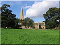
Area Overview for Ashfield District
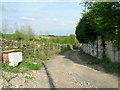
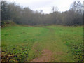
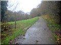
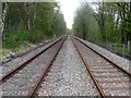
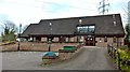
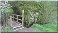
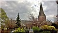
Photos of Ashfield District
Area Information
Living in Ashfield District offers a distinctly mature landscape within the unitary authority of Nottinghamshire. This local authority district spans 109.6 km², providing a significant landmass for residents to call home. The area is defined by its older demographic profile, which shapes the overall character of daily life here. You will find an established community rather than a rapidly expanding development zone. The sheer size of the district means you have ample space, though you should expect a slower pace of life compared to denser urban centres. Ashfield District stands apart from neighbouring boroughs due to its specific unitary status and local governance structure. When considering homes in Ashfield District, you are entering a market characterised by stability and tradition. The district does not boast rapid urban growth, which appeals to buyers seeking a settled environment. Your daily commute might involve travelling across this expansive 109.6 km² area depending on your specific location within the borough. The overall vibe is one of quiet residence, where the physical scale of the district meets a population of consistent age. You will appreciate the room to move within this defined geographical boundary without the noise of commercial expansion. Ashfield District presents a straightforward proposition for those who prioritise space and a predictable community atmosphere.
- Area Type
- District/Borough
- Area Size
- 109.6 km²
- Population
- Not available
- Population Density
- Not available
Demographics
The community in Ashfield District is unmistakably older than the national average, with a median age of 70 years. This figure defines the social fabric and influences available services and leisure activities. Most residents fall into age categories well past retirement, creating a homogenous population that values tradition and stability. You will encounter a neighbourhood where long-term residents are the norm. Home ownership levels are exceptionally high at 68%, indicating that most people live in houses they own outright rather than rent. This statistic suggests a financially secure resident base accustomed to long-term tenure. The prevalence of owned properties often correlates with larger family homes or spacious bungalows suited to an elderly population. Household composition reflects this pattern, with fewer young families or single-person households typical of major employment hubs. Accommodation types will likely skew towards detached and semi-detached dwellings rather than high-density flats. While specific ethnic breakdowns and religious census data are not provided in the current records, the demographic profile points to a traditional settlement. You should not expect a diverse mix of young professionals or international students moving to the area annually. Instead, prepare for a society where local knowledge is passed down through generations of permanent residents.
Household Size
Accommodation Type
Tenure
Ethnic Group
Religion
Household Composition
Age
Household Deprivation
NS-SEC
Explore more demographic insights in this area
Go to Demographics tabPlanning
Planning Constraints
- Flood RiskPremium
- Ramsar Wetland SitesPremium
- Area of Outstanding Natural BeautyPremium
- Protected Nature ReservePremium
- Protected WoodlandPremium
- Crime RiskPremium