Area Overview for Melton District (B)
Photos of Melton District (B)


Area Information
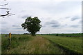
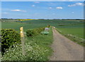
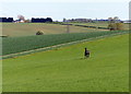
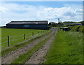
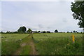
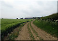
Melton District (B) forms a distinct local authority district within Leicestershire, covering an area size of 481.7 km² in the East Midlands. This region centres on the historic market town of Melton Mowbray, which grants the district its name, while also encompassing significant rural expanses such as the Vale of Belvoir. You are looking at a landscape defined by deep historical roots, where the modern borough was formally created on 1 April 1974 under the Local Government Act 1974 by merging the Melton Mowbray Urban District and the Melton and Belvoir Rural District. The area has flourished since first appearing in the 1086 Domesday Book, evolving from a thriving market town of roughly 200 inhabitants into a substantial administrative region today. Life here blends medieval heritage with contemporary living, anchored by locations such as Melton Market Place, Nottingham Street, and Church Lane. You will find yourself surrounded by Grade II* listed structures like the Maison Dieu Bedehouses, built in 1384, and the iconic Belvoir Castle, originally constructed in the late 11th century. Whether you prefer the quiet of the countryside or the amenities of the town, this district offers a setting where history permeates daily life. The combination of protected landmarks and accessible urban centres creates a distinctive environment for those seeking homes in Melton District (B).
- Area Type
- District/Borough
- Area Size
- 481.7 km²
- Population
- Not available
- Population Density
- Not available
Demographics
The community profile of Melton District (B) reveals a population heavily skewed towards older residents. Your research shows a median age of 70, placing it significantly higher than the national average. The majority of the demographic falls into the broad total age category, indicating a mature population base. This age distribution shapes the local climate, where services and amenities likely cater primarily to retirees and long-term residents rather than young families entering the property market. Home ownership is the dominant tenure method, standing at 72%. This high rate suggests a stable neighbourhood where most residents live in properties they have purchased or inherited over many decades. Accommodation types reflect this longevity, with large proportions of older housing stock compared to builds from the last few years. The area lacks recent diversification in household composition data or predominant ethnic group statistics that might indicate a newer, mixed community. Instead, you are looking at an established demographic where the way of life has remained consistent for generations. This stability is evident in the low churn of registered addresses and the enduring presence of traditional institutions. If your primary goal is to buy a home, the market here is driven by retirees selling up rather than first-time buyers seeking entry-level homes in Melton District (B). The community feel is tight-knit, defined by those who have called this district home since before the 1970s merger of the previous urban and rural districts.
Household Size
Accommodation Type
Tenure
Ethnic Group
Religion
Household Composition
Age
Household Deprivation
NS-SEC
Explore more demographic insights in this area
Go to Demographics tabPlanning
Planning Constraints
- Flood RiskPremium
- Ramsar Wetland SitesPremium
- Area of Outstanding Natural BeautyPremium
- Protected Nature ReservePremium
- Protected WoodlandPremium
- Crime RiskPremium