Area Overview for CV3 2FG
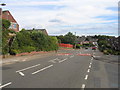
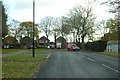
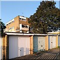
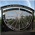
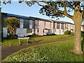
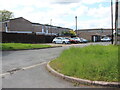
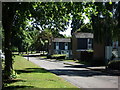
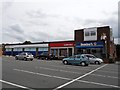
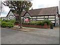
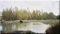
Photos of CV3 2FG

Area Information
Living in CV3 2FG means inhabiting a tightly knit residential cluster in the south-eastern part of Coventry, where the population density is exceptionally high at 278,137 people per square kilometre. This postcode covers parts of Binley and Willenhall, two areas that evolved from small villages into modern residential districts. Binley, in particular, has a rich history as a former mining village, now characterised by a mix of private homes and council properties. With 1,369 residents, the area is compact but offers a blend of historical landmarks, such as St Bartholomew’s Church, and contemporary amenities. Daily life here is shaped by proximity to Coventry’s transport network, including nearby rail stations and two airports, while the community remains largely residential. The high home ownership rate (87%) suggests a stable, long-term population, with many residents living in houses rather than flats. For those considering CV3 2FG, it is a place where history and modernity coexist in a densely populated yet functional urban setting.
- Area Type
- Postcode
- Area Size
- 4922 m²
- Population
- 1369
- Population Density
- 5561 people/km²
The property market in CV3 2FG is dominated by owner-occupied homes, with 87% of properties owned by residents rather than rented. Houses, not flats, are the primary accommodation type, reflecting a traditional suburban or semi-rural housing stock. This suggests a market tailored to families and long-term residents rather than short-term renters. The small area size (4,922 m²) means the housing stock is limited, and buyers may need to consider nearby areas for more options. The high home ownership rate indicates a stable market with little turnover, which could be advantageous for those seeking a secure investment. However, the compact nature of the postcode means properties are likely to be in close proximity to one another, potentially limiting privacy or space for larger families.
House Prices in CV3 2FG
Showing 6 properties
| Address | Type | Beds | Baths | Last Sale Price | Last Sale Date | |
|---|---|---|---|---|---|---|
| 1 Santos Close, Coventry, CV3 2FG | Terraced | 3 | 1 | £120,000 | Apr 2022 | |
| 3 Santos Close, Coventry, CV3 2FG | Terraced | 2 | - | £103,000 | Nov 2016 | |
| 5 Santos Close, Coventry, CV3 2FG | Terraced | 2 | 1 | £59,000 | Apr 2009 | |
| 2 Santos Close, Coventry, CV3 2FG | Terraced | 3 | - | £77,500 | May 2004 | |
| 4 Santos Close, Coventry, CV3 2FG | house | - | - | - | - | |
| Flat, Standard Bearer, 6 Santos Close, Coventry, CV3 2FG | Flat | - | - | - | - |
Energy Efficiency in CV3 2FG
Residents of CV3 2FG have access to a range of amenities within practical reach. Retail options include five shops, such as Lidl Binley, Morrisons Binley, and Asda Living, offering everyday essentials. The area’s proximity to Coventry’s transport hubs and two airports enhances its connectivity, while nearby rail stations provide easy access to urban centres. For leisure, Binley Woods and Willenhall Wood offer green spaces for walking or recreation. Historical sites like St Bartholomew’s Church and the Coombe Social Club add character, and the Binley Mega Chippy provides a local dining option. The mix of retail, transport, and natural spaces creates a convenient yet distinct lifestyle, blending suburban comfort with urban accessibility.
Amenities
Schools
The nearest school to CV3 2FG is Ernesford Grange Primary School, which has a good Ofsted rating. This school serves the local community with primary education, but no secondary schools are listed in the data. Families requiring secondary education may need to look beyond the immediate area, though nearby Coventry offers a range of schools. The presence of a well-rated primary school is a key consideration for parents, as it ensures access to quality early education. The absence of secondary schools nearby means prospective buyers should factor in commuting times or the availability of alternative educational options.
| Rank | School | Type | Entry gender | Ages |
|---|
Explore more schools in this area
Go to Schools tabDemographics
The population of CV3 2FG is 1,369, with a median age of 47, indicating a community skewed towards middle-aged adults, particularly those aged 30–64. Home ownership is exceptionally high at 87%, reflecting a predominantly owner-occupied area with houses as the primary accommodation type. The predominant ethnic group is White, though specific data on other demographics is not provided. The high population density—278,137 people per square kilometre—suggests a compact, closely knit community. This density may influence local services and amenities, but the area’s safety profile, including a low crime risk (score 79), suggests a stable environment. The age profile and home ownership figures indicate a mature population with long-term residency, potentially offering a sense of continuity and familiarity for new residents.
Household Size
Accommodation Type
Tenure
Ethnic Group
Religion
Household Composition
Age
Household Deprivation
NS-SEC
Explore more demographic insights in this area
Go to Demographics tabPlanning
Planning Constraints
- Flood RiskPremium
- Ramsar Wetland SitesPremium
- Area of Outstanding Natural BeautyPremium
- Protected Nature ReservePremium
- Protected WoodlandPremium