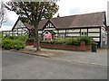
Area Overview for CV3 2FF
Photos of CV3 2FF


Area Information
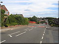
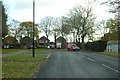
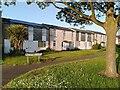
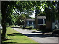
CV3 2FF is a small, densely populated residential cluster in the south-eastern corner of Coventry, England. Covering just 8,322 square metres, the area is home to 1,345 people, making it one of the most compact and high-density postcode areas in the region. Its origins trace back to Binley, a former mining village that evolved into a residential hub, and Willenhall, a historically distinct village absorbed into Coventry’s expansion. Today, the area is defined by its mix of private and council-owned houses, with a strong sense of community rooted in its past. Residents benefit from proximity to retail outlets like Lidl Binley and Morrisons Binley, as well as three nearby railway stations—Coventry Arena, Canley, and Bedworth—offering easy access to the city and beyond. The area’s compact size means amenities are within practical reach, though its density also reflects a long-standing pattern of suburban development. For those seeking a quiet, established residential environment with historical character, CV3 2FF offers a blend of convenience and tradition, though its small footprint means it is best suited for those prioritising proximity to services over expansive living space.
- Area Type
- Postcode
- Area Size
- 8322 m²
- Population
- 1345
- Population Density
- 3381 people/km²
The property market in CV3 2FF is characterised by high home ownership—79% of residents own their homes—suggesting a stable, long-term demographic. The area is predominantly composed of houses, which are the dominant accommodation type, indicating a preference for single-family living over flats or apartments. This makes CV3 2FF a relatively uniform area in terms of housing stock, with limited rental properties evident in the data. The small size of the postcode—just 8,322 square metres—means the housing market is tightly focused, with properties likely concentrated in established residential clusters. For buyers, this suggests a niche market where availability may be limited, but the high ownership rate implies strong demand from existing residents. The proximity to retail and transport hubs may enhance property value, though the area’s compact nature means buyers should consider the lack of expansion potential. Those seeking a family-oriented, owner-occupied home in a mature community may find CV3 2FF appealing, though its small size means competition for available properties could be fierce.
House Prices in CV3 2FF
Showing 20 properties
| Address | Type | Beds | Baths | Last Sale Price | Last Sale Date | |
|---|---|---|---|---|---|---|
| 17 Tysoe Croft, Coventry, CV3 2FF | Terraced | 3 | 1 | £235,000 | May 2024 | |
| 1 Tysoe Croft, Coventry, CV3 2FF | Terraced | 3 | 1 | £180,000 | Apr 2024 | |
| 7 Tysoe Croft, Coventry, CV3 2FF | house | - | - | £195,000 | Dec 2021 | |
| 5 Tysoe Croft, Coventry, CV3 2FF | Terraced | 3 | 1 | £175,000 | Nov 2020 | |
| 14 Tysoe Croft, Coventry, CV3 2FF | Terraced | 2 | 1 | £153,000 | Dec 2018 | |
| 4 Tysoe Croft, Coventry, CV3 2FF | Terraced | 3 | 1 | £145,000 | Aug 2018 | |
| 16 Tysoe Croft, Coventry, CV3 2FF | Terraced | 3 | 1 | £155,000 | Aug 2018 | |
| 21 Tysoe Croft, Coventry, CV3 2FF | house | - | - | £190,000 | Jul 2018 | |
| 6 Tysoe Croft, Coventry, CV3 2FF | Terraced | 3 | - | £135,000 | Dec 2017 | |
| 12 Tysoe Croft, Coventry, CV3 2FF | Maisonette | 2 | 1 | £65,000 | Jan 2017 |
Energy Efficiency in CV3 2FF
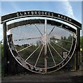
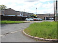
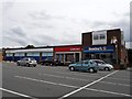
Living in CV3 2FF offers access to a range of local amenities within walking or short driving distance. Retail options include supermarkets like Lidl Binley, Morrisons Binley, and Asda Living, providing everyday shopping convenience. The area’s proximity to three railway stations—Coventry Arena, Canley, and Bedworth—ensures easy access to Coventry’s city centre and surrounding regions. For green spaces, residents can visit Brandon Wood, an ancient woodland managed by the Friends of Brandon Wood, or Willenhall Wood, a 9-hectare nature reserve. The historic St Bartholomew’s Church, a grade I listed building, adds cultural significance, while the Coombe Social Club offers a long-standing community hub. The Binley Mega Chippy is a local landmark for casual dining. The area also includes a Village Green, established in 1989, used for community events and children’s play. These amenities create a mix of practicality and charm, supporting both daily needs and recreational activities in a compact, well-connected environment.
Amenities
Schools
| Rank | School | Type | Entry gender | Ages |
|---|
Explore more schools in this area
Go to Schools tabDemographics
The population of CV3 2FF skews towards middle-aged adults, with a median age of 47 and the majority of residents falling within the 30–64 age range. This suggests a community with a strong presence of families and professionals in their prime working years. Home ownership is high, at 79%, indicating a stable, long-term resident base. The area is predominantly composed of houses, reflecting a preference for single-family dwellings over flats or apartments. The predominant ethnic group is White, though specific diversity metrics are not detailed in the data. The population density—161,626 people per square kilometre—highlights the area’s compact nature, which may contribute to a tight-knit community feel. However, this density also means limited space for expansion, which could impact future development. The age profile and ownership rates suggest a mature, settled population with established roots, though the absence of specific data on deprivation or income levels means the area’s economic challenges remain unquantified.
Household Size
Accommodation Type
Tenure
Ethnic Group
Religion
Household Composition
Age
Household Deprivation
NS-SEC
Explore more demographic insights in this area
Go to Demographics tabPlanning
Planning Constraints
- Flood RiskPremium
- Ramsar Wetland SitesPremium
- Area of Outstanding Natural BeautyPremium
- Protected Nature ReservePremium
- Protected WoodlandPremium