Area Overview for CV3 2HT
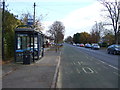
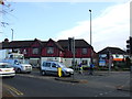
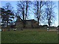
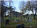
Photos of CV3 2HT
Area Information
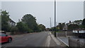
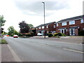
CV3 2HT is a small, densely populated residential cluster in the heart of Binley, a suburb on Coventry’s eastern edge. Covering just 1.8 hectares, the area is home to 1,369 residents, making it one of the most compact and intensely lived-in parts of the city. Its history as a former mining village has given way to a mix of private and council-owned homes, with the majority of properties built for long-term occupancy. The area’s proximity to Coventry’s urban core offers easy access to city amenities, while its residential character retains a sense of local identity. Binley itself evolved from a small village into a tightly knit community, with landmarks like St Bartholomew’s Church and Brandon Wood adding to its distinctiveness. Daily life here is shaped by proximity to schools, retail, and transport links, with a strong focus on family living. The area’s high population density and compact layout mean residents are close to neighbours, shops, and green spaces, creating a self-contained yet connected environment.
- Area Type
- Postcode
- Area Size
- 1.8 hectares
- Population
- 1369
- Population Density
- 5561 people/km²
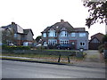
CV3 2HT is overwhelmingly an owner-occupied area, with 87% of homes owned by residents rather than rented. The accommodation type is predominantly houses, not flats, which is unusual for a small, high-density postcode. This suggests a mix of older, family-sized homes and newer developments, though the exact age of properties is not specified. The small area size—just 1.8 hectares—means the housing stock is limited, with little scope for new builds. Buyers should consider the proximity to Coventry’s industrial estates, such as Herald Way, which may influence property values. The high home ownership rate indicates a strong local market, but the small size of the area means competition for properties could be fierce. For those seeking a home, the focus should be on the quality of existing stock and its integration with nearby amenities.
House Prices in CV3 2HT
Showing 37 properties
| Address | Type | Beds | Baths | Last Sale Price | Last Sale Date | |
|---|---|---|---|---|---|---|
| 30 Haselbech Road, Coventry, CV3 2HT | Semi-detached | 4 | 2 | £370,000 | Mar 2025 | |
| 9 Haselbech Road, Coventry, CV3 2HT | Bungalow | 2 | 1 | £275,000 | Oct 2024 | |
| 24 Haselbech Road, Coventry, CV3 2HT | house | - | - | £225,000 | Jul 2023 | |
| 40 Haselbech Road, Coventry, CV3 2HT | Bungalow | - | - | £280,000 | Dec 2022 | |
| 36 Haselbech Road, Coventry, CV3 2HT | Bungalow | 2 | 1 | £270,000 | Nov 2022 | |
| 28 Haselbech Road, Coventry, CV3 2HT | Terraced | 3 | 1 | £162,000 | Dec 2020 | |
| 42 Haselbech Road, Coventry, CV3 2HT | Bungalow | 2 | 1 | £243,000 | Nov 2019 | |
| 12 Haselbech Road, Coventry, CV3 2HT | house | - | - | £200,000 | Nov 2019 | |
| 18 Haselbech Road, Coventry, CV3 2HT | Terraced | 3 | - | £157,000 | May 2016 | |
| 15 Haselbech Road, Coventry, CV3 2HT | Bungalow | - | - | £233,000 | Dec 2013 |
Energy Efficiency in CV3 2HT
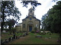
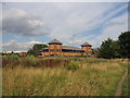
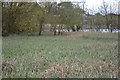
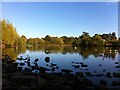
CV3 2HT offers a blend of retail, leisure, and green spaces within easy reach. Local shops include Lidl Binley, Morrisons Binley, and Asda Living, providing everyday essentials. The area’s proximity to Brandon Wood and Willenhall Wood offers opportunities for walking, cycling, and outdoor recreation. A Village Green, established in 1989, hosts community events and children’s activities. The Binley Mega Chippy is a notable local eatery, while St Bartholomew’s Church and the Coombe Social Club add to the area’s social fabric. The mix of retail, green space, and community venues creates a convenient, family-friendly lifestyle, balancing urban accessibility with local charm.
Amenities
Schools
The nearest school to CV3 2HT is Ernesford Grange Primary School, which has a ‘good’ Ofsted rating. This primary school serves the local community, offering education for younger children in the area. The absence of secondary schools in the immediate vicinity means families may need to look further afield for secondary education, though Coventry’s city centre is within practical reach. The presence of a well-rated primary school is a key draw for families, as it suggests a focus on early education and community cohesion. The school’s rating indicates a standard of teaching and facilities that meets official benchmarks, though no specific data on pupil numbers or performance metrics is provided.
| Rank | School | Type | Entry gender | Ages |
|---|
Explore more schools in this area
Go to Schools tabDemographics
The population of CV3 2HT is 1,369, with a median age of 47, reflecting a community skewed towards adults aged 30–64. Home ownership is high at 87%, indicating a stable, long-term resident base. The area is predominantly composed of houses, not flats, which aligns with the demographic profile of older, family-oriented households. The predominant ethnic group is White, with no specific data on other groups provided. The high home ownership rate and age range suggest a mature, established community with low turnover. This profile may appeal to buyers seeking a settled, low-maintenance environment. The absence of specific data on deprivation means the area’s socioeconomic challenges cannot be quantified, but the high ownership rate and age range imply a relatively stable economic foundation.
Household Size
Accommodation Type
Tenure
Ethnic Group
Religion
Household Composition
Age
Household Deprivation
NS-SEC
Explore more demographic insights in this area
Go to Demographics tabPlanning
Planning Constraints
- Flood RiskPremium
- Ramsar Wetland SitesPremium
- Area of Outstanding Natural BeautyPremium
- Protected Nature ReservePremium
- Protected WoodlandPremium