Area Overview for CV3 2GZ
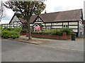
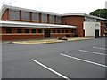
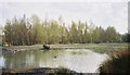
Photos of CV3 2GZ
Area Information
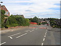
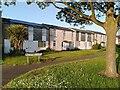
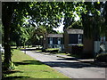
CV3 2GZ is a compact postcode area in the south-eastern outskirts of Coventry, part of the Binley and Willenhall ward. Covering just 1.2 hectares, it is a densely populated residential cluster with 1,369 residents, translating to a population density of 111,470 people per square kilometre. This small area sits within a historically significant region, once shaped by coal mining and estate development. Binley, its core suburb, evolved from a 11th-century village into a mix of private and council-owned homes. The area’s proximity to Coventry’s industrial and commercial hubs, combined with its residential character, makes it a practical choice for those seeking a balance between urban convenience and a tight-knit community. With a median age of 47 and a population skewed toward adults aged 30–64, the area reflects a mature demographic. Its low crime risk and absence of environmental constraints like protected woodlands or AONB designations suggest a stable, accessible living environment. For buyers, the high home ownership rate and proximity to retail, rail, and schools offer a blend of practicality and local amenities.
- Area Type
- Postcode
- Area Size
- 1.2 hectares
- Population
- 1369
- Population Density
- 5561 people/km²
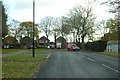
CV3 2GZ is a predominantly owner-occupied area, with 87% of homes owned by residents rather than rented. The accommodation type is exclusively houses, reflecting the suburban character of Binley and Willenhall. This contrasts with areas dominated by flats or rental properties, making CV3 2GZ a niche market for buyers seeking detached or semi-detached homes. The high home ownership rate suggests limited turnover, which could mean fewer new listings and a focus on long-term residents. Given the area’s small size (1.2 hectares), the housing stock is likely limited to a few hundred properties, with little scope for large-scale development. Buyers should consider the proximity to Coventry’s transport networks and amenities, which may offset the area’s compact footprint. The lack of planning constraints or protected sites also makes it a practical choice for those prioritising stability over historical or environmental features.
House Prices in CV3 2GZ
Showing 23 properties
| Address | Type | Beds | Baths | Last Sale Price | Last Sale Date | |
|---|---|---|---|---|---|---|
| 5 Brixworth Close, Coventry, CV3 2GZ | Bungalow | 3 | 2 | £290,000 | Jul 2025 | |
| 21 Brixworth Close, Coventry, CV3 2GZ | Semi-detached | 4 | 1 | £258,000 | Jun 2023 | |
| 8 Brixworth Close, Coventry, CV3 2GZ | Semi-detached | 3 | 2 | £270,000 | Jan 2022 | |
| 25 Brixworth Close, Coventry, CV3 2GZ | house | - | - | £267,000 | Nov 2020 | |
| 3 Brixworth Close, Coventry, CV3 2GZ | Semi-detached | 3 | 2 | £209,600 | Mar 2018 | |
| 20 Brixworth Close, Coventry, CV3 2GZ | Semi-detached | 3 | - | £215,000 | Nov 2016 | |
| 16 Brixworth Close, Coventry, CV3 2GZ | Semi-detached | 4 | - | £200,000 | Aug 2015 | |
| 6 Brixworth Close, Coventry, CV3 2GZ | Semi-detached | - | - | £182,000 | Aug 2007 | |
| 11A Brixworth Close, Coventry, CV3 2GZ | Semi-detached | - | - | £180,000 | Mar 2004 | |
| 18 Brixworth Close, Coventry, CV3 2GZ | Semi-detached | - | - | £150,000 | Sep 2003 |
Energy Efficiency in CV3 2GZ
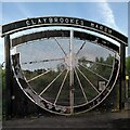
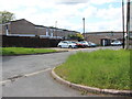
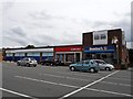
The lifestyle in CV3 2GZ is shaped by its proximity to retail, transport, and green spaces. Nearby amenities include five retail outlets, such as Lidl Binley and Morrisons Binley, offering everyday shopping convenience. The area’s rail network provides access to Coventry’s commercial and cultural hubs, while the nearby Coventry Airport (listed twice in the data) may offer travel options. For leisure, the area’s historical roots include landmarks like St Bartholomew’s Church and Brandon Wood, an ancient woodland accessible through community efforts. The Village Green in Binley, established in 1989, provides space for local events and recreation. Though the data does not specify dining options, the presence of retail and transport links suggests a functional lifestyle with opportunities for both routine and occasional outings.
Amenities
Schools
The nearest school to CV3 2GZ is Ernesford Grange Primary School, a primary institution with a good Ofsted rating. This school serves the local community, providing education for younger children in the area. The absence of secondary schools or other educational institutions in the immediate vicinity means families may need to consider nearby districts for secondary education. However, the presence of a well-rated primary school is a positive factor for families prioritising early education. The school’s location within practical reach of residents suggests it is a central feature of the area’s infrastructure. For those seeking a school with a strong performance rating, Ernesford Grange Primary offers a reliable option, though broader educational needs may require additional planning.
| Rank | School | Type | Entry gender | Ages |
|---|
Explore more schools in this area
Go to Schools tabDemographics
The population of CV3 2GZ is predominantly adults aged 30–64, with a median age of 47. This suggests a mature community with established households, likely reflecting the area’s history as a residential zone developed in the 1930s and 1940s. Home ownership is exceptionally high at 87%, indicating a strong presence of long-term residents and limited rental properties. The accommodation type is primarily houses, which aligns with the area’s suburban layout and historical development as a cluster of private residences. The predominant ethnic group is White, though specific data on diversity or deprivation is not provided. The age profile and ownership figures imply a stable, low-turnover community with little reliance on transient populations. The absence of detailed deprivation metrics means the area’s quality of life is inferred from its safety, connectivity, and amenities rather than socioeconomic indicators.
Household Size
Accommodation Type
Tenure
Ethnic Group
Religion
Household Composition
Age
Household Deprivation
NS-SEC
Explore more demographic insights in this area
Go to Demographics tabPlanning
Planning Constraints
- Flood RiskPremium
- Ramsar Wetland SitesPremium
- Area of Outstanding Natural BeautyPremium
- Protected Nature ReservePremium
- Protected WoodlandPremium