Area Overview for CV3 2FJ
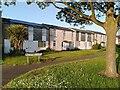
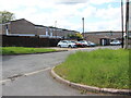
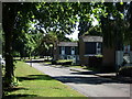
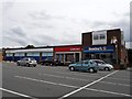
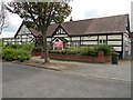
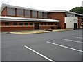
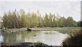
Photos of CV3 2FJ
Area Information
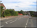
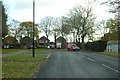
CV3 2FJ lies in the Binley and Willenhall area of Coventry, a small residential cluster with a population of 1,369 spread across 5,963 m². This densely populated zone, with 229,599 people per km², reflects its historical roots as a former mining village that expanded into a residential hub. Binley, a suburb on Coventry’s eastern edge, evolved from a 11th-century settlement into a mix of private and council-owned homes. Willenhall, once a separate village, now blends with the city’s broader fabric. Daily life here is shaped by proximity to retail, rail, and green spaces. The area’s compact size means amenities are within practical reach, while its low crime risk and excellent broadband connectivity cater to modern needs. Residents benefit from a blend of historical landmarks, like St Bartholomew’s Church, and contemporary infrastructure, making it a viable choice for those seeking a compact, well-connected community.
- Area Type
- Postcode
- Area Size
- 5963 m²
- Population
- 1369
- Population Density
- 5561 people/km²
CV3 2FJ is primarily an owner-occupied area, with 87% of homes owned by residents rather than rented. The accommodation type is predominantly houses, reflecting a residential character distinct from high-density housing. This suggests a market skewed towards family homes and long-term investment rather than short-term rentals. Given the area’s small size and high population density, the housing stock is limited, meaning buyers may need to consider nearby areas for more options. The mix of private and council-owned properties indicates a balance between market-driven and affordable housing. For buyers, this means a focus on established properties with potential for long-term value, though competition for available homes may be keen due to the area’s compact footprint.
House Prices in CV3 2FJ
Showing 19 properties
| Address | Type | Beds | Baths | Last Sale Price | Last Sale Date | |
|---|---|---|---|---|---|---|
| 8 Sandwick Close, Coventry, CV3 2FJ | Terraced | 3 | 1 | £180,000 | Dec 2023 | |
| 12 Sandwick Close, Coventry, CV3 2FJ | Terraced | 3 | 1 | £150,000 | Feb 2022 | |
| 2 Sandwick Close, Coventry, CV3 2FJ | Terraced | 3 | 1 | £125,000 | Feb 2018 | |
| 13 Sandwick Close, Coventry, CV3 2FJ | Terraced | 2 | - | £78,000 | Apr 2013 | |
| 11 Sandwick Close, Coventry, CV3 2FJ | Terraced | 2 | - | £71,500 | Jan 2013 | |
| 6 Sandwick Close, Coventry, CV3 2FJ | house | 2 | - | £75,000 | Aug 2011 | |
| 7 Sandwick Close, Coventry, CV3 2FJ | Terraced | 2 | - | £79,000 | Jul 2011 | |
| 3 Sandwick Close, Coventry, CV3 2FJ | house | - | - | £108,000 | May 2008 | |
| 10 Sandwick Close, Coventry, CV3 2FJ | Detached | 3 | 1 | £40,000 | Jul 2003 | |
| 9 Sandwick Close, Coventry, CV3 2FJ | house | - | - | £39,000 | May 2000 |
Energy Efficiency in CV3 2FJ
Living in CV3 2FJ offers access to a range of amenities within practical reach. Retail options include Lidl Binley, Morrisons Binley, and Asda Living, providing essential shopping and dining choices. The area’s proximity to rail stations and airports enhances mobility, while historical sites like St Bartholomew’s Church and Brandon Wood add cultural and recreational value. The Village Green, established in 1989, hosts community events and children’s activities, fostering a sense of local identity. Nearby, Binley Woods and Willenhall Wood offer green spaces for walking and relaxation. The blend of retail, transport, and natural amenities creates a balanced lifestyle, with convenience for daily needs and opportunities for leisure.
Amenities
Schools
The nearest school to CV3 2FJ is Ernesford Grange Primary School, which holds a ‘good’ Ofsted rating. This primary school serves the local community, offering education for younger children within the area. The absence of secondary schools in the immediate vicinity means families may need to look beyond CV3 2FJ for comprehensive schooling. However, the presence of a well-rated primary school is a key advantage for families prioritising early education. The school’s performance suggests a focus on quality teaching, though parents should consider transport logistics for older children. Overall, the educational infrastructure in the area is functional but limited to primary levels, requiring careful planning for long-term family needs.
| Rank | School | Type | Entry gender | Ages |
|---|
Explore more schools in this area
Go to Schools tabDemographics
The population of CV3 2FJ is predominantly adults aged 30–64, with a median age of 47. This suggests a mature, established community with a strong presence of families and long-term residents. Home ownership is high at 87%, with houses being the primary accommodation type. The predominant ethnic group is White, reflecting the area’s historical and social continuity. The high population density of 229,599 people per km² indicates a tightly knit neighbourhood, though this does not necessarily correlate with deprivation. The data does not specify deprivation levels, but the low crime risk and access to amenities suggest a stable quality of life. The demographic profile indicates a community focused on stability, with limited turnover and a mix of long-standing residents and newer homeowners.
Household Size
Accommodation Type
Tenure
Ethnic Group
Religion
Household Composition
Age
Household Deprivation
NS-SEC
Explore more demographic insights in this area
Go to Demographics tabPlanning
Planning Constraints
- Flood RiskPremium
- Ramsar Wetland SitesPremium
- Area of Outstanding Natural BeautyPremium
- Protected Nature ReservePremium
- Protected WoodlandPremium