Area Overview for B90 2NT
Photos of B90 2NT

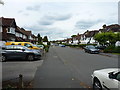
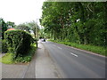
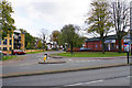
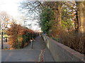
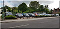
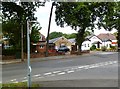

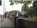
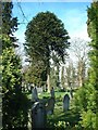
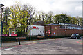
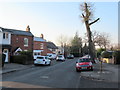
21 photos from this area
Area Information
Key information about the B90 2NT including its size, population, and administrative classification.
- Area Type
- Postcode
- Area Size
- 1.3 hectares
- Population
- 1529
- Population Density
- 2905 people/km²
House Prices in B90 2NT
26
Properties
£304,630
Average Sold Price
£77,000
Lowest Price
£515,000
Highest Price
Showing 26 properties
| Address | Type | Beds | Baths | Last Sale Price | Last Sale Date | |
|---|---|---|---|---|---|---|
| 38 Queens Avenue, Shirley, Solihull, B90 2NT | Semi-detached | 3 | 1 | £430,500 | Mar 2025 | |
| 26 Queens Avenue, Shirley, Solihull, B90 2NT | house | - | - | £515,000 | Jan 2022 | |
| 52 Queens Avenue, Shirley, Solihull, B90 2NT | house | - | - | £340,000 | Mar 2021 | |
| 28 Queens Avenue, Shirley, Solihull, B90 2NT | house | - | - | £449,950 | Mar 2021 | |
| 48 Queens Avenue, Shirley, Solihull, B90 2NT | Semi-detached | 3 | 1 | £345,000 | May 2020 | |
| 46 Queens Avenue, Shirley, Solihull, B90 2NT | house | - | - | £285,000 | Jan 2017 | |
| 36 Queens Avenue, Shirley, Solihull, B90 2NT | Detached | 3 | 1 | £220,000 | Jan 2014 | |
| 20 Queens Avenue, Shirley, Solihull, B90 2NT | house | 4 | - | £285,000 | Jan 2012 | |
| 24 Queens Avenue, Shirley, Solihull, B90 2NT | house | 3 | - | £314,000 | Jul 2011 | |
| 44 Queens Avenue, Shirley, Solihull, B90 2NT | house | - | - | £240,000 | Oct 2010 |
Page 1 of 3
Energy Efficiency in B90 2NT
Amenities
Schools
| Rank | School | Type | Entry gender | Ages |
|---|
Explore more schools in this area
Go to Schools tabDemographics
Household Size
Two person
most common
Accommodation Type
Houses
most common
Tenure
94
majority
Ethnic Group
White
most common
Religion
N/A
most common
Household Composition
N/A
most common
Age
47
median
Adults (30-64 years)
most common
Household Deprivation
N/A
with no deprivation
NS-SEC
45
in Lower managerial occupations
Explore more demographic insights in this area
Go to Demographics tabPlanning
Planning Constraints
- Flood RiskPremium
- Ramsar Wetland SitesPremium
- Area of Outstanding Natural BeautyPremium
- Protected Nature ReservePremium
- Protected WoodlandPremium