Area Overview for B90 2NS
Photos of B90 2NS

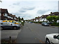
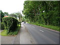
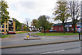


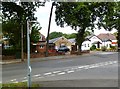


21 photos from this area
Area Information
Key information about the B90 2NS including its size, population, and administrative classification.
- Area Type
- Postcode
- Area Size
- 1.5 hectares
- Population
- 1574
- Population Density
- 4672 people/km²
House Prices in B90 2NS
35
Properties
£267,646
Average Sold Price
£1,450
Lowest Price
£517,000
Highest Price
Showing 35 properties
| Address | Type | Beds | Baths | Last Sale Price | Last Sale Date | |
|---|---|---|---|---|---|---|
| 71 Queens Avenue, Shirley, Solihull, B90 2NS | house | 3 | 1 | £517,000 | Jan 2025 | |
| 49 Queens Avenue, Shirley, Solihull, B90 2NS | Semi-detached | 3 | 2 | £407,000 | Aug 2022 | |
| 31 Queens Avenue, Shirley, Solihull, B90 2NS | Retail | 4 | 1 | £480,000 | Jul 2022 | |
| 41 Queens Avenue, Shirley, Solihull, B90 2NS | house | - | - | £391,950 | Jun 2021 | |
| 37 Queens Avenue, Shirley, Solihull, B90 2NS | Semi-detached | 4 | 2 | £372,500 | Oct 2020 | |
| 29 Queens Avenue, Shirley, Solihull, B90 2NS | Detached | 4 | 1 | £462,500 | Oct 2020 | |
| 33 Queens Avenue, Shirley, Solihull, B90 2NS | Semi-detached | - | - | £1,450 | Oct 2019 | |
| 21 Queens Avenue, Shirley, Solihull, B90 2NS | Semi-detached | 4 | 1 | £351,000 | Sep 2018 | |
| 15 Queens Avenue, Shirley, Solihull, B90 2NS | Semi-detached | 4 | - | £400,000 | May 2018 | |
| 17 Queens Avenue, Shirley, Solihull, B90 2NS | Semi-detached | 4 | - | £332,500 | Aug 2016 |
Page 1 of 4
Energy Efficiency in B90 2NS
Amenities
Schools
| Rank | School | Type | Entry gender | Ages |
|---|
Explore more schools in this area
Go to Schools tabDemographics
Household Size
Family (3-5 people)
most common
Accommodation Type
Houses
most common
Tenure
91
majority
Ethnic Group
White
most common
Religion
N/A
most common
Household Composition
N/A
most common
Age
47
median
Adults (30-64 years)
most common
Household Deprivation
N/A
with no deprivation
NS-SEC
43
in Lower managerial occupations
Explore more demographic insights in this area
Go to Demographics tabPlanning
Planning Constraints
- Flood RiskPremium
- Ramsar Wetland SitesPremium
- Area of Outstanding Natural BeautyPremium
- Protected Nature ReservePremium
- Protected WoodlandPremium