Area Overview for B42 2EG
Photos of B42 2EG

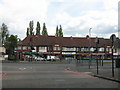
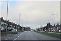
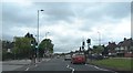
17 photos from this area
Area Information
Key information about the B42 2EG including its size, population, and administrative classification.
- Area Type
- Postcode
- Area Size
- 1.3 hectares
- Population
- 1557
- Population Density
- 6379 people/km²
House Prices in B42 2EG
39
Properties
£140,048
Average Sold Price
£20,500
Lowest Price
£220,000
Highest Price
Showing 39 properties
| Address | Type | Beds | Baths | Last Sale Price | Last Sale Date | |
|---|---|---|---|---|---|---|
| 156 Cramlington Road, Birmingham, B42 2EG | house | 3 | 1 | £20,500 | May 2024 | |
| 138 Cramlington Road, Birmingham, B42 2EG | Semi-detached | 4 | 1 | £152,000 | Mar 2024 | |
| 118 Cramlington Road, Birmingham, B42 2EG | Semi-detached | 3 | 1 | £211,000 | Jul 2023 | |
| 136 Cramlington Road, Birmingham, B42 2EG | Semi-detached | 3 | 1 | £205,000 | May 2023 | |
| 116 Cramlington Road, Birmingham, B42 2EG | house | - | - | £195,000 | Sep 2022 | |
| 114 Cramlington Road, Birmingham, B42 2EG | Semi-detached | 3 | 1 | £188,500 | May 2022 | |
| 146 Cramlington Road, Birmingham, B42 2EG | house | 3 | - | £180,000 | Feb 2022 | |
| 86 Cramlington Road, Birmingham, B42 2EG | house | - | - | £220,000 | Mar 2021 | |
| 104 Cramlington Road, Birmingham, B42 2EG | Semi-detached | 3 | 1 | £185,000 | Jan 2021 | |
| 110 Cramlington Road, Birmingham, B42 2EG | Semi-detached | 3 | 1 | £150,000 | Nov 2020 |
Page 1 of 4
Energy Efficiency in B42 2EG
Amenities
Schools
| Rank | School | Type | Entry gender | Ages |
|---|
Explore more schools in this area
Go to Schools tabDemographics
Household Size
Family (3-5 people)
most common
Accommodation Type
Houses
most common
Tenure
79
majority
Ethnic Group
White
most common
Religion
N/A
most common
Household Composition
N/A
most common
Age
47
median
Adults (30-64 years)
most common
Household Deprivation
N/A
with no deprivation
NS-SEC
29
in Lower managerial occupations
Explore more demographic insights in this area
Go to Demographics tabPlanning
Planning Constraints
- Flood RiskPremium
- Ramsar Wetland SitesPremium
- Area of Outstanding Natural BeautyPremium
- Protected Nature ReservePremium
- Protected WoodlandPremium