Area Overview for B42 2BN
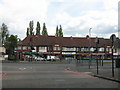
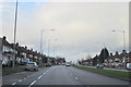
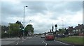
Photos of B42 2BN

Area Information
B42 2BN represents a specific postcode cluster within the broader suburban landscape of Perry Barr, located in north Birmingham. This small residential area covers just 8,527 square metres yet houses 1,557 people, reflecting a compact living environment. The location derives its name from two ancient manors recorded in the Domesday Book, Pirio and Barre, translating to pear tree and hill top in Old English and Celtic respectively. Residents live in a setting that has evolved from a chapelry in the parish of Handsworth to its current status as part of the West Midlands county. The area currently accommodates approximately 1,561 residents according to current records. Living in B42 2BN means residing in a neighbourhood with deep historical roots, where the community evolved significantly after being incorporated into Birmingham in 1928 and later becoming part of the Warwickshire parish before merging again in 1930. Today, the suburb stands as a distinct council ward where the name persists as both a local identifier and a parliamentary constituency. The physical boundaries remain small, creating a strong sense of locality for the 1,557 individuals calling this space home. This density concentrates the character of the neighbourhood into a tangible, close-knit environment that defines the daily rhythm for families and professionals alike.
- Area Type
- Postcode
- Area Size
- 8527 m²
- Population
- 1557
- Population Density
- 6379 people/km²
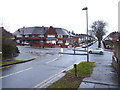
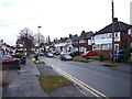
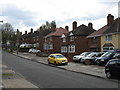
Homes in B42 2BN are characterised by a specific housing stock type defined exclusively by houses. This distinction separates the area from zones dominated by flat blocks or apartments found elsewhere in the city. With 79% home ownership, the market operates primarily as an owner-occupied sector rather than a rental hub. This high rate of ownership suggests that buyers prefer owning a home in B42 2BN over renting. The accommodation type data confirms that the available stock consists of detached, semi-detached, or terraced housing styles typical of suburban developments. Living in this postcode means accessing properties suited for families who value ground-level access and private gardens rather than communal corridors. The concentration of houses aligns with the area's history as a suburban expansion of Perry Barr. Since the area forms part of a larger suburb of Birmingham, property trends here often mirror those of the wider Perry Barr neighbourhood but on a smaller scale. The 79% ownership figure indicates a stable stock where sellers have lived there for years, potentially reducing the volume of quick flips in the market. Prospective buyers looking for these specific house types will find B42 2BN a logical choice within the north Birmingham landscape. The ownership structure also implies that maintenance responsibilities rest heavily with individual homeowners rather than housing associations or landlords.
House Prices in B42 2BN
Showing 27 properties
| Address | Type | Beds | Baths | Last Sale Price | Last Sale Date | |
|---|---|---|---|---|---|---|
| 297 Perry Wood Road, Birmingham, B42 2BN | Detached | 3 | 1 | £228,500 | Dec 2025 | |
| 263 Perry Wood Road, Birmingham, B42 2BN | house | - | - | £221,000 | Sep 2021 | |
| 275 Perry Wood Road, Birmingham, B42 2BN | Semi-detached | 3 | 1 | £183,000 | Jan 2020 | |
| 273 Perry Wood Road, Birmingham, B42 2BN | Semi-detached | 2 | 1 | £187,000 | Oct 2019 | |
| 259 Perry Wood Road, Birmingham, B42 2BN | Semi-detached | 3 | 1 | £135,000 | Aug 2019 | |
| 267 Perry Wood Road, Birmingham, B42 2BN | Semi-detached | - | - | £24,000 | Oct 2014 | |
| 271 Perry Wood Road, Birmingham, B42 2BN | house | - | - | £95,000 | Feb 2013 | |
| 277 Perry Wood Road, Birmingham, B42 2BN | house | 3 | - | £115,000 | Feb 2007 | |
| 241 Perry Wood Road, Birmingham, B42 2BN | Semi-detached | 3 | - | £143,000 | Apr 2006 | |
| 247 Perry Wood Road, Birmingham, B42 2BN | Semi-detached | 3 | 1 | £145,000 | Apr 2006 |
Energy Efficiency in B42 2BN
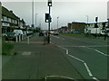
Residents of B42 2BN enjoy practical access to a range of amenities within reach. Retail options include Iceland Great, Aldi Great, and Co-op Birmingham, providing essential food and household shopping. Three railway stations lie nearby: Hamstead Railway Station, Perry Barr Railway Station, and Tame Bridge Parkway Railway Station, offering rail links for regional travel. Public transport is further supported by five metro stops, including Handsworth Booth Street, Winson Green Outer Circle, and Soho Benson Road. These transport nodes connect the neighbourhood to the wider Birmingham network efficiently. The proximity of supermarkets means daily errands require minimal travel, enhancing convenience for busy households. Railway access allows residents to commute to central Birmingham without relying solely on buses or private cars. The availability of Co-op alongside discount retailers like Iceland and Aldi caters to varied price points and shopping habits. Living in B42 2BN places residents comfortably within reaching distance of both local stores and major transit hubs. The density of amenities ensures that essential services are never far away. You can shop for groceries at Co-op Birmingham or travel from the nearest metro station with ease. This balance of retail and transport infrastructure defines the practical daily life for inhabitants of this postcode.
Amenities
Schools
Families living in B42 2BN have access to a trio of local educational institutions located nearby. Calshot Primary School offers education with a Good rating from Ofsted, ensuring a quality learning environment for younger children. Two additional schools serve the catchment area: Calshot Junior School and Calshot Infant School. Both of these establishments are designated as primary institutions, meaning they cater to the early formal education years rather than secondary education. The Ofsted rating for Calshot Primary School provides concrete assurance regarding the standard of teaching and facilities provided by the state system. For residents seeking schools near B42 2BN, this cluster offers multiple options within the primary phase. The mix of infant and junior schools suggests a step-wise educational progression available without leaving the immediate neighbourhood. Families with children aged five to eleven will find these institutions as their main choice for attendance. The presence of a rated school enhances the appeal of the postcode for parents prioritising educational standards. The data confirms that these three schools form the immediate educational network, meaning families do not need to commute far to secure state-subsidised education in the early years.
| Rank | School | Type | Entry gender | Ages |
|---|
Explore more schools in this area
Go to Schools tabDemographics
The community profile in B42 2BN reflects a mature and stable population structure. Adults aged between 30 and 64 years constitute the most common age range among residents. The median age for the area stands at 47 years, indicating a demographic skewed significantly towards middle and older adulthood. This age distribution suggests the area attracts individuals seeking stability rather than the transient lifestyles associated with younger demographics. Home ownership is prevalent within the cluster, with 79% of homes owned outright or with a mortgage. The remaining 21% likely represent owner occupiers with different tenure statuses or private renters. All standard accommodation listed in the data consists of houses, confirming the absence of high-rise apartments or terraced flats within this specific cluster. The predominant ethnic group is White, forming the majority of the local population. High home ownership levels at 79% typically indicate long-term residency and established family roots. The demographic profile of 1,557 residents across 8,527 square metres points to a neighbourhood where people have put down deep roots. This stability often correlates with lower turnover rates for homes and a community focused on maintaining local property values over time. The absence of younger family units in the median age suggests a lack of significant student population or young professionals moving frequently into the area. Instead, residents are likely putting significant effort into their local schools and community groups.
Household Size
Accommodation Type
Tenure
Ethnic Group
Religion
Household Composition
Age
Household Deprivation
NS-SEC
Explore more demographic insights in this area
Go to Demographics tabPlanning
Planning Constraints
- Flood RiskPremium
- Ramsar Wetland SitesPremium
- Area of Outstanding Natural BeautyPremium
- Protected Nature ReservePremium
- Protected WoodlandPremium