Area Overview for B42 2EF
Photos of B42 2EF
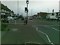
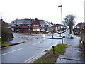
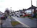

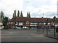
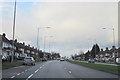
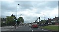
17 photos from this area
Area Information
Key information about the B42 2EF including its size, population, and administrative classification.
- Area Type
- Postcode
- Area Size
- 1.3 hectares
- Population
- 1557
- Population Density
- 6379 people/km²
House Prices in B42 2EF
41
Properties
£137,954
Average Sold Price
£49,000
Lowest Price
£245,000
Highest Price
Showing 41 properties
| Address | Type | Beds | Baths | Last Sale Price | Last Sale Date | |
|---|---|---|---|---|---|---|
| 107 Cramlington Road, Birmingham, B42 2EF | Terraced | 3 | 1 | £205,000 | Jun 2025 | |
| 131 Cramlington Road, Birmingham, B42 2EF | Terraced | 3 | 1 | £225,000 | Dec 2024 | |
| 113 Cramlington Road, Birmingham, B42 2EF | Terraced | 3 | 1 | £245,000 | Jul 2023 | |
| 121 Cramlington Road, Birmingham, B42 2EF | Terraced | 3 | 1 | £192,000 | May 2023 | |
| 155 Cramlington Road, Birmingham, B42 2EF | Semi-detached | 3 | 1 | £211,000 | Feb 2023 | |
| 181 Cramlington Road, Birmingham, B42 2EF | house | 3 | - | £205,000 | Sep 2021 | |
| 175 Cramlington Road, Birmingham, B42 2EF | Semi-detached | 3 | 1 | £180,000 | Nov 2020 | |
| 133 Cramlington Road, Birmingham, B42 2EF | Semi-detached | 2 | 1 | £170,000 | Aug 2020 | |
| 179 Cramlington Road, Birmingham, B42 2EF | Semi-detached | 3 | 1 | £155,000 | Jun 2018 | |
| 123 Cramlington Road, Birmingham, B42 2EF | Terraced | 3 | 1 | £139,000 | Dec 2017 |
Page 1 of 5
Energy Efficiency in B42 2EF
Amenities
Schools
| Rank | School | Type | Entry gender | Ages |
|---|
Explore more schools in this area
Go to Schools tabDemographics
Household Size
Family (3-5 people)
most common
Accommodation Type
Houses
most common
Tenure
79
majority
Ethnic Group
White
most common
Religion
N/A
most common
Household Composition
N/A
most common
Age
47
median
Adults (30-64 years)
most common
Household Deprivation
N/A
with no deprivation
NS-SEC
29
in Lower managerial occupations
Explore more demographic insights in this area
Go to Demographics tabPlanning
Planning Constraints
- Flood RiskPremium
- Ramsar Wetland SitesPremium
- Area of Outstanding Natural BeautyPremium
- Protected Nature ReservePremium
- Protected WoodlandPremium