Area Overview for B42 2BJ
Photos of B42 2BJ
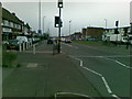
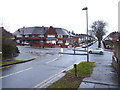
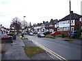

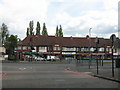
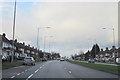
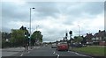
17 photos from this area
Area Information
Key information about the B42 2BJ including its size, population, and administrative classification.
- Area Type
- Postcode
- Area Size
- 1.4 hectares
- Population
- 1472
- Population Density
- 5559 people/km²
House Prices in B42 2BJ
35
Properties
£145,434
Average Sold Price
£43,000
Lowest Price
£258,000
Highest Price
Showing 35 properties
| Address | Type | Beds | Baths | Last Sale Price | Last Sale Date | |
|---|---|---|---|---|---|---|
| 304 Perry Wood Road, Birmingham, B42 2BJ | Semi-detached | 3 | 1 | £235,000 | Jun 2025 | |
| 266 Perry Wood Road, Birmingham, B42 2BJ | Semi-detached | 3 | 1 | £230,000 | Aug 2024 | |
| 264 Perry Wood Road, Birmingham, B42 2BJ | Semi-detached | 3 | 1 | £216,000 | Aug 2023 | |
| 298 Perry Wood Road, Birmingham, B42 2BJ | Semi-detached | - | - | £59,042 | May 2023 | |
| 270 Perry Wood Road, Birmingham, B42 2BJ | house | - | - | £258,000 | Jan 2023 | |
| 288 Perry Wood Road, Birmingham, B42 2BJ | Semi-detached | 3 | 1 | £215,000 | Jul 2022 | |
| 260 Perry Wood Road, Birmingham, B42 2BJ | house | - | - | £60,000 | Feb 2022 | |
| 284 Perry Wood Road, Birmingham, B42 2BJ | house | - | - | £185,000 | Oct 2020 | |
| 262 Perry Wood Road, Birmingham, B42 2BJ | Semi-detached | 3 | 1 | £168,000 | Nov 2019 | |
| 306 Perry Wood Road, Birmingham, B42 2BJ | Semi-detached | 3 | 1 | £160,000 | Aug 2019 |
Page 1 of 4
Energy Efficiency in B42 2BJ
Amenities
Schools
| Rank | School | Type | Entry gender | Ages |
|---|
Explore more schools in this area
Go to Schools tabDemographics
Household Size
Family (3-5 people)
most common
Accommodation Type
Houses
most common
Tenure
74
majority
Ethnic Group
White
most common
Religion
N/A
most common
Household Composition
N/A
most common
Age
47
median
Adults (30-64 years)
most common
Household Deprivation
N/A
with no deprivation
NS-SEC
29
in Lower managerial occupations
Explore more demographic insights in this area
Go to Demographics tabPlanning
Planning Constraints
- Flood RiskPremium
- Ramsar Wetland SitesPremium
- Area of Outstanding Natural BeautyPremium
- Protected Nature ReservePremium
- Protected WoodlandPremium