Area Overview for B42 2BL
Photos of B42 2BL
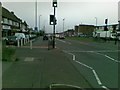
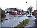
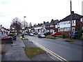

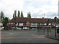
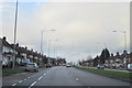
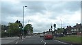
17 photos from this area
Area Information
Key information about the B42 2BL including its size, population, and administrative classification.
- Area Type
- Postcode
- Area Size
- 1.5 hectares
- Population
- 1557
- Population Density
- 6379 people/km²
House Prices in B42 2BL
44
Properties
£145,273
Average Sold Price
£33,000
Lowest Price
£246,000
Highest Price
Showing 44 properties
| Address | Type | Beds | Baths | Last Sale Price | Last Sale Date | |
|---|---|---|---|---|---|---|
| 209 Perry Wood Road, Birmingham, B42 2BL | house | - | - | £225,000 | Feb 2025 | |
| 225 Perry Wood Road, Birmingham, B42 2BL | Semi-detached | 3 | 1 | £231,000 | May 2023 | |
| 161 Perry Wood Road, Birmingham, B42 2BL | Retail | 3 | 1 | £246,000 | Apr 2022 | |
| 207 Perry Wood Road, Birmingham, B42 2BL | house | - | - | £170,000 | Nov 2021 | |
| 173 Perry Wood Road, Birmingham, B42 2BL | Semi-detached | 3 | 2 | £194,000 | Jun 2021 | |
| 163 Perry Wood Road, Birmingham, B42 2BL | Semi-detached | 3 | 1 | £182,500 | Mar 2020 | |
| 189 Perry Wood Road, Birmingham, B42 2BL | Semi-detached | 3 | 1 | £160,000 | Feb 2019 | |
| 215 Perry Wood Road, Birmingham, B42 2BL | Semi-detached | 3 | 1 | £169,000 | Jan 2019 | |
| 201 Perry Wood Road, Birmingham, B42 2BL | Semi-detached | 3 | 2 | £158,000 | Jul 2018 | |
| 229 Perry Wood Road, Birmingham, B42 2BL | Terraced | - | - | £139,500 | Jul 2017 |
Page 1 of 5
Energy Efficiency in B42 2BL
Amenities
Schools
| Rank | School | Type | Entry gender | Ages |
|---|
Explore more schools in this area
Go to Schools tabDemographics
Household Size
Family (3-5 people)
most common
Accommodation Type
Houses
most common
Tenure
79
majority
Ethnic Group
White
most common
Religion
N/A
most common
Household Composition
N/A
most common
Age
47
median
Adults (30-64 years)
most common
Household Deprivation
N/A
with no deprivation
NS-SEC
29
in Lower managerial occupations
Explore more demographic insights in this area
Go to Demographics tabPlanning
Planning Constraints
- Flood RiskPremium
- Ramsar Wetland SitesPremium
- Area of Outstanding Natural BeautyPremium
- Protected Nature ReservePremium
- Protected WoodlandPremium