Area Overview for B42 2ED
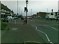
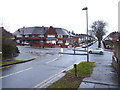
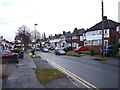
Photos of B42 2ED
Area Information
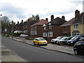
Living in B42 2ED means residing in a small, specific residential cluster nestled within the wider suburb of Perry Barr. This postcode covers an area of 6566 square metres and is home to a population of 1557 residents. The location dates back to the Domesday Book, where the two ancient manors known as 'Pirio' and 'Barre' recorded a combined population of around 60. Perry Barr was formerly a chapelry in the parish of Handsworth before becoming a separate civil parish in 1894. It later joined Birmingham in 1928 and became part of the West Midlands county in 1974. The name itself reflects its origins, with 'Perry' derived from the Old English for 'pear tree' and 'Barr' from the Celtic term for a hill top. Today, you are living in a community with deep historical roots, situated at coordinates 52.524912, -1.877622. The area functions as a quiet residential pocket where modern life intersects with the legacy of local history.
- Area Type
- Postcode
- Area Size
- 6566 m²
- Population
- 1557
- Population Density
- 6379 people/km²
The property market in B42 2ED is distinctly owner-occupied, with 79% of homes sitting under resident ownership. This statistic highlights a stable market where most residents have already purchased their properties. The predominant accommodation type is houses, meaning you are likely to find detached or semi-detached dwellings rather than flats or apartments. This housing stock contrasts with denser urban centres where rental markets often dominate. With the area defined as a specific postcode covering a small residential cluster, the supply of available homes is naturally limited. Buyers entering this market, such as those searching for homes in B42 2ED, face a situation where competition exists primarily among purchasers rather than landlords seeking tenants.
House Prices in B42 2ED
Showing 23 properties
| Address | Type | Beds | Baths | Last Sale Price | Last Sale Date | |
|---|---|---|---|---|---|---|
| 34 Hilliards Croft, Birmingham, B42 2ED | Detached | 3 | 1 | £249,000 | Jul 2022 | |
| 30 Hilliards Croft, Birmingham, B42 2ED | Semi-detached | 3 | 1 | £155,000 | Mar 2020 | |
| 16 Hilliards Croft, Birmingham, B42 2ED | Semi-detached | 3 | 1 | £146,000 | Sep 2018 | |
| 26 Hilliards Croft, Birmingham, B42 2ED | house | - | - | £170,000 | Apr 2018 | |
| 28 Hilliards Croft, Birmingham, B42 2ED | house | - | - | £147,000 | Oct 2015 | |
| 21 Hilliards Croft, Birmingham, B42 2ED | Terraced | - | - | £119,950 | Oct 2004 | |
| 35 Hilliards Croft, Birmingham, B42 2ED | Terraced | - | - | £59,950 | Mar 1999 | |
| 33 Hilliards Croft, Birmingham, B42 2ED | Terraced | 3 | 1 | - | - | |
| 20 Hilliards Croft, Birmingham, B42 2ED | Semi-detached | 3 | - | - | - | |
| 31 Hilliards Croft, Birmingham, B42 2ED | Terraced | - | - | - | - |
Energy Efficiency in B42 2ED
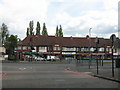
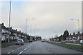
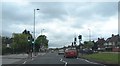
Daily life in B42 2ED is supported by amenities within practical reach of homes in the area. Retail options include Iceland Great, Co-op Walsall, and Aldi Great, offering standard grocery and daily shopping needs. Five railway stations serve the community, including Perry Barr Railway Station, which connects you to wider Birmingham networks. Residents also have access to five Metro stops, with Handsworth Booth Street being one notable option. These five retail venues and six transport hubs are all located within the broader Perry Barr suburban setting. The combination of supermarkets and frequent rail and metro services ensures you do not need to travel far for essential tasks. This setup supports a lifestyle where daily errands are quick and convenient.
Amenities
Schools
Families in B42 2ED have access to a selection of local educational institutions. Calshot Primary School holds a 'good' Ofsted rating and serves as a top-tier option for education. You will also find Calshot Junior School and Calshot Infant School nearby, providing a range of primary education options for children at different developmental stages. The presence of both infant and junior schools indicates that children can receive their education within a single local catchment area without travelling far. For parents looking at schools near B42 2ED, having multiple named institutions within the immediate vicinity offers flexibility. These schools rated and unrated by Ofsted form the backbone of the local education environment.
| Rank | School | Type | Entry gender | Ages |
|---|
Explore more schools in this area
Go to Schools tabDemographics
The community in B42 2ED is characterised by an older demographic profile compared to national averages. The median age for residents is 47 years, with the most common age range being adults between 30 and 64 years old. This indicates a neighbourhood not dominated by young families or retirees, but by established households. Home ownership stands at a high level of 79%, suggesting that the vast majority of residents have bought their properties rather than renting. The predominant accommodation type consists of houses, reinforcing the suburban, family-oriented nature of the estate. Diversity in the area is currently defined by a predominantly White ethnic group. These figures paint a clear picture of a mature, settled community where long-term residents outnumber newcomers.
Household Size
Accommodation Type
Tenure
Ethnic Group
Religion
Household Composition
Age
Household Deprivation
NS-SEC
Explore more demographic insights in this area
Go to Demographics tabPlanning
Planning Constraints
- Flood RiskPremium
- Ramsar Wetland SitesPremium
- Area of Outstanding Natural BeautyPremium
- Protected Nature ReservePremium
- Protected WoodlandPremium